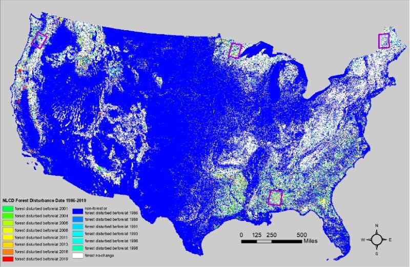
 In a recently published study, researchers from the U.S. Geological Survey Earth Resources Observation and Science (EROS) Center presented a comprehensive strategy to detect when and where forest disturbance happens at a large scale and provide a deeper understanding of forest change. …To understand the big picture of a changing landscape, scientists rely on the National Land Cover Database, which turns Earth-observation satellite (Landsat) images into pixel-by-pixel maps of specific features. Between 2001 and 2016, the database showed that nearly half of the land cover change in the contiguous United States involved forested areas. …Suming Jin, a physical scientist with the EROS Center developed a method to detect forest disturbance by year. The approach combines a time-series algorithm and a 2-date detection method to improve large-region operational mapping efficiency, flexibility, and accuracy.