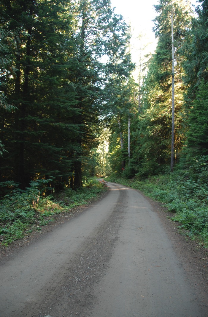
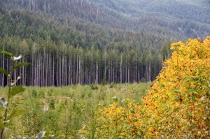
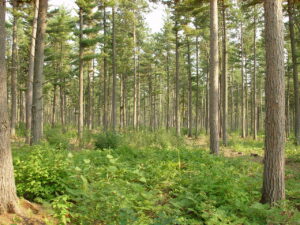
 One of the challenges that the forest managers are facing is the lack of precision inventory tools at the operational level. Forest managers do not currently have the tools to efficiently and accurately measure dispersed residues and forest regeneration. In an era of automation, digital transformation, and the need for live accurate data, FPInnovations has been working on using drones to create responsive remote sensing solutions that would address these issues. FPInnovations has been working on converting the data bits from a drone into actionable information bytes for supporting forest operations. FPInnovations recently held an exclusive webinar to its members on automated interactive tools for post-harvest inventory and compliance using drone imagery, specifically for tracking and reporting the status of regeneration (FPSilvi) and of dispersed logging residues (FPResidue) with no or limited field assessment required with the process. For in-depth details, watch the recording of the webinar.


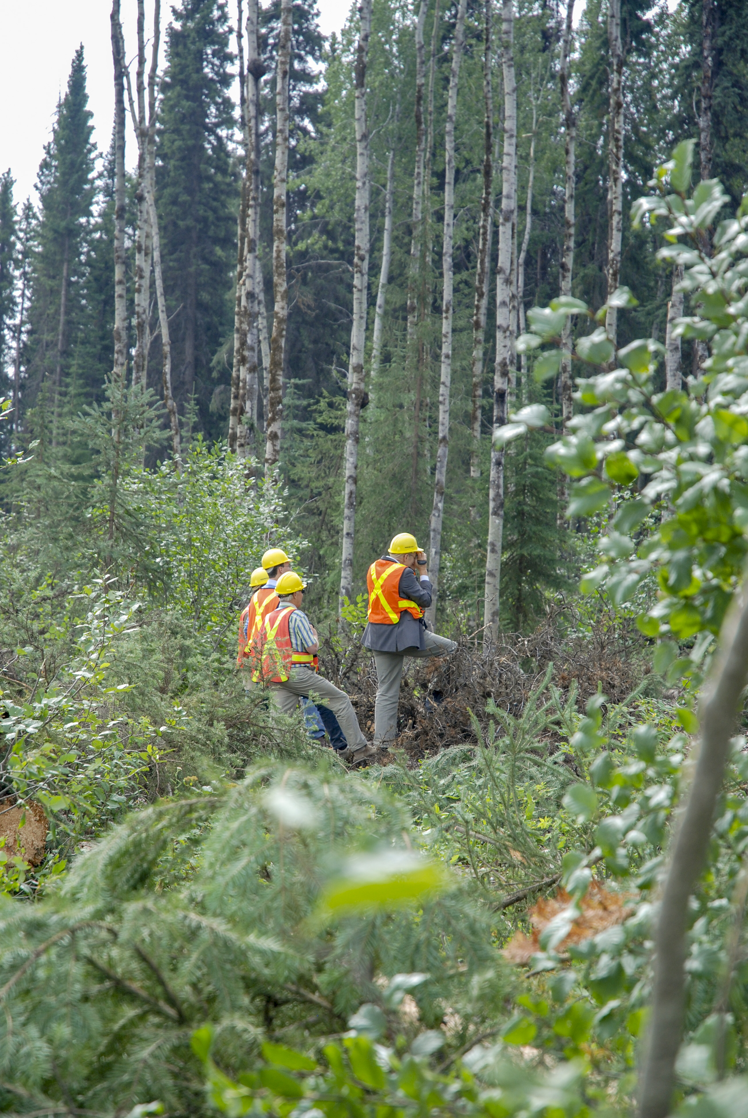
 The Government of Saskatchewan is renewing its commitment to a strong, resilient and growing forestry sector with the development of a forest resource inventory project by the Ministry of Environment. “This project will facilitate the expansion of our forestry industry and support appropriate stewardship of our forests by providing critical information to industry and other users,” Environment Minister Dana Skoropad said. “The information from the forest resource inventory will help us, along with industry, continue to sustainably manage Saskatchewan’s publicly owned forests to a high standard that is recognized nationally and around the world.” …The Ministry of Environment has completed the forest resource inventory for more than five million hectares and anticipates completing the entire commercial forest within five years.
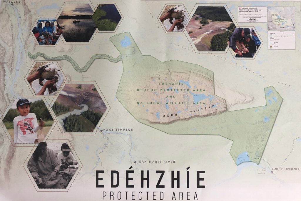
 The Kitasoo Xai’xais and Nuxalk First Nations, along with BC Parks, have signed an agreement that could lead to shared compliance and enforcement responsibilities within provincial protected areas in both Nations’ territories. Once established, the Guardian Shared Compliance and Enforcement Pilot Project will designate select Indigenous guardians with the same legal authorities as BC Parks rangers, making it the first project of its kind in B.C. “Our Nation has stewarded our traditional territory for millennia. Our traditional laws, knowledge systems and practices, combined with the legal authorities envisioned under this pilot project, create a unique opportunity to ensure the land and all of its natural and cultural values are protected for the long term,” said Chief Doug Neasloss of the Kitasoo Xai’xais Nation.


 The B.C. government should do a better job of forecasting potential flooding and recognize that activities such as logging, road-building in forests, and the growing threat of wildfires contribute to flood risks, concludes a report by the Canadian Centre for Policy Alternatives. The report — based on interviews with nearly a dozen experts, including a former head of the B.C. River Forecast Centre — calls on the province to enact reforms such as incorporating information on wildfires, logging and roadbuilding into flood forecast models to increase their effectiveness. …“The provincial government needs to listen to what these experts are saying. There are things clearly in the province’s control that could reduce the prospect for devastating floods and provide vulnerable communities with ample warning of troubles that lie ahead,” said the report’s author, Ben Parfitt, a resource policy analyst with the Canadian Centre for Policy Alternatives.
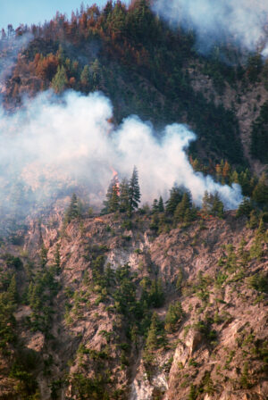
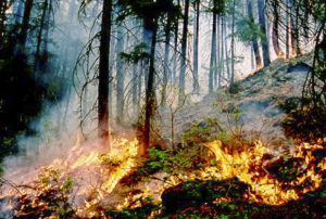 After a couple of quiet years, the 2021 wildfire season in the Cariboo was another challenging one. The BC Wildfire Service has released a summary that shows that there were 305 wildfires between April 1st, 2021 and March 28th, 2022. That was up from just 48 in 2020 and 51 in 2019. 129,537 hectares were burned, which was also up significantly from just 57 and 189 hectares the previous two years. Of course, last year’s numbers pale in comparison to 2017, which was the worst wildfire season in BC’s history. …Most the wildfires of note were located in the South Cariboo region. …Province-wide, 60 percent of the wildfires were natural caused, 35 percent were human caused and 5 percent were undetermined.


 Conservation groups are suing the U.S. Fish and Wildlife Service over its assessment of the Flathead National Forest’s road-building policy in grizzly bear and bull trout habitat. Last year, the U.S. District Court in Missoula ordered FWS to reevaluate its 2018 biological opinion which stated that the way in which the Flathead National Forest closed roads didn’t threaten grizzly bears and bull trout. Both animals are protected under the Endangered Species Act, and roads are known to restrict movement of grizzlies and impact stream quality for bull trout. During last year’s case, Friends of the Wild Swan and the Swan View Coalition argued that closing roads by blocking entrances with logs or boulders allowed continued use by off-road vehicles, and the court agreed.
 A recent commentary “30×30 not the answer to stop destructive wildfires” by Jerry G. Schickedanz, has numerous inaccurate assumptions about wildfire. His comments repeat many common misunderstandings of fire ecology and how natural systems function. He advocates more logging to solve large wildfires. It may seem intuitive that the removal of trees will reduce large blazes, but what is intuitive isn’t always accurate. …Mr. Schickedanz asserts that land protection by the Wilderness Act and other policies has resulted in a “non-use, no-management plan has produced a tinder box for intense wildfires.” If Mr. Schickedanz is correct, we should find the largest fires occurring in areas with the greatest biomass or fuel. …But these coastal forests seldom burn. Why? Because the climate is cool and moist. Climate/weather, not fuels, drives most large western fires.
 OREGON Gov. Kate Brown has signed legislation that makes the Private Forest Accord . …We understand why many segments of the timber industry have embraced the forest management framework spelled out in the accord. Only time will tell whether it will provide the regulatory certainty that it promises. …The legislation is expected to set the stage for a federal Habitat Conservation Plan for the state’s private forests, which would shield landowners from liability under the Endangered Species Act when harvesting trees. That would be a huge benefit to private timber owners. Support for the deal is not unanimous in the timber industry — critics argue that it complicates forest management. …But several forest product companies and the Oregon Small Woodlands Association signed onto the Private Forest Accord with the understanding that it would provide more regulatory certainty and reduce the likelihood of disruptive lawsuits.
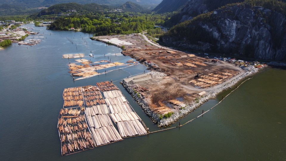
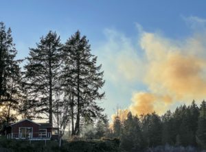 Driving around parts of southern El Dorado County, you can’t miss the trucks. Everywhere near the areas ravaged by the 2021 Caldor fire that leveled the community of Grizzly Flats, you see semis hauling trees and Ford F-150s with their company logos. Residents could understandably wonder: Who is paying for all this work? And who is profiting from it? It’s mostly the federal government and insurance companies writing the checks, meaning taxpayers and insurance customers are footing the bill. …The economic costs of a disaster to state and local governments are much discussed, but less explored are the economic benefits to governments and contractors. …Take logging, for example. Logging in federal and state parks is prohibited, and it is cost-prohibitive on residential property. …When a wildfire sweeps through an area, however, the burned trees that remain present many hazards. … As part of the debris removal process, these hazardous trees are removed.
 ELKINS — A new program is now available for landowners with a minimum of 30 acres of wooded land, to improve forest health on their property. The program, the Family Forest Carbon Program, is a carbon program designed to help forest owners find resources and adopt long-term sustainable forest practices that will improve the health of their forest over time. Interested landowners can log on to familyforestcarbon.org to learn more and see if their property and goals are a fit. Enrollees receive annual payments to implement improved forest practices, as well as expert consultation from a local forester who can help identify tree species, provide advice on invasives and will help write a forest management plan customized for their property. Enrollment is for 20 years, and annual payments are determined by property size and forest conditions.

 The forest ecosystems of Europe, which include both natural and planted forests, provide habitats for numerous species and are havens for much of Europe’s biodiversity. In a comprehensive new European Forest Institute study, a multidisciplinary team of 13 authors from 10 countries have analysed how to effectively maintain and enhance forest biodiversity in Europe. …In addition, the study explores thoroughly how forest biodiversity is more than just a mixture of species. It concerns gene pools, structural and functional diversity as well as scale aspects that range from a single tree to entire regions. …Policymakers should note that a considerable time lag between biodiversity responses to new policies has to be taken into account, given the slow pace of forest development and related management interventions. Long-term commitment and societal support for biodiversity policy is therefore a must.
 AUSTRALIA– About 220,000 hectares of previously logged West Australian (WA) forest could still be subject to tree removal beyond a 2024 native timber logging ban “for environmental health” as trees compete for water in a drying climate. The figure is about 11 per cent of the forests currently available for harvest in the government’s existing forest management plan, which expires when the ban begins. WA’s remaining native timber businesses, which employ about 500 people, are concerned despite government reassurances that the thinning will not provide enough material for firewood, furniture and charcoal for products such as silicon, a material needed in solar panels. They say without formalizing the plans for “thinning”, people will have to accept that all hardwood timber would need to be imported. For their part, forest protection groups are also concerned that too much land is being made available for thinning.
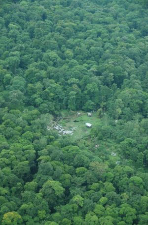 A new analysis of satellite data of the Amazon published in late May provides the most detailed analysis yet of year-to-year deforestation in the region, revealing exactly where and why the rainforest is being cleared across Brazil, Bolivia, Peru and Colombia. The