 Natural Resources Canada is seeking the development of a software solution for the creation of high-resolution vegetation mapping data in wildland urban interface areas and wildland areas near communities to enable detailed fire behaviour prediction, fire hazard assessment and fire hazard mitigation activity planning. …Over the past 10 years, more than 2.5 million ha have been burned annually by wildfires. Fighting wildfires can be greatly improved with timely and accurate fuel attribute mapping data. The forest sector is operationally using airborne laser scanning (ALS) and digital aerial photogrammetry (DAP) data to produce and update enhanced forest inventory (EFI) maps, but currently there are no software tools available to quickly and cost-effectively produce detailed vegetation fuel type maps or fuel attribute maps from these types of data. In particular, fire managers lack maps of surface fuel and understory forest structure.
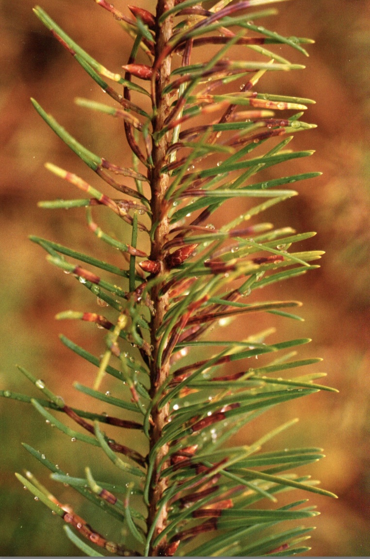 As global warming enables destructive insects and diseases to move farther north into Canada’s forests, keeping the public informed about these pests is critical, says François Lorenzetti, an expert on insects and professor of forest dynamics at the Université du Québec en Outaouais. … Many insects affect urban forests, so arming Canadians with the knowledge to “counter these kinds of insects around their house and even in public spaces and urban settings” is important, said Lorenzetti. Natural Resources Canada is currently updating pest information on its widely used database on trees, insects and diseases found in Canada’s forests. …Not only do Lorenzetti and his entomologist colleagues use the database frequently, it is their go-to resource to share with people emailing them questions about insects. “I think it’s a good way for families and kids to get interested in the natural world and science,” he said.


 After members of the Elphinstone Community Association (ECA) asked the regional district to urgently apply to withdraw District Lot 1313 from BC Timber Sales operating plans, the Sunshine Coast Regional District is taking formal steps to protect the 48-hectare area on Mount Elphinstone also known as the Reed Road Forest. On Feb. 17, the directors moved to begin a formal referral to the Sḵwx̱wú7mesh Nation (Squamish Nation) about the protection of DL 1313. …In a letter dated Nov. 1, 2021, Powell River-Sunshine Coast MLA Nicholas Simons outlined options the SCRD could pursue. …Of the three options, staff reported that none “appear to be an obvious fit to prevent logging of DL 1313.
 Operating community forests who are members of the BCCFA are asked to participate in the 8th annual survey of the benefits that Community Forest Agreements bring to their communities and to the province. The survey results, combined with your stories and photos, provide us with our most important and valuable tool in advocating for community forests and the provincial policies that support their success. This fact cannot be underestimated, particularly in these times of tremendous change in government policy. A link has been set up for each community forest and sent to the key contact for the organization on February 22nd. The link can be shared with others in your organization to complete the survey. The deadline for survey completion is April 15th. Contact Susan at smulkey@bccfa.ca or 250-353-1477 with any questions.


/https://www.thestar.com/content/dam/thestar/news/canada/2022/02/26/she-was-once-left-for-dead-in-a-dumpster-now-grandma-losah-is-leading-a-major-protest-movement/_4losah.jpg)
 A Manitoba First Nation has filed a lawsuit against the province and a logging company, alleging the province failed to consult the community before extending a timber harvesting licence in traditional territory. Wuskwi Sipihk First Nation announced the lawsuit against the Manitoba government and Louisiana-Pacific on Wednesday. Chief Elwood Zastre said the government has allowed Louisiana-Pacific to build roads and harvest timber in its traditional territory around Porcupine Provincial Forest and Kettle Hills in west-central Manitoba for the past 16 years. Zastre said the timber harvesting has negatively impacted land, water and species in the territory. … The First Nation alleges the province issued further authorization to the logging company to continue work without notifying the community, and says the province breached its duty to consult. … The lawsuit asks the court to suspend forestry developments in the area.
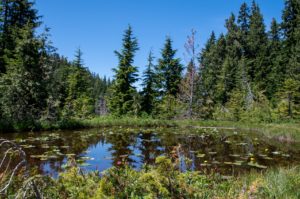 Re. Castanet’s three recent articles on the amount of clear cut logging our chief forester is allowing in Shuswap, Okanagan and Boundary areas Aren’t we all getting a little fed up with government press releases, industry facts, regurgitation of data with no back up? …Why not question these sources and ask govt and industry some real hard questions …? Other journalists reporting on recent announcements by the chief forester on new allowable annual cuts … merely reprint what the chief forester says without question. … With public safety at serious risk from the twin crises of climate change and biodiversity loss, a concerned and alarmed public needs the assistance of journalists in asking the right questions and in seeking informed answers.
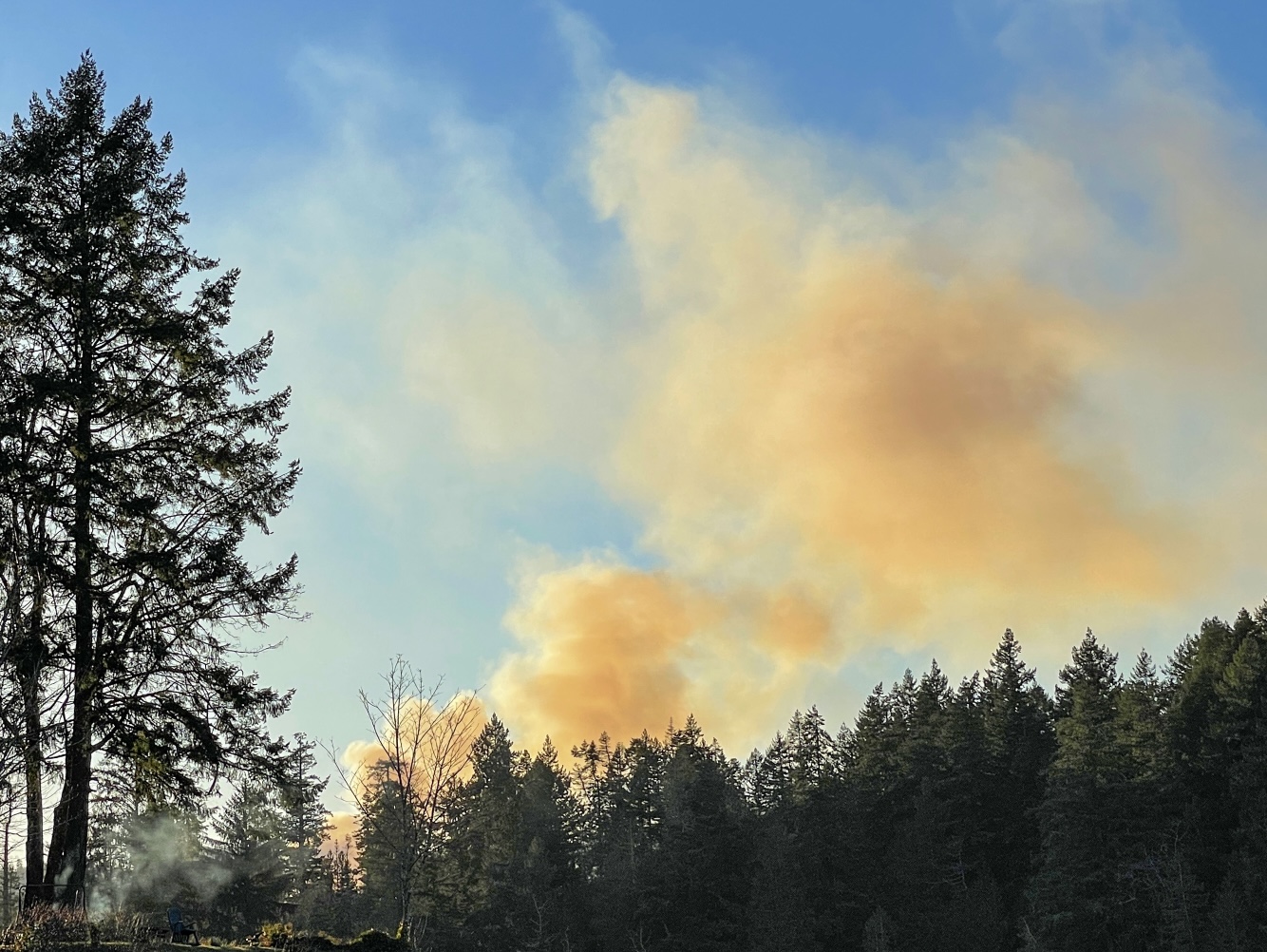
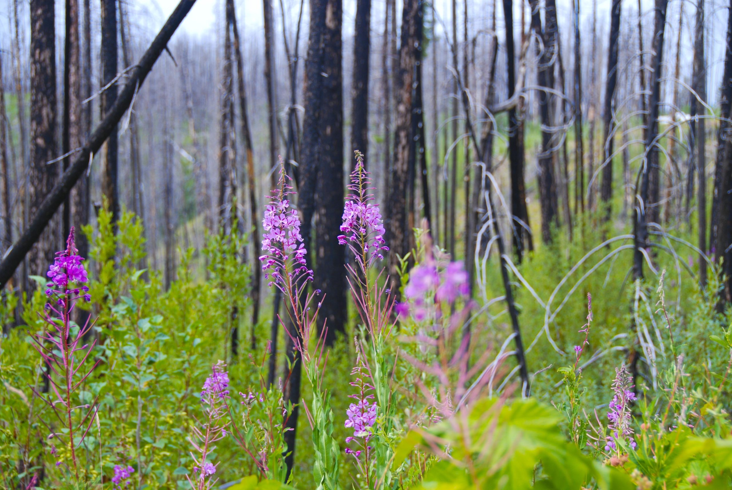 Fire has shaped ecosystems on Earth ever since there was vegetation and an ignition source, including lightning, to ignite them. In addition, human use and management of fire have also impacted ecosystems and biodiversity. Prior to European settlement, many Indigenous peoples in BC used fire to sustain biodiversity and break up the landscape to limit fire spread and severity. In the late 1800s and early 1900s, as natural and human-caused fires impacted growing communities, fire suppression practices began—a practice that through the decades has impacted the development of forest ecosystems. Today, the impacts of climate change on forest health with BC’s more than 100 years of fire exclusion and suppression is highlighting new challenges and shifting paradigms in forest and fire management. Resource managers are looking at ways to restore the natural role of fire in the landscape—to support resilient, healthy forests while reducing the risk of catastrophic wildfire.
 West Fraser Hinton paused its controversial clearcut logging plan in critical habitat of the threatened A La Peche caribou in west-central Alberta, following the province’s creation of a temporary “No Harvest Zone” until it finishes its land-use plan for the area. The decision comes after months of opposition from local trappers, the Mountain Métis community, the conservation community and concerned Albertans. While conservation groups said in a joint press release that they appreciate the change, they are making calls for the caribou population to be permanently protected. …The Fitzhugh asked West Fraser what reasons, in addition to the province’s creation of a temporary “No Harvest Zone,” led to its decision to halt clearcut logging plans. Joyce Wagenaar, West Fraser communications director said, “sustainable, healthy forests and ecosystems are critical to West Fraser.” …West Fraser says caribou recovery and other outcomes would occur in the years following the release of the subregional land-use plan.
 A judge hearing a request to stay proceedings against people arrested at old-growth logging protests on Vancouver Island says the application has a reasonable prospect of success, but he wants another judge to consider it with “fresh eyes.” B.C. Supreme Court Justice Douglas Thompson says he has asked the chief justice to assign a second judge to hear the protesters’ application, which alleges misconduct by the RCMP during arrests where about 400 people were charged with criminal contempt. …Six protesters were part of the application, but the Crown has since stayed charges against two women who also alleged abuse of process by officers who they said used unlawful tactics to arrest them. …Thompson says he anticipates a new judge will hold a pre-hearing conference to get advice before lawyers for protesters and the Crown are told when the stay application will be heard.


 COLORADO — There goes Washington again. But will the huge sums Joe Biden recently pledged to spend on national forest restoration and wildfire prevention — $50 billion over 10 years — really do the job? …More funding, if judiciously spent could help, at least at the margins. I’m not suggesting we look this gift horse in the mouth. But if history is any guide, the relief Coloradans desperately seek won’t be found through funding alone. A host of other reforms, policy changes and political dynamics must change if this is to be anything more than an empty gesture and boondoggle. …A similarly “bold” plan was initiated by the Bush administration in late 2003, The Healthy Forests Initiative, as some may recall. It, too, was touted as a “game-changing” breakthrough. …Today, almost every major forest decision is litigated, sometimes repeatedly, often ad nauseam, which is intended to delay or derail any proposal.
 Foresters will now be able to use machines to help clear hazardous brush on slopes of 30-50 percent after policy changes approved by the Tahoe Regional Planning Agency Governing Board on Wednesday. … Prior to the update, Lake Tahoe agencies could use ground-based mechanical equipment on slopes up to a 30 percent gradient, while work on steeper slopes was limited to hand crews, pile burning, and aerial logging to protect water quality from potential erosion. … Steep terrain can be more difficult and resource intensive for land managers to reduce hazardous forest fuels. Research recently completed … showed that the use of newer mechanical equipment in combination with hand crews on slopes of 30-50 percent would not cause significant impacts to the watershed. The research also showed the new policy would increase forest and ecosystem resilience to disturbances such as fire, insects and disease, and climate change.
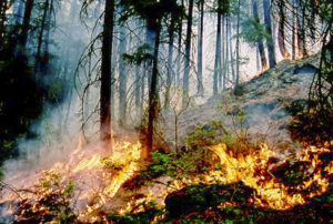 An alarming new United Nations report warns that the number of extreme wildfires is expected to increase 50% globally by the end of the century, and that governments are largely unprepared for the burgeoning crisis. Even the Arctic, previously all but immune to the threat, faces growing wildfire risk because of climate change and other factors,
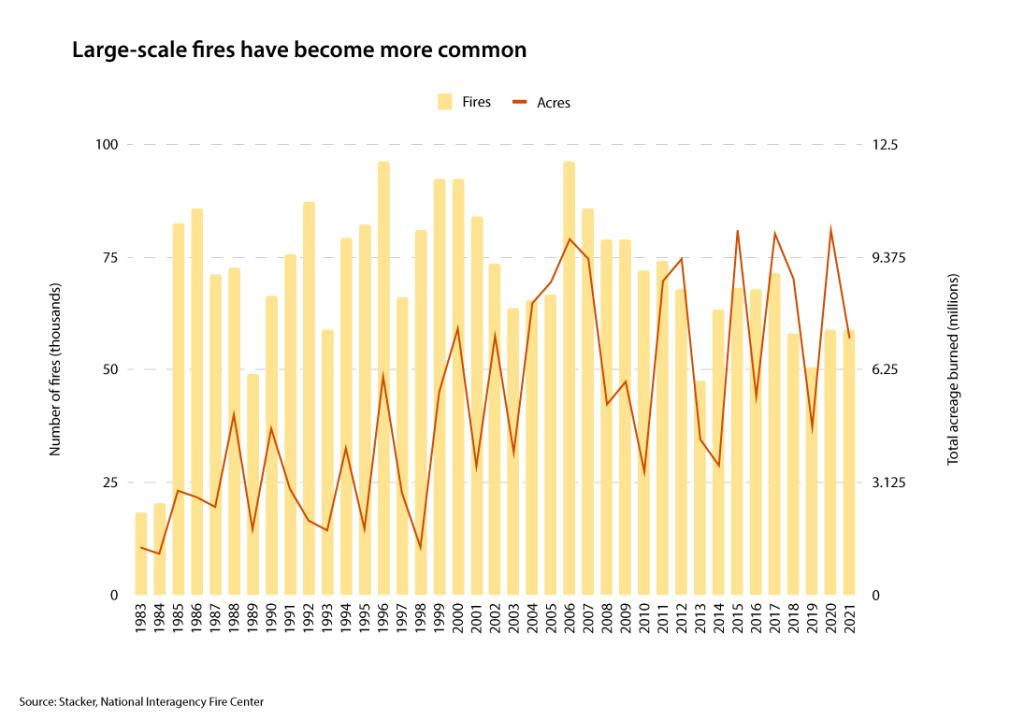

 The George Washington and Jefferson national forests cover 1.8 million acres of land across several states, including Virginia. Now, advocates are pushing for new protections for the oldest residents of the forests. A coalition of environmental groups is urging the Biden administration to establish new rules safeguarding old-growth trees on federal lands. Elly Boehmer, director of Environment Virginia, said such trees play a critical role in forest ecologies. “They moderate temperatures, improve our soil health and then obviously provide habitat for countless [numbers] of our favorite wildlife species,” Boehmer outlined. According to the Climate Forests campaign, 17.2 billion metric tons of carbon are stored in the country’s national forests, and older trees can store more carbon than their younger counterparts.
 In July 2020 Nature published some surprising results showing an abrupt increase in harvested forest area in Europe, especially in the Nordic countries. A new study provides empirical insights into where the Nature study went wrong. “Unfortunately, this mistake may already have had unintended consequences for European