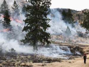
 While images of wildfires capture their ferocity, data can provide insight into how bad a fire season is. Such is the case with two graphics, powered by satellite data, that showcase a Canadian wildfire season off to a wild — and scary — start. Twice a day a NASA satellite sends images to the ground, giving a real-time view of where fires are burning. This is especially useful for remote areas where no sensors are stationed. As of Tuesday that satellite had picked up four times as many fire hot spots across Canada than is typical for early June. Based on data from the Canadian Interagency Forest Fire Centre, about 200 fires are actively burning in Canada and have consumed about 7,700 square miles (19,900 square kilometers) of terrain, most of it in the last week.