©GeoReach
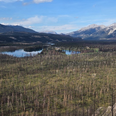
As visitors at Old Fort Point look out at the mosaic of burnt patches of forest from the Jasper wildfire, they see a vastly different landscape than they would have before July 2024. But that same barren view looks strikingly similar to photos taken in the early 1900s. Now, as the Jasper landscape begins to regenerate in the wake of last year’s massive wildfire, hikers can participate in a citizen science project to help document the area’s rebirth. …Parks Canada and the University of Waterloo have teamed up to crowdsource photos from three locations on the hike …they installed three cellphone stands, each with a cradle for the camera, along the popular 3.8-kilometre hike, which starts just east of the Jasper townsite. Visitors will take a photo, then scan the QR code to directly upload a photo, or visit the GeoReach website to share their photo with researchers