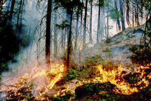
 For years, Colorado’s wildfire risk map was so inaccurate that state officials all but ignored it. …After an infusion of $480,000 in state funds, Colorado unveiled a new map that included a host of updates, such as the pine beetle damage. It’s an upgrade that has put in place a “powerful” tool capable of driving wildfire mitigation, Manriquez said — and one that comes as communities across Colorado and the country brace for a future of climate-juiced wildfires. …States in recent years have struggled to keep pace with the changes. And many states haven’t dedicated enough — if any — consistent funding to keep the tools up to date. But forestry and fire officials in states such as Colorado, Oregon, Utah and Texas are stepping up their efforts to ensure they have high-quality fire risk data, models and maps to more accurately determine which areas are most at risk.