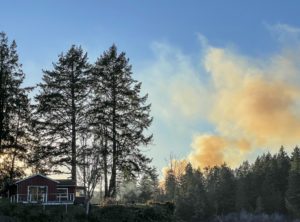
 A year after Oregon endures its most destructive fire season on record in 2020, state lawmakers order a map estimating the wildfire risk for every property in the state. It’s the kind of rating now available on real estate sites like Zillow. The state wants to use the results to decide where it will apply forthcoming codes for fire-resistant construction and protections around homes. Around the same time, insurance companies start dropping Oregon homeowners’ policies and raising premiums to limit future losses, much as they have done in other disaster-prone states. Insurers have their own sophisticated risk maps to guide them, but some brokers instead tell homeowners the blame lies with the map. The belief gets treated as fact both on social media and in mainstream news — even though insurers and regulators say it’s not true. …By the time the state pulls back the map, the myths about it have gained so much momentum there’s no stopping them.