Category Archives: Forest Fires

Forest Fires

Whitecourt Forest Area wildfires: Woodlands County gives evacuation order for some

By Brad Quarin
The Whitecourt Star
May 11, 2026
Category: Forest Fires
Region: Canada West

Residents of Woodlands County impacted by a wildfire south of Highway 43, east of Range Road 114 are being ordered to evacuate. The area includes the West Ridge subdivision. The order was given on the evening of May 11 after the wildfire was spotted earlier in the afternoon, approximately 3.5 kilometres south of Whitecourt, according to Woodlands County. According to Alberta Wildfire, the fire is approximately 75 hectares in size and the county noted that firefighters and helicopters are responding. “All residents in the affected area must evacuate immediately,” the county stated on the evening of May 11.  “Gather pets, important documentation, and medication.” Meanwhile, another wildfire in the Whitecourt Forest Area first spotted on May 10 grew to be 11.67 ha in size and is currently being held, according to Alberta Wildfire. The fire started burning 22 km northeast of the Town of Whitecourt and east of Blue Ridge Haul Road, according to Alberta Wildfire.

Read More

10 Manitoba firefighters land in Minnesota to help state’s wildfire fight

CBC News
May 11, 2026
Category: Forest Fires
Region: Canada West, US West

Manitoba is returning the favour to a southern neighbour that sent firefighters to the province during last year’s devastating wildfire season that killed two people and displaced 33,000 others. Ten Manitoba firefighters landed in Bemidji, Minn., on Saturday to help with that state’s wildfire-fighting efforts. “You were there for us, we will be there for you,” said Ian Bushie, Manitoba’s natural resources minister. …Manitoba and Minnesota are part of the Great Lakes Forest Fire Compact and share resources during major fires. …There was a blaze near Lake Bemidji State Park over the weekend that burned around eight acres. “While their fires are not out of control, this is assistance and relief for the crews that they have on the ground there,” Bushie said in an interview. He added the firefighters are on a 14-day deployment but could be called back early if conditions change.

Read More

Out-of-control wildfire burning on Vancouver Island raises alarm

By Megan Yamoah
CTV News
May 5, 2026
Category: Forest Fires
Region: Canada, Canada West

A small but concerning wildfire burning on Vancouver Island is drawing attention from provincial wildfire officials. The British Columbia Wildfire Service says the fire, located east of Nanaimo near Fourth Lake, is currently classified as out of control, meaning it’s expected to continue spreading under current conditions. Discovered on Tuesday, the blaze is estimated at about 0.7 hectares in size. While relatively small, officials say its behaviour and location are enough to warrant a full response. Two initial attack crews, along with two officers and a water tender, have been deployed to the scene. Early indications suggest the fire may be human caused. The wildfire service reports 28 active fires across the province, with two currently out of control, and approximately 124 firefighters engaged in suppression efforts.

Read More

Heat records fall across Vancouver Island as wildfire risks climb

By Hannah Link
Victoria Times Colonist
May 5, 2026
Category: Forest Fires
Region: Canada West

©BCWildfireService

Warm weather across British Columbia broke daily temperature records in at least nine Vancouver Island locations this past weekend. Victoria’s Gonzlaes station got to 26.9 C, breaking the record of 25 C for May 3 set in 1898, while the Victoria International Airport recorded a high of 25.1 C, breaking the previous record of 25.0 C set in 1944.  …The B.C. Wildfire service said it’s expecting above-seasonal temperatures into this week and warns that could increase the likelihood of new wildfire starts. There are about 31 active wildfires in B.C., with roughly 10 new fires recorded Sunday — including two on Vancouver Island. …The B.C. Wildfire Service said one blaze deemed under control was discovered just west of Coombs near Highway 4 early Sunday afternoon. …Another fire was discovered near Tyee Creek, east of Ladysmith.

Related BC wildfire news by Amy Judd in Global News: B.C. wildfire burning near Cultus Lake as hot weather continues

Read More

Evacuation alert issued due to wildfire between Williams Lake and Quesnel

By Ian Holliday
CTV News
April 30, 2026
Category: Forest Fires
Region: Canada West

©BCWildfireService

A large swath of sparsely populated land in B.C.’s Cariboo region has been placed on evacuation alert due to a nearby wildfire. The Cariboo Regional District issued the alert for eight parcels covering 696.57 hectares in the Webster Creek Fire Area on Thursday, citing “potential danger to life and health.” The Webster Creek wildfire was discovered Wednesday. It’s located west of Highway 97 between Williams Lake and Quesnel, two of the region’s largest population centres. According to the B.C. Wildfire Service, the blaze is currently burning on roughly 66 hectares and displaying Rank 1 and Rank 2 fire behaviour, the least intense levels on the scale. There are 19 firefighting personnel responding to the wildfire, supported by helicopters and heavy equipment.

Read More

Ferrabee wildfire near Hell’s Gate remains out of control at 53 hectares

By Dillon white
The Ladysmith – Chemainus Chronicle
April 29, 2026
Category: Forest Fires
Region: Canada West

©BCWildfireService

BC Wildfire Service (BCWS) crews continue to respond to a wildfire between Hope and Lytton. According to the latest update from BC Wildfire Service on Wednesday morning (April 29), the Ferrabee fire near Hell’s Gate remains out of control. BCWS defines out-of-control blazes as spreading or anticipated to spread beyond their current perimeter. “This wildfire does not currently pose a threat to structures, critical infrastructure or public safety,” the update reads. The blaze was discovered on Thursday afternoon (April 23) and was estimated to be 27 hectares in size on Saturday (April 25) and 36 hectares on Monday (April 27). The fire has since grown to 53 hectares. Approximately two dozen ground personnel are responding to the blaze alongside aerial support. …The wildfire is believed to be human-caused.

Read More

Wildfire burning ‘out of control’ south of Coombs

Parksville Qualicum Beach News
April 26, 2026
Category: Forest Fires
Region: Canada West

©BCWildfireService

A wildfire is burning “out of control” near Coombs, according to BC Wildfire Service. The fire is one hectare in size and is located within a cut-block, four kilometres south of Coombs. It was discovered on April 26. BC Wildfire service has responded with a unit crew and initial attack personnel, with aerial support. Smoke may be visible from the Alberni Highway (Highway 4A), parts of the Island Highway (Highway 19) and surrounding communities, along with activity from firefighting aircraft. The wildfire does not currently pose a threat to structures, critical infrastructure or public safety, according to BC Wildfire Service.

Read More

Three wildfires remain active in Calgary Forest Area

By Noel Edey
Cochrane Now
December 2, 2025
Category: Forest Fires
Region: Canada West

With wildfire activity winding down for 2025, the Calgary Forest Area continues to have three active wildfires, all classified as under control, with firefighters working toward full extinguishment. These are among 26 wildfires still active in Alberta, 25 of which are under control, with one being held. Fire crews have extinguished 1,248 fires in forest protection areas this year, mirroring numbers from 2024 yet exceeding the five-year average by more than 100. One of the remaining fires in the Calgary Region is located 25 kilometres west of Water Valley in the Harold Creek area. The fire was first spotted on Nov. 10 at 8 p.m. and has been aggressively managed by wildfire crews, remaining contained to 27 hectares. Since Jan. 1, 2025, the Calgary Forest Area has experienced 73 wildfires, burning more than 67 hectares. Although Oct. 31 marked the official end of Alberta’s wildfire season, ongoing dry conditions mean the risk of wildfire remains in several areas. 

Read More

Wildfire erupts in forest protection area west of Sundre, danger upgraded to high

The Albertan
October 24, 2025
Category: Forest Fires
Region: Canada West

MOUNTAIN VIEW COUNTY – Provincial officials upgraded the wildfire danger rating to high across the Rocky Mountain House Forest Area Thursday as a new wildfire erupted in the area earlier in the day. Parts of Mountain View County are included in the forest area, namely west of Sundre and Bergen, covering Coal Camp and Bearberry west of Range Road 60 from Township Road 312 to the north boundary of the county. “The wildfire danger in the Rocky Mountain House Forest Area has increased to high,” the province’s Oct. 23 update said.”Continued warm temperatures, windy conditions and dry vegetation are contributing to the elevated risk. The wildfire danger will remain high until the area receives consistent and lasting moisture.” A wildfire was detected in the Rocky Mountain House Forest Area earlier in the day on Thursday. RWF080 is estimated at 80 hectares in size.

Read More

BC Wildfire Service reports wildfire activity decrease in northern BC

By Steve Berard
Energetic City
October 10, 2025
Category: Forest Fires
Region: Canada West

©BCWildfireService

FORT ST. JOHN, B.C. — Wildfire activity so far in 2025 is down compared to the same time last year, according to the BC Wildfire Service (BCWS). The agency has issued a status report for the Prince George Fire Centre as of Thursday, October 9th, which says 340 wildfires have been reported in the region so far in 2025. That’s a significant decrease from 2024, which saw 444 wildfires reported in the same time frame, although it’s still higher than the 10-year average of 308 blazes. The number of hectares burned so far this year is also down to 723,609 after last year saw 803,557 burned by October 9th. However, 2025’s wildfire season has still seen significantly more hectares burned than the 10-year average of 376,039.


Read More

Up to 20 millimetres of rain possible over Munro Lake fire, Peachland

By Nicholas Johansen
Castanet
September 28, 2025
Category: Forest Fires
Region: Canada West

©BCWildfireService

Some showers in the forecast could bring relief to firefighters on the line at the Munro Lake wildfire. Environment Canada meteorologist Philippe-Alain Bergeron said there is the potential for 10 to 20 millimetres of rain in the vicinity of the fire Monday evening and into Tuesday. Central Okanagan Emergency Operations has issued an evacuation order for an additional property near the fire. 5875 Brenda Mines Road, Zipzone Adventure Park, joins a handful of other non-residential addresses affected by the order. All evacuation alerts previously issued will remain in place overnight. Residents who were previously ordered out were allowed to return to their homes on Saturday. Unless conditions change, no further updates from the Emergency Operations Centre will be issued tonight. The Munro Lake wildfire remains out of control but has not grown in size. It remains at 310 hectares.

Read More

Wildfire season takes early toll on dry New Brunswick forests

By Alan Cochrane
The Telegraph-Journal
May 6, 2026
Category: Forest Fires
Region: Canada, Canada East

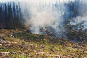
New Brunswick’s wildfire season has begun with more forests burned than at this time last year, according to the government’s wildfire dashboard. As of Wednesday afternoon, the dashboard reported there has been 178 fires so far this season, which have burned 343 hectares of forest. At the same date in 2025, there had been 100 fires burning 87.7 hectares of forest. The 10-year average for the period up to May 6 is 84 fires burning 105 hectares. As of 9 a.m. Wednesday, there were no out-of-control fires in the province, compared with six Tuesday night. …New Brunswick’s wildfire season begins in early April and continues through the summer. Last year, several fires resulted in restrictions on forest trail use. In Moncton, municipal fire departments joined with provincial firefighters. …“Record-low precipitation, minimal snowpack, and prolonged drought have pushed fire risks higher than normal,” the Department of Natural Resources said.

Read More

Many small wildfires spring up across New Brunswick Tuesday afternoon

Sam Farley
CBC News
May 5, 2026
Category: Forest Fires
Region: Canada, Canada East

…Around 7 p.m., spokesperson Nick Brown forwarded a social media post from the department on social media that staff are on scene responding to “active wildfires” near Rogersville, Doaktown and Blissfield. “At this time, there is no imminent risk to public safety,” the post said. …which are listed as out of control. …The fires listed as out of control as of 8 p.m. were near Doaktown, Renous, Nelson Junction, located south of Miramichi, and Rogersville. Another fire south of Rogersville is listed as contained, one near Canterbury is under control, and then additional fires near Hainesville, Tracy, Cap-Pelé, Elsipogtog First Nation, Rexton, Caraquet and Miramichi are listed as being patrolled, which means the fires are contained. …This year, there have been 171 fires so far, while last year up to this point there were 99.

Read More

Nova Scotia wildfire burning out of control amid hot fall weather

By Keith Doucette
The Canadian Press in the National Observer
October 6, 2025
Category: Forest Fires
Region: Canada, Canada East

NOVA SCOTIA — Unseasonably warm temperatures proved challenging Monday as the fight against an out-of-control wildfire in Nova Scotia’s Annapolis Valley entered its second week. The Department of Natural Resources estimated that the fire at Lake George had grown slightly in 24 hours to just over 2.8 square kilometres, mainly because of dry and windy conditions. Monday’s forecast for the area near Aylesford, N.S., called for a high of 28 C — the average daily high in the region for October is normally below 15 C. “I can’t believe it — in October we normally get frost and cold,” Dave Corkum, mayor of the Municipality of the County of Kings, said in an interview. “There is some rain in the forecast in a few days and hopefully we will get it.” Despite the conditions, Corkum said there are no reports of damage to structures in the area.

Read More

275 homes, cottages under evacuation order as N.S. wildfire burns near Lake George

By Meig Campbell
CBC News
September 30, 2025
Category: Forest Fires
Region: Canada East

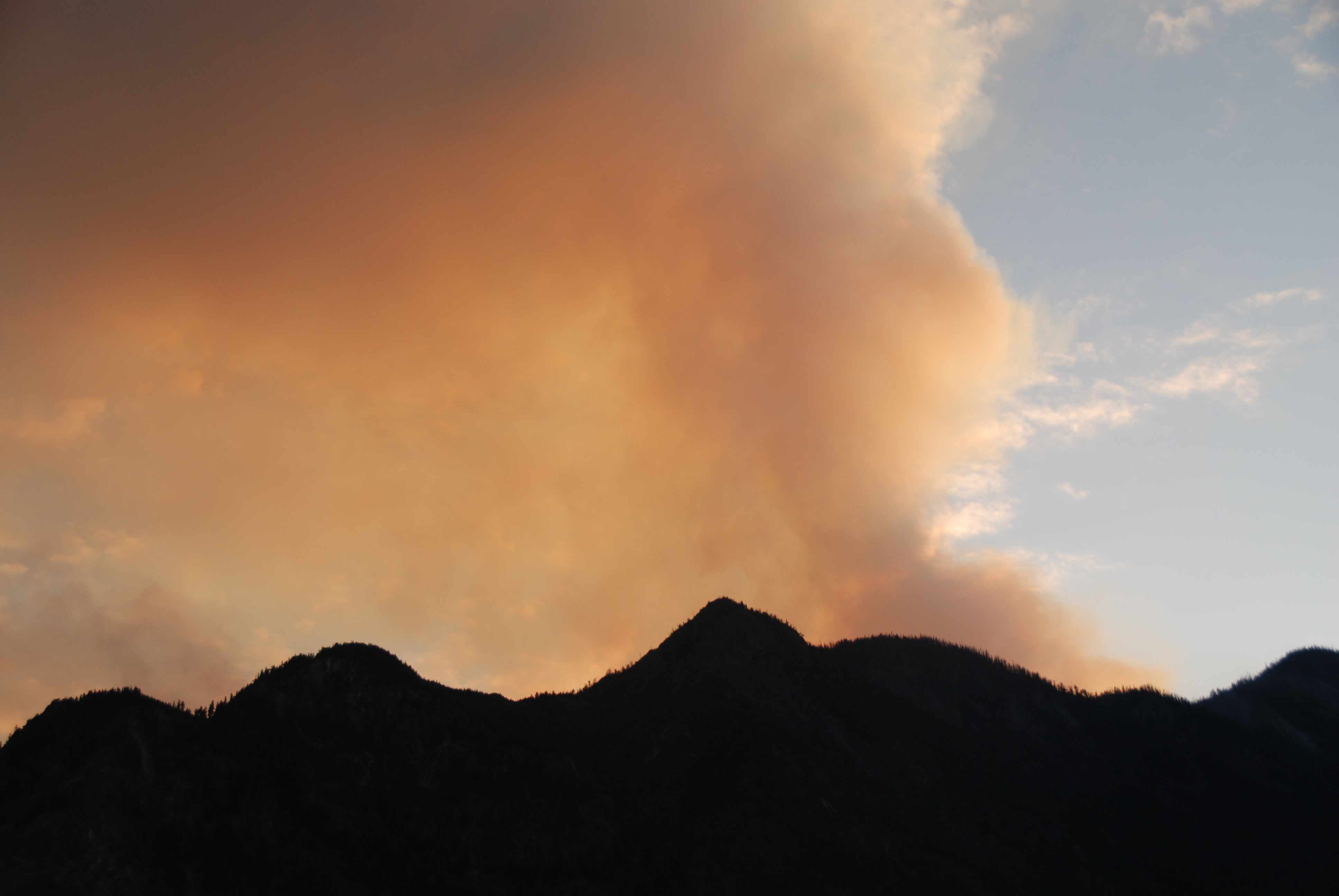
Nova Scotia’s Department of Natural Resources says more evacuations are possible as a fire near Lake George in the Annapolis Valley continues to burn out of control. Residents of … Aylesford Lake’s southwest end have been told to prepare to evacuate. The fire in Kings County, which broke out Sunday, is estimated to be 150 hectares. It had been pegged at 300 hectares Monday night but officials at a briefing Tuesday afternoon said that was the result of an overestimation due to dense smoke conditions. Jim Rudderham, DNR’s director of fleet and forest protection, told reporters the cause of the fire has not been determined but it’s presumed human activity is responsible since there has been no lightning in the area. “It’s frustrating for us and for everybody when this happens,” Rudderham said. No buildings have been damaged but 275 civic addresses have been evacuated and 56 others are under an evacuation alert. Some of those addresses are cottages.

Read More

Out-of-control wildfire in Nova Scotia threatens homes in Annapolis Valley

Canadian Press in CityNews Everywhere
September 29, 2025
Category: Forest Fires
Region: Canada East

AYLESFORD — Nova Scotia officials say more evacuation orders are possible as a wildfire in the Annapolis Valley remains out of control. In a social media post, the Department of Natural Resources said a helicopter had been dispatched to gauge the area of the Lake George fire, which at last estimate was roughly 300 hectares in size. The fire broke out Sunday and was declared out of control late Monday, prompting officials to announce an evacuation of nearby campgrounds and homes. Officials said Tuesday residents on Birch Lane, Spruce Drive and Blue Lane at Aylesford Lake’s southwest end should be prepared to evacuated. Dry and windy conditions have helped push the fire from the northern end of Lake George eastward toward the northern end of Aylesford Lake. Evacuees are asked to register at the Louis Millett Community Complex in New Minas, N.S., where services are being offered.

Read More

Oregon Department of Forestry team arrives in Asheville to assist on North Carolina fires

By Bobby Corser
KATU News
March 23, 2026
Category: Forest Fires
Region: United States

©OregonDeptForestrty

21 firefighters from Oregon are in North Carolina helping to battle wildfires. The firefighters from the Oregon Department of Forestry arrived in North Carolina on Sunday and traveled to Asheville this morning. They traveled to the east coast under the a state-to-state mutual aid agreement. “These agreements help bolster Oregon’s complete and coordinated fire protection system and create a cache of reciprocal resources for all of us to call on when needed,” said Ron Graham, Deputy Chief of Operations for ODF’s Protection Division. Firefighters will serve a two-week rotation.

Read More

Prescribed burn turns into wildfire 14 miles from Bend

By April Ehrlich
Oregon Public Broadcasting
May 8, 2026
Category: Forest Fires
Region: United States, US West

A multi-day prescribed burn in Deschutes County jumped containment lines on Thursday, prompting fire agencies to declare a wildfire. The fire on Pine Mountain, about 14 miles southeast of Bend, grew to 2,866 acres by Friday afternoon with the perimeter listed as 25% contained. The fire was mostly burning on federal land, as well as some private land. The wildfire declaration should help the U.S. Forest Service and local fire agencies tap into additional resources — like equipment and extra hands — as they dig containment lines around the fire’s perimeter. …That morning, the smoke appeared to be petering out, based on camera footage from the Oregon Hazards Lab’s wildfire camera networks. …On Thursday morning, the Forest Service announced it was canceling the burn “due to unfavorable conditions.” The agency declared the burn had turned into a wildfire that afternoon, after multiple spot fires appeared outside of the burn’s boundaries.

Read More

Wildfire south of Colorado Springs grows to 7,300 acres with no containment

By David Krause
The Colorado Sun
March 23, 2026
Category: Forest Fires
Region: US West

The wildfire burning south of Colorado Springs has grown to more than 7,300 acres and officials said the state highway on the west side of Fort Carson will likely remain closed through Friday. The 24 fire started Wednesday and currently there is no containment, but in an update Monday morning officials said overnight “fire crews were successfully able to tie in all control lines, boxing in the fire. As of this morning, control lines remain strong.” The fire started near mile marker 24 on Colorado 115, which connects Colorado Springs to Penrose. The road will be closed at least through Friday, but will be reevaluated daily, officials said Monday. The cause of the fire remains under investigation but started off the highway, not on the Army base, officials said last week. The fire was mapped at 7,385 acres early Monday morning, up from 4,900 acres Sunday morning.

Read More

Labor Mountain Fire near Cle Elum consumes 35,000 acres, more fire support on its way

By Stella Sun
KOMO News
September 29, 2025
Category: Forest Fires
Region: US West

@DirtyFreehub

CLE ELUM, Wash. — The Labor Mountain Fire continues to grow near US-96 Blewett Pass, forcing Level 3 “get out now” evacuation orders in and around the area. The fire, which began Sept. 1 from lightning, has forced a 30-mile closure of US-97 between mileposts 149 and 178, affecting the popular recreation area of Blewett Pass. A dozen trailheads, recreation residences, Camp Wahoo, the Teanaway Community Forest, and a historic guard station are at risk. These areas remain under evacuation orders… Marilyn Davis, the Labor Mountain Fire public information officer, said the fire has exceeded 35,000 acres as of Monday, Sept. 29. Just four days prior, on Sept. 25, the fire was only 17,000 acres. The Okanagan-Wenatchee National Forest is known for its rugged terrain, “is considered the most rugged of any national forest in the country,” according to the Labor Mountain Inciweb fire update webpage.

Read More

Crews battle Northern Michigan wildfire for third day

By Justine Lofton
Michigan Live
May 6, 2026
Category: Forest Fires
Region: US East

OSCODA COUNTY, MI – Firefighters are holding the line around a 124-acre wildfire in Northern Michigan today. This is the third day of firefighting operations around the Mapes Fire, which started on Monday, about five miles west of Mio in Oscoda County. As of this morning, the fire is 90% contained, according to the U.S. Forest Service. The fire began on private property on Mapes Road in Big Creek Township. It quickly spread to public land and has burned mostly within the Huron-Manistee National Forest. At least two structures have been destroyed. Residents on Camp 10 Road were evacuated from their homes Monday afternoon but were allowed to return later that day. Reports say the fire was caused by downed power lines and high wind speed, as determined by a Michigan Department of Natural Resources inspector. However, the USFS says the cause is under investigation.

Read More

Crews work to contain 100 acre wildfire amid critical fire weather

By Roxanne Werly
UpNorthLive
May 5, 2026
Category: Forest Fires
Region: US East

OSCODA COUNTY, Mich. — Crews are working to contain a wildfire in Oscoda County after it prompted evacuations Monday. The wildfire is about 100 acres and primarily on national forest land around Camp Ten Road near Lost Sky Ranch. Residents living near Camp 10 Road were evacuated to a shelter Monday afternoon, but were able to return home several hours later. Monday night officials said two structures were destroyed and the fire was about 80 percent contained. …A Red Flag Warning is in effect for parts of Michigan due to critical fire weather, including high winds, low humidity and dry vegetation.

Read More

South Georgia wildfires scorch over 55,000 acres as crews race to contain hot spots and protect homes

CBSd News in WDEF
April 29, 2026
Category: Forest Fires
Region: US East

©GeorgiaForestryCommission

Firefighters in South Georgia say they’re making progress, but both major wildfires remain active and far from contained. According to a Wednesday morning update from the Georgia Forestry Commission, the Pineland Road Fire has now burned 32,569 acres and is 23% contained, while the Highway 82 Fire has reached 22,601 acres and is 32% contained. Officials say crews are continuing to strengthen containment lines and push forward where conditions allow. Even as those large fires burn, crews are still responding to new ones. The agency said it handled eight additional wildfires Tuesday, burning a total of 2.8 acres statewide, not including the two major fires. The Highway 82 Fire, burning in Brantley County and impacting communities including Atkinson and Waynesville, remains a “dynamic, changing situation” due to ongoing drought and dry conditions. The entire state is under drought conditions, with that area facing what officials describe as an exceptional drought.

Related news: Blog by Johnny Sabo, GFC Director: Inside Georgia’s Wildfire Preparedness Efforts

Read More

Fighting fire with fire: Crews set strategic burns as wildfire threatens homes in south Georgia

By Abby Kousouris
WTVY News 4
April 29, 2026
Category: Forest Fires
Region: US East

©BrantleyCountyECHOLS COUNTY, Ga. — Firefighters battling the Pineland Road Fire in south Georgia pushed strategic “backburns” inside the evacuation zone as the wildfire grew to 32,569 acres and remained 23% contained, according to the Georgia Forestry Commission. The fire continued to challenge crews across Clinch and Echols counties with active fire behavior, the agency said in its Wednesday update. Mandatory evacuations remained in effect in Echols County… Officials reported no injuries. With permission from the Georgia Forestry Commission, Atlanta News First went inside the evacuation zone and up to the fire line. …Crews were carrying out what officials call a “strategic firing operation,” a controlled burn designed to remove dry brush and other fuel ahead of the main fire, especially in areas too dangerous for heavy equipment. Georgia Forestry Commission said the goal was to widen blackened buffer zones and prevent hidden heat deep in bogs from reigniting weeks or months later…

Read More

State forestry commission reports strides in containing southeast Georgia wildfires

By Jonathan Raymond
11 Alive
April 28, 2026
Category: Forest Fires
Region: US East

Georgia Forestry Commission

BRANTLEY COUNTY, Ga. — Crews working the wildfires in southeast Georgia have made significant strides in containment through Tuesday morning, the state forestry commission reported. The Georgia Forestry Commission said in a social media post that the Highway 82 fire in Brantley County — the smaller but so far more destructive of two major wildfires in the region — was now 32% contained. That’s up from just 6% a day before. Meanwhile the Pineland Road fire in Clinch County, which has burned more than 32,000 acres, is considered 23% contained. “That progress doesn’t happen by chance — it happens because of the men and women on the ground every single day,” the forestry commission wrote. Governor Brian Kemp also visited the region, specifically the area of the Pineland Road fire, on Tuesday. He visited Brantley County and the area of the Highway 82 fire previously on Sunday.

Read More

Heavy weekend rain slows 2 sprawling Georgia wildfires, even as new blazes start

By Russ Bynum and Jeff Martin
Associated Press in WRAL News
April 27, 2026
Category: Forest Fires
Region: US East

NAHUNTA, Ga. — Heavy rain slowed the progress of two sprawling southern Georgia wildfires over the weekend, allowing crews to make some progress in containing the blazes that have destroyed more than 100 homes. Although the rain helped the firefighting efforts, it wasn’t “nearly enough to put the fires out” and crews responded to 10 new blazes throughout the drought-stricken state Sunday, the Georgia Forestry Commission said Monday. …Georgia’s biggest blaze, the Pineland Road Fire, has scorched more than 50 square miles and at least 35 homes… about 35 miles north of Florida, which is also dealing with wildfires. The area has been full of highly combustible dead trees and other vegetation since Hurricane Helene carved a destructive path northward in September of 2024. About 60 miles to the northeast, the Highway 82 Fire has been burning since April 20. It has destroyed at least 87 homes and torched more than 35 square miles. It is only 6% contained.

Read More

Georgia wildfires that destroyed more than 120 homes continue to threaten residents

Associated Press
April 25, 2026
Category: Forest Fires
Region: US East

©GovBrianKempFB

NAHUNTA, Ga. — Two wildfires in southeastern Georgia continued to threaten homes and lives on Saturday as officials warned that strong winds could spread the flames. Brantley County Manager Joey Cason called it a “dynamic situation” and begged residents to “please evacuate” if ordered to do so. “This fire is going to move rapidly once these winds get here later today,” he said. The Highway 82 Fire has been burning since Monday and has destroyed at least 87 homes. Georgia Gov. Brian Kemp said Friday that is the most for a single wildfire in the state’s history. The blaze was started by a foil balloon hitting live power lines. That created an electrical arc that ignited combustible material on the ground. …A joint statement issued by multiple government agencies said the fire’s perimeter was more than 14.8 square miles (38 square kilometers) and it was only about 10% contained.

Additional coverage:

Read More

Southern US wildfires force residents to flee: ‘I don’t know if I have a house standing or not’

The Guardian
April 23, 2026
Category: Forest Fires
Region: US East

Wildfires tearing through the south have forced hundreds of Georgia residents to flee in minutes, leaving them distraught about the homes and animals they left behind. The fires that spread this week during an extreme drought in Georgia and Florida have blanketed cities hundreds of miles away in smoke, leading to more air quality warnings on Thursday across the south-east. Driven by strong winds and low humidity, the two biggest fires in southern Georgia have spread rapidly over the past two days and destroyed more than 50 homes in rural areas. But the growing threat led to more evacuations and school closings on Wednesday. “I don’t know if I have a house standing or not,” said Denise Stephens, who was forced to evacuate because of the fast-moving Brantley county fire near Georgia’s coast. “I know what it’s taken from other people, but I don’t know what I have left standing.”

Additional coverage from the Associated Press in Fire Engineering: Wildfires Across GA and FL Destroy More Than 50 Homes and Force Evacuations

Read More

Smoke from South Georgia wildfires spreads across 30,000 acres

By Christopher Harris
CBS News
April 23, 2026
Category: Forest Fires
Region: United States, US East

GEORGIA — Smoke has filled the air across parts of the Peach State this week as wildfires continue to burn out of control in southern Georgia, forcing evacuations and destroying homes. According to the Georgia Forestry Commission, crews responded to 34 new wildfires Wednesday that burned about 75 acres statewide. But officials say the biggest concern remains two large, active fires that have already scorched tens of thousands of acres. The Pineland Road Fire in Clinch County has grown to nearly 29,606 acres and is about 10% contained. In Brantley County, the Highway 82 Fire has burned more than 4,400 acres and is roughly 15% contained. Officials say dry conditions, high winds, and a lack of rain are making the fires harder to control. …The growing wildfire threat prompted Brian Kemp to declare a state of emergency, allowing more state and federal resources to assist, including expected support from FEMA.

Read More

Wildfires burning across Georgia and Florida destroy homes and force evacuations

By Edward Helmore
The Guardian
April 22, 2026
Category: Forest Fires
Region: US East

Wildfires burning across the south-eastern US intensified on Wednesday across parts of south-east Georgia, where 50 homes were destroyed, and across north-east Florida, forcing evacuations and school closures in some communities. The Georgia forestry commission issued its first mandatory burn ban in the state’s history, effective across 91 counties in the lower half of the state, due to worsening drought conditions and rising wildfire activity. “My office and I are working closely with the Georgia Forestry Commission to respond to the increasing threat of wildfires in South Georgia,” Governor Brian Kemp wrote on X. ”If you are in a directly affected area, please adhere to guidance from your local officials to keep you and your family safe.” Smoke from the fires drifted to Atlanta and Savannah, Georgia, as well as Jacksonville, Florida, while air quality in parts of south Georgia declined to the unhealthy category.

Read More

Vehicle ignites 20-acre wildfire in Ocala National Forest after going off road, getting stuck

Ocala-News
April 13, 2026
Category: Forest Fires
Region: US East

@USFS

A weekend off-roading excursion turned into a 20-acre wildfire in the Ocala National Forest after a vehicle’s exhaust system ignited dry grass. U.S. Forest Service (USFS) and Lake County Fire Rescue firefighting crews responded to the “Grassy Pond 3 Fire” located off Paisley Road on Saturday, April 11. According to the USFS, the fire was caused by a 4×4 vehicle that was driven off a designated trail and into a patch of soft ground. The vehicle became stuck, and despite recent rainfall in the area, the surrounding tall grass had dried enough to be ignited by the heat of the vehicle’s exhaust system. The operators and bystanders were unable to free the vehicle, which was declared a total loss. …On Sunday, the U.S. Forest Service issued a stern reminder to visitors that driving off designated trails and surfaces is both unwise and illegal on forest land.

Read More

Alabama Forestry Commission battling wildfire size of 2,500 football fields in Shelby County

By Taylor Pollock
WBRC News 6
March 30, 2026
Category: Forest Fires
Region: US East

SHELBY COUNTY, Alabama – Officials with the Alabama Forestry Commission (AFC) continued working Monday, March 30, to put out a fire in Shelby County that they say spans roughly 2,500 football fields. The wildfire, which is within the city limits of Westover, Alabama, is burning on an old game preserve near Rosewood Drive. No homes or businesses are in immediate danger. AFC officials Monday said that the fire is 90% contained. They were first called out to the fire Saturday, March 28. Tyler Givens, a unit manager with the AFC, said that the fire has been challenging to battle due to the steep, rocky terrain. “What we have to do is use leaf blowers and fall off the side of the mountain with leaf blowers and blow in a line rather than use a bulldozer because it was just inaccessible,” Givens said. 

Read More

Forest Service crews respond to two wildfires in western North Carolina

By US Forest Service
US Department of Agriculture
March 24, 2026
Category: Forest Fires
Region: US East

Asheville, N.C. USDA Forest Service firefighters are currently responding to two wildfires in western North Carolina: the Poplar Fire on the Appalachian Ranger District of the Pisgah National Forest and the lightning-caused Tarkiln Ridge Fire on the Tusquitee Ranger District of Nantahala National Forest. The nearly 100-acre Poplar Fire is located north of Poplar, North Carolina, along the east side of NC-197 in Mitchell County. The cause of the fire is under investigation. The fire is burning in an area heavily affected by Hurricane Helene, where an extensive number of downed trees are contributing to increased wildfire intensity and risk. …The Tarkiln Ridge Fire is burning in rugged terrain northwest of Hayesville, North Carolina, in Clay County near Fires Creek. Crews first responded to the fire on Monday, March 23, in an area that was previously identified as a future prescribed fire unit for hazardous fuels reduction. 

Read More

South Carolina Forestry Commission issues statewide Red Flag Fire Alert amid ongoing drought

By Marissa Thompson
WCSC 5 News Leader
March 24, 2026
Category: Forest Fires
Region: US East

CHARLESTON, S.C. — The entirety of the State of South Carolina is now under a Red Flag Fire Alert as an intensifying drought continues to create an elevated risk of wildfires. The South Carolina Forestry Commission said they are issuing this alert to “strongly discourage people from burning outdoors” amid continuously dry conditions across the state with no end in sight. With the lack of rain and forecasts predicting both high winds and low humidity levels, the likelihood of an outdoor burn resulting in a wildfire is significantly higher than normal. The alert urges citizens to voluntarily postpone any planned burning until the alert is lifted. “Because current weather conditions are very conducive to fires escaping easily and spreading rapidly, anyone considering outdoor burning should take extra precautions if they still choose to burn under a Red Flag,” the commission said in a statement.

Read More

Louisiana remains ‘tinderbox’ for wildfires after Winn fire contained

By Greg Hilburn
Shreveport Times
March 19, 2026
Category: Forest Fires
Region: United States, US East

A wildfire that destroyed about 1,500 acres of mostly timberland in Winn Parish was contained Thursday morning, but Louisiana Agriculture and Forestry Commissioner Mike Strain said the state remains “an absolute tinderbox.” Strain said his forest firefighters and personnel from other local and state agencies battled the Winn Parish fire until 10 p.m. March 18. He said the Winn fire bordered Louisiana 34 and primarily damaged timberland owned by Weyerhaeuser. “The high winds caused the fire to keep jumping our fire lines,” Strain said. He said investigators believe the fire was started from sparks from a blown tire on an 18-wheeler. The Winn fire follows recent large wildfires in Livingston Parish and St. Tammany Parish, which caused Interstate 12 to be temporarily closed. Strain said there already have been 350 wildfires in 2026. There are an average of 752 fires for an entire year in Louisiana.

Read More

Wildfires rage in Oklahoma as thousands urged to evacuate a small city

By Dennis Romero
NBC News
February 17, 2026
Category: Forest Fires
Region: US East

Warm, dry and windy weather in Oklahoma has fueled multiple wildfires and prompted authorities to urge nearly one-third of the residents of the small city of Woodward to flee. Matt Lehenbauer, director of emergency management for Woodward and its nearly 12,000 inhabitants, said the evacuation recommendation covers roughly 4,000 people. It is voluntary, he said, because Oklahoma prohibits mandatory evacuations. The wildfire in Woodward, about 140 miles northwest of Oklahoma City, is approaching a “worst-case scenario,” Lehenbauer said, but it hasn’t moved into the most populated area of the city. A blaze in Beaver County at the base of the Oklahoma Panhandle, about 217 miles northwest of Oklahoma City, has consumed an estimated 15,000 acres alone, Oklahoma Forestry Services said. 

Read More

Firefighters responding to wildfire in Mark Twain National Forest

By Drew Tasset
Ozarks First
November 17, 2025
Category: Forest Fires
Region: US East

ROLLA, Mo. — Firefighters with the Mark Twain National Forest Service are battling a wildfire in the Mark Twain National Forest south of Cassville, according to the Forest Service. The wildfire is estimated to be at 50 acres and growing, the Forest Service says. The fire is located twelve miles south of Cassville and six miles south of Seligman. Fire crews are utilizing three Forest Service engines, two dozers and the Mark Twain Veteran Crew to fight the fire, as well as a drone to help coordinate the response.

Read More

Chile declares ‘state of catastrophe’ as wildfires leave at least 18 dead

By Henri Astier
BBC News
January 18, 2026
Category: Forest Fires
Region: International

Chilean President Gabriel Boric has declared a state of catastrophe in two regions where deadly wildfires have left at least 18 people dead. More than 50,000 people have also been evacuated in the Ñuble and Biobío regions, about 500km (300 miles) south of the capital Santiago. Boric said the death toll was expected to increase. The most dangerous fire has swept through dry forests bordering the coastal city of Concepción. About 250 homes have been destroyed, disaster officials said. Local media have shown pictures of charred cars in the streets. Chile’s forestry agency, Conaf, said firefighters were battling 24 fires across the country on Sunday. The most threatening, it added, were in Ñuble and Biobío. The fires have burnt through 8,500 hectares (21,000 acres) in the two regions so far.

Read More

Over 5,500 hectares burnt in Patagonia wildfires, says Chubut governor

Buenos Aires Times
January 11, 2026
Category: Forest Fires
Region: International

©Ignacio Torres

Major forest fires in southern Patagonia has burned more than 5,500 hectares, authorities said Saturday, as hundreds of firefighters and volunteers battled to contain the blaze threatening small communities. The fire broke out Monday at Puerto Patriada, about 1,700 km (1,050 miles) southwest of Buenos Aires in the southern Patagonia region, and has since surrounded Epuyén, a town of 2,000 residents. “There’s no way to describe what we’re living through. Every five minutes a new fire starts. It’s hell,” said local resident Flavia Broffoni on Instagram. Ignacio Torres, the governor of the surrounding Chubut Province, said on social media that 5,500 hectares had already burned and warned the next 48 hours would be critical due to adverse weather.

Read More

Hyrcanian UNESCO forests in Iran burning amid drought and complex terrain

By Iain Hoey
International Fire and Safety Journal
November 24, 2025
Category: Forest Fires
Region: International

© Hirkan National Park

Iran has asked foreign governments to help contain a large wildfire in the Hyrcanian forests in northern Iran, after flames reignited in the UNESCO World Heritage-listed area in mid November. Local media reported on November 22 that the fire has burned through the ancient forests for several days. The blaze first broke out in early November, was temporarily brought under control and then reignited on 15 November, according to the official IRNA news agency. The Hyrcanian forests run for around 1,000 kilometres along the Caspian Sea coast in Iran and into neighbouring Azerbaijan. Mohammad Jafar Ghaempanah, Deputy to Iranian President, said that Iran had requested urgent assistance from friendly countries because domestic efforts could not keep the fire under control. UNESCO recognised the Hyrcanian forests as a World Heritage Site in 2019, describing them as being between 25 and 50 million years old and containing more than 3,200 plant species, including many rare and endemic tree species.

Read More