Category Archives: Forest Fires

Forest Fires

Wildfires are getting more extreme. Did we get too good at putting them out?

By Steve McKinley
The Toronto Star
August 16, 2022
Category: Forest Fires
Region: Canada

Though the number of wildfires nationwide has slowly dwindled over the years, the fires themselves are getting more severe. One of the reasons, forestry experts say, is that we’ve gotten a little too good at putting them out.  Climate change, which brings us longer, hotter, drier seasons, is also driving the increase in intensity. But part of the problem, said forestry expert Kira Hoffman, is that fire is no longer our friend.  Where once we’d let forest fires burn if they weren’t threatening a community or infrastructure, and where once Indigenous people would practice cultural burns — setting fires around habitation sites for safety and resource management — decades ago the needle swung toward suppressing fires. … “There’s this kind of big shift that happens in the 1930s where we start to think of fire as really the enemy,” said Hoffman, a post-doctoral researcher in fire ecology at the University of British Columbia.

Read More

Mayor says wildfire, power grid problems mean visitors should avoid Jasper

Canadian Press in North Shore News
September 8, 2022
Category: Forest Fires
Region: Canada, Canada West

JASPER NATIONAL PARK — The mayor of Jasper, Alta., is asking visitors to stay away from the town and national park as a nearby wildfire is expected to grow and crews work to restore power. Richard Ireland says the restoration of electricity through temporary generators has been rife with technical problems and the Chetamon Mountain fire, about 15 kilometres away, has made the situation precarious. Ireland says ATCO is assessing the extent of the damage to its overhead transmission line, but the utility says repairs could take several weeks. …Katie Ellsworth of Parks Canada says the wildfire is estimated at 55 square kilometres and is expected to grow without significant rainfall. “We would like to echo and reiterate the mayor’s messages, that it is not the time to visit Jasper right now.”
Read More

Battleship fire attack to ramp up

By Matt Preprost
Alaska Highway News
September 6, 2022
Category: Forest Fires
Region: Canada, Canada West

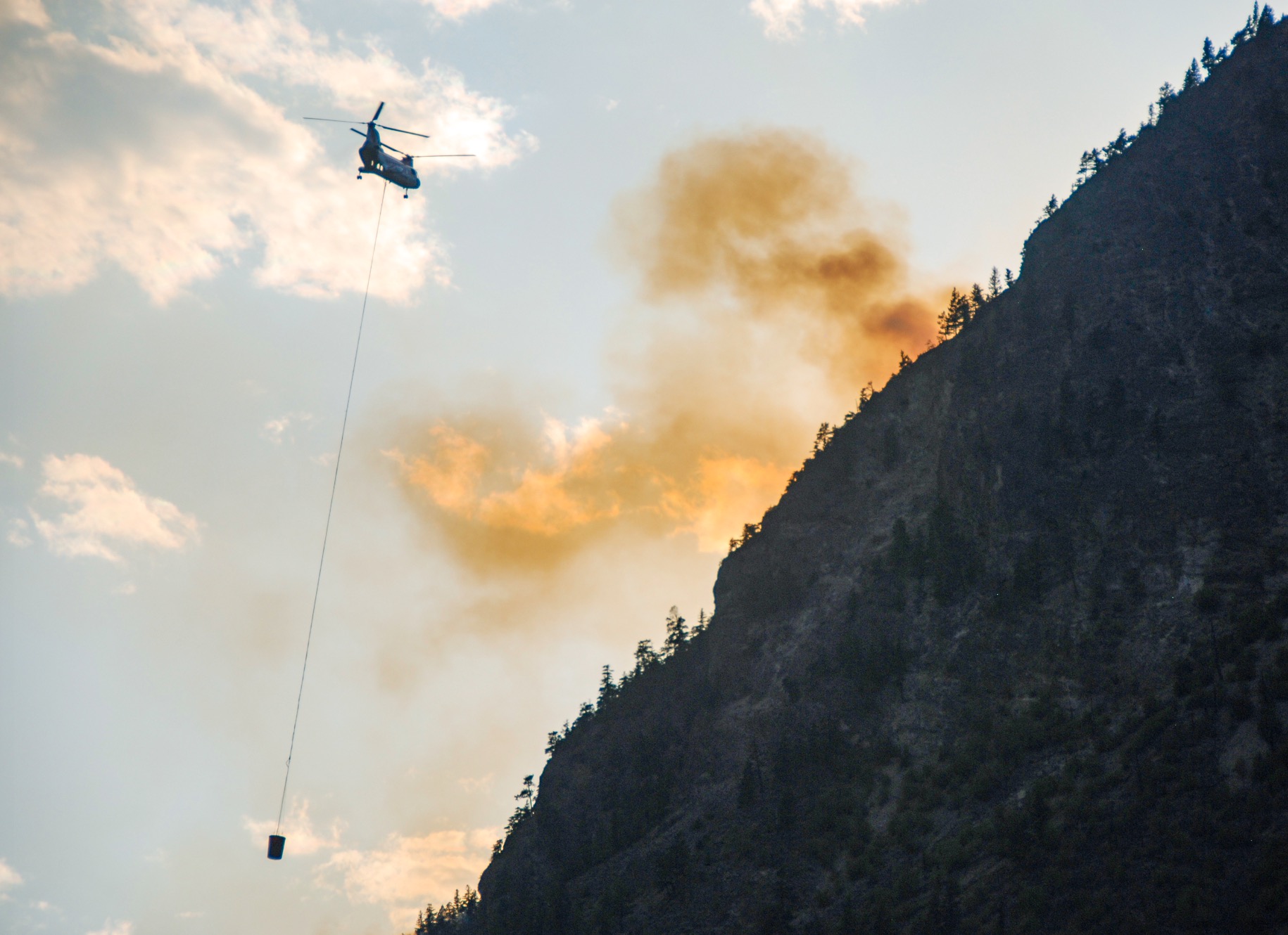
B.C. wildfire crews will be in a “tight crunch” tonight and Tuesday to bring in heavy equipment and establish guard lines to help stifle the Battleship Mountain wildfire near Hudson’s Hope. “We’re ramping things up to begin to really start going at this thing over the next number of days,” said incident commander Scott Rennick said. The Battleship fire is now at an estimated 11,949 hectares, or about 120 square kilometres in size, roughly five times the size of the city of Fort St. John. …There are now 25 firefighters assigned to the blaze, who have access to the area over the W.A.C. Bennett dam, which can’t take heavy equipment. Sixteen helicopters are assigned to the broader Battleship complex of six fires burning in the region, with bucketing operations at the sides of Battleship Mountain ongoing to “buy time” until the heavy equipment arrives, Rennick said.

Read More

Eastgate placed on evacuation alert due to wildfire in Manning Park

By Chelsea Powrie
Castanet
September 6, 2022
Category: Forest Fires
Region: Canada, Canada West

The Regional DIstrict of Okanagan Similkameen has issued evacuation alerts for the community of Eastgate due to the Heather Lake wildfire burning in Manning Park. One-hundred-eighty properties are impacted by the alert, listed here. Residents are being told to pack their bags and be ready to evacuate on a moment’s notice. The wildfire is straddling the U.S.-Canada border and is burning about five kilometers southeast of the Manning Park Resort, two kilometers south of Highway 3 and 10 kilometers southwest of Eastgate. It has burned 1,900 hectares of Canadian forest. Burning within a park protected from commercial logging and ravaged by the mountain pine beetle, fire officials say the blaze is consuming “a heavy fuel and has the potential for aggressive and rapid growth if winds, and terrain align.” …Structural protection crews are on site installing sprinklers on assets.

Read More

B.C. firefighters battling two aggressive and fast-spreading wildfires

By Tiffany Crawford
Vancouver Sun
September 4, 2022
Category: Forest Fires
Region: Canada, Canada West

B.C. firefighters are battling two aggressive and fast-spreading wildfires, as hot, dry and windy conditions hamper containment efforts. One is the Heather Lake wildfire that started in the U.S., in the Okanogan Wenatchee National Forest, according to the B.C. Wildfire Service. That blaze, which is considered out of control, was discovered in the U.S. last month but officials said Saturday that it has now crossed the border and is quickly spreading into E. C. Manning Provincial Park. The fire “is exhibiting aggressive fire behaviour and is highly visible from Highway 3,” fire officials said. The fire is suspected to be caused by lightning and is estimated at 1,500 hectares in size. Meantime, an evacuation alert was issued Friday …by the Penticton Indian Band for the Shingle Creek area due to the Blue Mountain Wildfire, which broke out Friday west of Penticton and quickly spread to 50 hectares, fanned by strong winds.

Read More

Jasper preparing for ‘extended’ power outage as Chetamon Mountain wildfire plays havoc with transmission lines

By Jonny Wakefield
Edmonton Journal
September 5, 2022
Category: Forest Fires
Region: Canada, Canada West

Visitors and residents in Jasper should be prepared for “extended” power outages as crews continue to battle the Chetamon Mountain wildfire, the town’s mayor said Monday. Parks Canada officials and ATCO crews were switching to generator power to keep critical sites including the hospital and water treatment facilities running after losing power from the main transmission lines around 4 a.m., Richard Ireland said in a news conference Monday. The town itself was under no direct threat from the fire — which is burning about 15 km north of the townsite — and officials were not considering evacuation. However, Ireland said it is still too soon to say how long the town will be without power. …“I don’t know how long ‘extended’ might be, and we don’t know yet all of the capacity issues. So even when power is restored, it may not be possible to restore power to all the facilities accessed by the ATCO grid,” he said.

Additional coverage in City News Everywhere, by Alejandro Melgar, ‘Out of control’ wildfire grows to nearly 8,000 hectares, power out in Jasper

Read More

High winds continue to fuel Battleship Mountain wildfire delaying start of new school year in Hudson’s Hope

By Michael Popove
CJDC TV
September 5, 2022
Category: Forest Fires
Region: Canada, Canada West

HUDSON’S HOPE, BC — There are currently three wildfires of note raging in the Peace Region. The largest of those fires, the Battleship Mountain wildfire has now grown to 11,944 hectares. The fire is currently burning out of control about 50 kilometres west of the community of Hudson’s Hope, which has declared a local state of emergency.  On Saturday, the Peace River Regional District issued an evacuation order for people in the Battleship Mountain and Carbon Lake areas due to the threat from the fire. The Battleship Mountain fire grew overnight, driven by wind gusts of up to 65 km/h. The BC Wildfire Service said, “abnormally strong winds” were contributing to the growth and spread of the fires, while smoke had reduced visibility “limiting fire suppression operations.” …The Peace River Regional District issued the evacuation order “due to immediate danger to life, safety, and health due to wildfire.”

Read More

Heather Lake wildfire in EC Manning Park now estimated at 1,900 hectares

By Cheyanna Lorraine
Kelowna Now
September 5, 2022
Category: Forest Fires
Region: Canada, Canada West

The Heather Lake wildfire located in the E.C. Manning Park is now estimated at 1,900 hectares. This is a significant increase from the estimate of 400 hectares reported on Sunday. According to the BC Wildfire Service, smoke and the type of topography in the area made it challenging for crews to accurately map the fire. The fire continues to burn in a “highly volatile fuel type” which has the potential to introduce aggressive fire behaviour in the coming days. Highway 3 and the Manning Park Resort remain unthreatened, however, the fire is about five kilometres away from the resort. “This wildfire is also resulting in dense smoke, especially east of Manning Park Resort,” says BC Parks. “Wildfire crews are actively monitoring and may be working in the area. In the event of changing wildfire conditions, visitors in this park may receive limited notice to evacuate.”

Read More

Out-of-control wildfires burning near major dams in B.C.’s northeast

CBC News
September 1, 2022
Category: Forest Fires
Region: Canada, Canada West

The B.C. Wildfire Service declared two wildfires of note in B.C.’s Peace region on Thursday, as officials warn September will continue to pose a risk after a calmer than average summer. The Battleship Mountain wildfire is estimated to be 5.5 square kilometres and is burning out of control about 50 kilometres west of Hudson’s Hope. The Dinosaur Lake Wildfire is also near Hudson’s Hope, burning about five kilometres from the Peace Canyon Dam and Highway 29. The B.C. Wildfire Service upgraded that fire to “out of control” on Thursday but says it is not threatening any structures. Officials say the fire is exhibiting moderate to extreme fire behaviour and additional growth is expected. The suspected cause of the fire — which is being exacerbated by weather conditions — is lightning, according to Prince George Fire Centre spokesperson Alex Lane.

Read More

Wildfire hazard rating Very High in Grande Prairie Forest Management area

Everything Grande Prairie
August 30, 2022
Category: Forest Fires
Region: Canada, Canada West

GRAND PRAIRIE, Alberta — The province is reminding residents in the Grande Prairie Forest Management area that a fire advisory is currently in place. That means all current fire permits are suspended, with the exception of burn barrels, incinerators, smudges, and smokehouse permits. No new permits are being issued and essential burning is being evaluated on a case-by-case basis until significant rain falls in the region. There is currently one active wildfire in the GP Forest Management area, which is listed as being under control. Since March 1st, around 96 hectares of land have been burned by a combined total of 56 wildfires. [END]

Read More

B.C. wildfires: Fires of note reduced to 2

By Jane Skrypnek
Vernon Morning Star
August 29, 2022
Category: Forest Fires
Region: Canada, Canada West

Nearly half of wildfires burning in B.C. remain out of control, but the number of fires of note are reducing. As of Monday (Aug. 29), there are 201 active blazes throughout the province. Of them, 93 are considered out of control, 58 are under control, 38 are being held, 10 are new and two are fires of note. Fires of note are ones that are particularly visible or pose a potential threat to the public. A week ago, six wildfires were classified as such. On Sunday, the Connell Ridge fire near Cranbrook was the latest wildfire to be reclassified and is now considered under control. …The fires of note are located in the Kamloops and southeast fire regions. They include: Keremeos Creek (estimated fire size: 7,017 hectares) and Weasel Creek (estimated fire size: 1,088 hectares).

Read More

Wildfire burns near Great Central Lake in Port Alberni

By Elena Rardon
Alberni Valley News
August 29, 2022
Category: Forest Fires
Region: Canada, Canada West

A wildfire burning near Great Central Lake in Port Alberni is currently being held at 6.4 hectares. The fire was reported to Coastal Fire Centre on the evening of Sunday, Aug. 28. It is located near the 25-km mark on Ash Main Road, just a kilometre west of Patterson Lake. “We responded with crews last night,” said Gordon Robinson, a fire information officer with the Coastal Fire Centre. “They worked through the night and got it to being held this morning.” This means that as of Monday, Aug. 29, the wildfire is not likely to spread under current conditions. Robinson said BC Wildfire currently has about 20 people working on the ground, as well as some personnel and an excavator from Mosaic Forest Management.

Read More

Keremeos Creek wildfire not expected to grow, classified as ‘held’

By Colin Dacre
Castanet
August 26, 2022
Category: Forest Fires
Region: Canada, Canada West

The Keremeos Creek wildfire burning southwest of Penticton his now considered “held.”  After nearly a month of suppression efforts, the BC Wildfire Service made the announcement Friday morning.  “At this stage, the wildfire will not likely spread beyond predetermined boundaries under forecast conditions. Wildland firefighting crews continue to patrol control lines, conduct fuel management activities and mop-up,” BCWS said.  The fire, which sparked on July 29, has scorched just over 7,000 hectares of forest in an area between Apex Mountain Resort and Olalla and Highway 3A.  It is expected the fire will continue to burn at a low intensity until winter, so smoke may be visible for several weeks.  “In places with the potential for further spread, crews have used a combination of direct attack, black-lining, and wet-lining to extinguish or remove available fuels 15 to 30 metres from the edge of the fire inward,” BCWS said.

Additional coverage in Penticton Herald, by Joe Fries: Disaster averted on Keremeos Creek fire

Read More

Wildfire risk high in Alberta as hot, dry conditions persist

By Nicole Stillger
Global News
August 26, 2022
Category: Forest Fires
Region: Canada, Canada West

The hot and dry weather in much of Alberta is creating the perfect conditions for wildfires to ignite and spread. “We are expecting the high fire danger to continue as long as this hot and dry spell continues as well,” said Josee St-Onge, provincial information officer with Alberta Wildfire. The heightened risk is affecting most of the province — in the boreal forest and along the southern part of the Rocky Mountains. “Some of that is typical for this time of year, especially dryness in the south of the province, but that does mean that we’re not going to be on high alert,” St-Onge said. “We have crews positioned in strategic areas throughout the province to be able to respond to wildfires quickly, and we do expect more fire activity in the coming week.” As of Friday afternoon, there were 64 wildfires burning in Alberta — 37 are held, 23 are under control and four are out of control.

Read More

B.C. wildfires: Fires of note set to reduce to 3

By Jane Skrypnek
Penticton Western News
August 25, 2022
Category: Forest Fires
Region: Canada, Canada West

The number of blazes BC Wildfire Service considers particularly visible or threatening is set to reduce from five to three. By end-of-day Aug. 25, the Briggs Creek fire near Kaslo and Mount Docking fire near Radium Hot Springs will no longer be classified as fires of note. …Across the province, 82 of the 230 wildfires actively burning are out of control, according to BC Wildfire. Another 65 are under control and 34 are being held. Forty-four fires are considered new, with the final five considered fires of note (soon to be three). Lightning is believed to be the cause of 76.1 per cent of them, with people behind another 7.4 per cent and the start of the remaining 16.5 per cent unknown. …There are 84 wildfires in the southeast, 34 in the Kamloops fire region, 39 along the coast, and 16 in the Cariboo region. Another 39 are burning in the Prince George fire region, with the final 18 in the northwest.

Read More

Wet’suwet’en Camps on Evacuation Alert as Wildfire Brought Under Control

By Amanda Follett Hosgood
The Tyee
August 24, 2022
Category: Forest Fires
Region: Canada, Canada West

Smoke-free skies above the Unist’ot’en Healing Centre, where BC Wildfire crews have worked for the past two days to bring a lightning-sparked fire under control, have raised hopes that an evacuation alert for the surrounding area might soon be lifted. Several Wet’suwet’en homes and occupation camps in the area between Lamprey Creek, south of Houston, B.C., and the area north and west of Morice Lake were included in the alert, but it was unclear which, if any, Coastal GasLink work camps in the area were also affected. …this past Monday healing centre occupants abandoned a work bee at the remote location nearly 70 kilometres southwest of Houston and prepared to leave at a moment’s notice. …By Tuesday morning, the fire had grown to about five hectares and its status had been updated from “out of control” to “being held,” Northwest Fire Centre information officer Casda Thomas said.

Read More

Wildfire on northeastern Vancouver Island grows to 25 hectares

By Darron Kloster
Victoria Times Colonist
August 22, 2022
Category: Forest Fires
Region: Canada, Canada West

A wildfire near the Nimpkish River south of Woss on northeastern Vancouver Island has grown to 25 hectares, making it the largest blaze of the season, according to the B.C. Wildfire Service. The fire reported Saturday is considered out of control. The cause is not yet known. A series of lightning strikes has been blamed for eight other fires on the Island over the past several days. All of those fires are considered spot fires, or under a hectare in size. Christi Howes of the Coastal Fire Centre said the wildfire service has deployed a “modified response” to the Nimpkish River fire — because no structures or human activity are near the blaze, a perimeter has been set up to observe the fire’s behaviour and start suppression techniques. …Amid rising temperatures and dry conditions that have led to fire-risk ratings on the Island ranging from ­moderate to extreme in some areas…

Read More

B.C. wildfires: Close to 40,000 hectares burned so far in 2022

By Jane Skrypnek
BC Local News
August 22, 2022
Category: Forest Fires
Region: Canada, Canada West

Just shy of 40,000 hectares have burned as the result of wildfires so far this year in B.C. The number is a large one, but just a fraction of the more than 850,000 hectares that burned in 2021, and the 10-year average of 320,377 hectares burned per wildfire season in the province. The only years with lower burn areas in the last decade, according to BC Wildfire Service data, are 2020 at 14,536 hectares, 2019 at 21,138 hectares and 2013 at 18,298 hectares. The most destructive years were 2017 and 2018, with 1.2 million and 1.35 million hectares burned, respectively. The relatively low burn area so far this year is thanks in large part to the wet winter and cool spring B.C. experienced, according to BC Wildfire Service. The province saw very few wildfires until about the end of July when more hot, dry conditions set in. As of August 22, 192 fires are actively burning throughout B.C., 69 of which started in the last two days.

Read More

Wildfire east of Armstrong now 3 hectares; Kal Park fire being held

Vernon Morning Star
August 19, 2022
Category: Forest Fires
Region: Canada, Canada West

Due to more accurate tracking, the Vlem Creek wildfire is now an estimated three hectares in size.  BC Wildfire Service (BCWS) fire information officer Shaelee Stearns said Saturday will see 25 firefighters work on the blaze using eight pieces of heavy equipment to help establish fire guards. Three helicopters have also been assigned to the fire.  The Vlem Creek wildfire is believed to be human-caused.  The Township of Spallumcheen has activated a level-one emergency operations centre in response to the fire. The Armstrong Spallumcheen Fire Department is further assessing the blaze with BC Wildfire and township staff.  The township noted in a news release that as of Saturday afternoon the fire has not entered township borders and no structures are currently threatened.

Read More

Northern and Interior B.C. continue to battle new wildfires

CBC News
August 19, 2022
Category: Forest Fires
Region: Canada, Canada West

The B.C. Wildfire Service says they responded to several new wildfires Friday, and at least one blaze thought to be contained is now burning out of control.  According to the B.C. Wildfire Dashboard, there were 180 active fires across the province Saturday morning, an increase of 76 in the last two days.  According to the service’s Twitter feed, crews responded to “numerous wildfires that were sparked by lightning” overnight Thursday and through Friday in the Cariboo Fire Centre — which stretches from Clinton, north to the Cottonwood River, east to Wells Gray Provincial Park and west to Tweedsmuir Provincial Park.  Most of the fires are located in the 100 Mile and Central Cariboo regions, with one fire northeast and another southwest of Canoe Lake, plus a third near Big Bar Lake, they said.

Read More

New ‘highly visible’ blaze sparked near Kamloops

By Tiffany Crawford
Vancouver Sun
August 18, 2022
Category: Forest Fires
Region: Canada, Canada West

B.C. firefighters are battling a new wildfire near Kamloops, as a heat wave continues in the area with temperatures of up to 40 C expected Thursday. A tweet from the B.C. Wildfire Service on Wednesday said the blaze is “highly visible to Kamloops and the surrounding areas.” The East Meadows Plateau fire is about 20 kilometres north of Kamloops and is “displaying a rank 2 and 3 fire behaviour,” which means a surface fire with a slow to moderate rate of spread. As of Thursday morning, the fire was mapped at about seven hectares — abouthalf the size of Granville Island — and was considered out of control. They said the fire is unrelated to the Watching Creek wildfire, which is about nine kilometres south of Kamloops. Neither blaze is considered a wildfire of note. A heat warning for B.C.’s Southern Interior says daytime temperatures were expected to be between 35 C and 40 C.

Read More

Paradise Lake forest fire a ‘sleeping giant’ as hot spots continue to burn

CBC News
August 18, 2022
Category: Forest Fires
Region: Canada, Canada East

The largest of three major forest fires in central Newfoundland has the potential to worsen if hot and dry conditions continue in the Grand Falls-Windsor region, says a provincial fire official. Forest fire duty officer Mark Lawlor said Thursday the Paradise Lake forest fire is still considered out of control, as crews work to cut into the number of hot spots it contains. “I’m going to venture and say we have thousands of hot spots on that fire. It’s a huge fire, it’s 17,000 hectares,” Lawlor said. “The scope and the scale of that fire is so large that it’s going to take time for us to get enough people on the ground to take care of all those hot spots. The fire is still a bit of a sleeping giant. If we get hot, dry weather again, the fire is quite capable of getting up and going again.” 

Read More

Oregon’s largest wildfire tops 100,000 acres, still 0% contained

Oregon Public Broadcasting
September 8, 2022
Category: Forest Fires
Region: United States, US West

The Double Creek Fire, burning in Eastern Oregon’s Wallowa-Whitman National Forest, nearly doubled again in size Wednesday, due to hot, dry conditions and gusty winds. Fire officials reported Thursday morning that the fire has now grown to 100,977 acres. And it’s still 0% contained. The town of Imnaha and areas just north and south are under Level 3 “Go Now” evacuations. A total of 553 fire personnel are assigned to the Double Creek Fire as of Thursday morning. The fire has been burning since Aug. 30 and was caused by lightning. A nearby group of three fires in the Eagle Cap Wilderness is burning another 30,000 acres. In Central Oregon, the Cedar Creek Fire east of Oakridge is over 30,000 acres and 18% contained. That fire has spurred new Level 3 evacuations for several recreational areas and campgrounds in Linn, Deschutes, and Klamath counties.

Read More

Officials warn of fire danger, prepare for Gifford Pinchot wildfires to spread

By Katie Fairbanks
The Longview Daily News
September 8, 2022
Category: Forest Fires
Region: United States, US West

Forest officials Thursday urged caution and braced for a possibility of severe wildfire activity as hot, dry winds move into the region. The National Weather Service issued a red-flag warning for nearly all of western Washington and Oregon from 11 a.m. Friday to 11 p.m. Saturday. The forecast calls for east winds of 10 to 20 mph, with gusts up to 40 mph in some areas, and low relative humidity. Temperatures will reach the high 80s and low 90s throughout the weekend. “We cannot stress enough how important it is to understand the fire potential with the combination of these conditions,” wrote the Cowlitz County Department of Emergency Management in a Facebook post. This will likely be the highest fire danger of the season west of the Cascades, as the hot, dry winds leave normally damp fuels ready to burn, according to the Washington State Department of Natural Resources.

Read More

Northern California wildfire burns homes, causes injuries

Associated Press in MyNorthwest
September 3, 2022
Category: Forest Fires
Region: United States, US West

WEED, Calif.  — A fast-moving wildfire in rural Northern California injured several people Friday, destroyed multiple homes and forced thousands of residents to flee, jamming roadways at the start of a sweltering Labor Day weekend. The blaze dubbed the Mill Fire started on or near the property of Roseburg Forest Products, a plant that manufactures wood veneers. It quickly burned through homes, pushed by 35-mph (56-kph) winds, and by evening had engulfed 4 square miles of ground. Annie Peterson said she was sitting on the porch of her home near the Roseburg facility when “all of a sudden we heard a big boom and all that smoke was just rolling over toward us.” Very quickly her home and about a dozen others were on fire. …Meanwhile, a second fire that erupted a few miles north of the Mill Fire near the community of Gazelle had burned 600 acres (243 hectares) acres and prompted some evacuations.

Updated additional coverage in SFGate, by Amy Graff, Photos show the devastation California’s Mill Fire left in its path 

Read More

Rum Creek Fire threatens more than 7,000 structures in Josephine County

Oregon Public Broadcasting
August 30, 2022
Category: Forest Fires
Region: United States, US West

The Rum Creek Fire in Josephine County has grown to nearly 12,000 acres and is only about 1% contained.  Officials say the fire has destroyed one home and two structures. As of Tuesday morning, it was threatening 5,035 homes and more than 2,600 other structures, according to the Northwest Interagency Coordination Center.  High temperatures and shifting winds over the next few days are expected to increase the fire danger in the area.  Level 3 – Go Now evacuations are in place for dozens of homes near the cities of Rand and Galice. Level 1 and 2 evacuations are in place for some surrounding areas.  …Over the weekend, Gov. Kate Brown declared a state of emergency across Oregon due to the imminent threat of wildfire. 

Read More

Wildfire continues to grow in Oregon’s Josephine County

Oregon Public Broadcasting
August 28, 2022
Category: Forest Fires
Region: United States, US West

A wildfire in remote southwest Oregon gained thousands of acres this weekend, forcing evacuations and prompting the governor to invoke an emergency act. That allows the state fire marshal to take command of fire suppression efforts.  The Rum Creek Fire increased from about 1,200 acres Friday to over 8,400 acres by Sunday morning. Evacuations were ordered for several unincorporated communities along the Rogue River.  The blaze is burning near the unincorporated communities of Galice and Rand, about 20 miles northwest of Grants Pass.  Josephine County emergency management officials are urging residents to familiarize themselves with the evacuation level system and to remain vigilant. Local emergency officials issued “go now” evacuations and lower-level evacuation alerts for homes near the fire. The Josephine County Sheriff’s Office is maintaining a digital evacuation map here.

Read More

Rum Creek Fire growth on Rogue River prompts evacuations, emergency declaration from governor

By Zach Urness Skyla Patton
Statesman Journal
August 27, 2022
Category: Forest Fires
Region: United States, US West

The Rum Creek Fire grew rapidly Friday evening, gaining over 3,000 acres overnight, and brought multiple evacuations to the iconic Rogue River town of Galice, located northwest of Grants Pass. Gov. Kate Brown on Saturday morning invoked the Emergency Conflagration Act, effectively providing further support from the state to fight the wildfire, with a focus on structure protection.  A level 3 evacuation was issued for the outposts of Rand, Galice and a large surrounding area up to Hog Creek and north of Belknap Gulch, according to the Josephine County Sheriff’s Office.  …“The Rum Creek Fire grew rapidly overnight, requiring additional resources to battle the fire and support the state’s response,” Brown said in a statement. “This is a good reminder that conditions can change quickly, and that fire knows no bounds.”

Read More

Crews battle Cherry Fire, spot fires: Siskiyou, Trinity fire updates

By Jessica Skropanic
Redding Record Searchlight
August 27, 2022
Category: Forest Fires
Region: United States, US West

Firefighters are working to put out several fires burning in the North State, including spot fires erupting out of the McKinney Fire burn area in Siskiyou County and the Six Rivers Lightning Complex burn area in Trinity and Humboldt counties.  Brush is extremely dry and fire weather is still a problem, but weekend temperatures could give firefighters a slight break after weeks of triple-digit heat. Daytime high temperatures will reach no higher than the mid-90s in most of the North State.  In the Sacramento Valley around Redding, daytime temperatures will stay below 100 through Monday, then go up to 101 degrees on Tuesday, according to the National Weather Service out of Sacramento.  Firefighters spent Friday morning mopping up after the Cherry Fire, burning in the McKinney Fire burn area.

Read More

Gov. Brown declares statewide emergency as Rum Creek Fire doubles in size

By Ben Lonergan
The Register-Guard
August 28, 2022
Category: Forest Fires
Region: United States, US West

Gov. Kate Brown had declared a statewide emergency in anticipation of “imminent” wildfire danger. …”I issued this emergency declaration to ensure every resources is made available for firefighting efforts and to the crews striving to protect our state.” The declaration authorizes the Oregon Department of Forestry, the Office of the State Fire Marshal and the Oregon Department of Emergency Management to call on personnel, equipment and facilities from other state agencies to mitigate any wildfire threats. It also authorizes National Guard troops to respond to fires. The declaration comes as the southern Oregon Rum Creek Fire nearly doubled in size to roughly 8,404 acres on Sunday. …As wildfire season continues, the forecast ahead is dry, hot and windy, the perfect storm of wildfire conditions. …At least 740 personnel are now battling the blaze.

Read More

Record-setting wildfire in New Mexico declared contained

By Susan Montoya Bryan
Associated Press in News Channel 10
August 23, 2022
Category: Forest Fires
Region: United States, US West

ALBUQUERQUE, N.M.  — More than four grueling months and $300 million later, the federal government has declared the largest wildfire in New Mexico’s recorded history 100% contained, a notable milestone but just another step in what local residents and officials say will be a long journey toward recovery. The blaze was sparked in the spring by two errant prescribed fires conducted by the U.S. Forest Service. More than 530 square miles of the Rocky Mountain foothills burned, hundreds of homes were destroyed, livelihoods were lost and drinking water supplies were contaminated. Local officials say there are years of work ahead of them to restore the landscape and protect against post-fire flooding. …The scar left behind by the wildfire includes some areas that were reduced to ash and others where the severity was less intense. …The U.S. Forest Service said helicopters will distribute about 138 tons (125 metric tonnes) of seed and 5,440 tons (4,935 metric tonnes) of mulch. 
Read More

Moose fire near Salmon now largest wildfire in lower 48 states

By Jakob Throlington
Idaho State Journal
August 23, 2022
Category: Forest Fires
Region: United States, US West

IDAHO — The human-caused Moose fire has burned nearly 95,000 acres in the Salmon-Challis National Forest as of Monday afternoon and is the largest active wildfire in the lower 48 states of the U.S., according to National Interagency Fire Center statistics. The fire started July 17 about 17 miles north of Salmon and remains under investigation. According to the fire’s InciWeb Incident Information System, the fire started due to an escaped campfire. Salmon River Road between Spring Creek and Panther Creek was closed on Aug. 15 due to increased fire activity hazards. The road was open for through traffic from 6 a.m. to 1 p.m. Sunday and Monday to allow access to Corn Creek. The fire is 36% contained and 785 firefighters, 10 crews, six helicopters and 41 engines are working to contain the fire. Full containment is estimated by Oct. 31.

Read More

Wildfire updates: Six Rivers Complex grows, new fire starts in Siskiyou County

By Jessica Skropanic
The Redding Record Searchlight
August 17, 2022
Category: Forest Fires
Region: United States, US West

Firefighters worked to suppress several blazes throughout the North State on Wednesday, including one new fire. Weather continues to be dry and hot, with heat advisories and red flag warnings in place throughout much of the North State. Daily high temperatures in Shasta and Tehama counties are expected to reach or surpass 105 degrees through Friday. In Siskiyou County, the forecast is for temperatures to soar into the high 90s to 101 daily. Those conditions could make it easier for new sparks to catch fire and for current fires to spread. The agency issued a heat advisory through 8 p.m. Friday for the Sacramento Valley, from Redding to Sacramento, south to Modesto.

Updates on North State fires as of noon Wednesday:

  • Curly Fire, Siskiyou County
  • Ranch Fire, Shasta County
  • McKinney Fire, Siskiyou County
  • Yeti and Alex fires, Siskiyou County
  • Six Rivers Complex, Humboldt and Trinity counties

Read More

Turkish wildfire brought under control after 1,000 evacuated

The Associated Press in ABC News
September 8, 2022
Category: Forest Fires
Region: International

ANKARA, Turkey — Firefighters brought a wildfire in southern Turkey under control Thursday, a day after more than 1,000 people were evacuated from homes and hotels, officials said. The fire broke out Wednesday in the district of Gulnar in the Mediterranean coastal province of Mersin and spread to parts of the nearby district of Silifke, fanned by strong winds. At least 29 water-dropping helicopters, 11 planes and about 850 personnel were involved in efforts to extinguish the blaze, according to Turkey’s disaster and emergency management agency, AFAD. Hundreds of homes and at least two hotels were evacuated as a precaution, the agency said. At least eight people were hospitalized due to the fire, one in serious condition, Health Minister Fahrettin Koca said.
Read More

Number of Brazil Amazon fires hits five-year high in August

By Fabiano Maisonnave
The Associated Press
September 1, 2022
Category: Forest Fires
Region: International

BRAZIL — More fires burned in the Brazilian Amazon rainforest this August than in any month in nearly five years, thanks to a surge in illegal deforestation. Satellite sensors detected 33,116 fires according to Brazil’s national space institute. The dry season months of August and September are usually worst for both deforestation and fire. It was also the worst August for fire in 12 years. That includes August of 2019, when images of the burning rainforest shocked the world and drew criticism from European leaders. …The president downplayed the raging fires then and continues to do so today. He told media network Globo on Aug. 22 — the worst single day for outbreaks of fire in 15 years — that the criticism is part of an effort to undermine the nation’s agribusiness sector.
Read More

Forest fires south of Moscow flare up amid heatwave, officials say

Reuters
August 22, 2022
Category: Forest Fires
Region: International

MOSCOW – Forest fires raging south of Moscow have intensified, Russian authorities said on Monday, as residents of the capital complained of a sharp smell of smoke pervading the air. Since early August fires have been raging across the Ryazan region, some 200 km (125 miles) southeast of Moscow, where officials have been scrambling personnel to put them out. The region’s acting governor Pavel Malkov said a state of emergency had been put in place and that residents in two settlements – Olgino and Golovanovo – had been ordered to evacuate. “The area covered by the fire continues to grow slowly. According to the Aerial Forest Protection Service, we are looking at about 8,000-9,000 hectares today,” he said, describing the situation as “tense”. Sergei Sobyanin, the mayor of Moscow, said the city had sent equipment and personnel to the Ryazan region but that their efforts had not been enough to contain the blazes.

Read More

Winds drive major wildfire in Spain; Portugal goes on alert

Associated Press in the Washington Post
August 19, 2022
Category: Forest Fires
Region: International

MADRID — A wildfire burning out of control in Spain’s eastern province of Valencia has become one of the country’s biggest fires this year, and 35 aircraft were deployed to fight it as the blaze entered its fifth day, authorities said Friday. The wildfire has already scorched more than 19,000 hectares (47,000 acres) along a 137-kilometer (85-mile) perimeter. Efforts to bring it under control Thursday failed and strong winds have made the fire “very aggressive,” the Valencian regional government said. In neighboring Portugal, the government on Friday announced a nationwide three-day state of alert beginning Sunday. Portugal is in the grip of a severe drought and has also seen devastating wildfires this summer. The measure, which grants authorities special, temporary powers such as barring people from woodlands, is a response to forecasts of inland temps above 40 degrees Celsius (104 degrees Fahrenheit) beginning Sunday in what could be the country’s third heat wave this summer.

Read More

Argentina orders armed forces to help fight forest fires

By Muhammed Emin Canik
The Anadolu Agency
August 21, 2022
Category: Forest Fires
Region: International

BUENOS AIRES — Argentina ordered its armed forces Saturday to help respond to forest fires that have been burning in the Parana Delta for more than two weeks. “We cannot allow fires to continue in the Delta that affect the environment and the health of millions of Argentines. Therefore, I have ordered the Armed Forces to take immediate action to stop the fires,” President Alberto Fernandez wrote on Twitter. …Fernandez said necessary steps were taken to find those responsible for the fires that are believed to have been started deliberately. Santa Fe State Governor Omar Perotti had requested that Fernandez deploy the military to respond to fires in the Parana Delta. With no rain in sight, the fires continue to devastate the Paraná River Delta. So far this year, more than 131,000 hectares (323,708 acres) have been burned.

Read More

Forest Fire Smog Blankets Moscow

Agence France-Presse in Barron’s
August 18, 2022
Category: Forest Fires
Region: International

Thick smog blanketed Moscow on Thursday as it blew in from nearby forest fires, which the national forestry agency said were made worse by neglectful local authorities. Hundreds of firefighters and several aircraft were battling the blazes in the Ryazan region, some 250 kilometres (155 miles) southeast of Moscow, the emergencies ministry said. The Federal Forestry Agency accused the region’s authorities of downplaying the scale of the fires and delaying an adequate response. “The forestry authorities of the Ryazan region and its nature areas let the situation with the forest fires slip and hid its real scale,” the agency told the RIA Novosti news agency. The region’s governor Pavel Malkov said Wednesday that over 800 hectares (1,980 acres) had been affected by the fires. But the international environmental group Greenpeace put the figure at over 3,300 hectares.

Read More

Forest Fires in Northern Algeria Leave at Least 26 Dead

Agence France-Presse in Voice of Africa News
August 17, 2022
Category: Forest Fires
Region: International

At least 26 people died and dozens of others were injured in forest fires that ravaged 14 districts of northern Algeria on Wednesday, the interior minister said. Kamel Beldjoud told state television that 24 people died in fires in El Tarf, near the border with Tunisia, and two others died earlier in Setif. The civil protection agency in Setif had said that two women, “a 58-year-old mother and her 31-year-old daughter,” were killed in the town. In Souk Ahras, farther to the east near Algeria’s border with Tunisia, people were seen fleeing their homes as fires spread before firefighting helicopters were deployed.

Read More