Category Archives: Forest Fires

Forest Fires

BC’s out-of-control wildfires burn down to 16

By Lyle Adriano
Insurance Business Magazine
September 8, 2021
Category: Forest Fires
Region: Canada, Canada West

Wildfires classified as out-of-control in BC dwindled over the weekend, though there are still over 200 total fires burning across the province. In a release, BC minister of forests Katrine Conroy noted that this year’s wildfire season has been “one of the most active and destructive on record,” adding that dry conditions and aggressive fire behaviour presented “numerous challenges” this summer. CTV News reported that as of Monday, 210 wildfires remain active in BC; 16 of those fires were considered out-of-control. Meanwhile, 11 fires were classified as wildfires of note. “About 300 personnel from the Canadian Armed Forces’ Land Task Force and 55 personnel from the Air Task Force were assigned to help with wildfires in BC, with about 625 individuals cycling through as part of that ongoing effort,” said Conroy. She noted that those crews “played a significant role” in helping respond to the out-of-control fires…

Read More

Alberta saw average wildfire season in 2021, despite record temperatures

CBC News
September 8, 2021
Category: Forest Fires
Region: Canada, Canada West

While B.C and Saskatchewan dealt with raging wildfires this year, Alberta had a relatively average year. Despite heat waves that gripped much of the province throughout summer, a combination of luck and good fire management helped Alberta have an average number of wildfires that did not cause as much severe damage and destruction as in neighbouring provinces. Mike Flannigan, a fire-science research chair at Thompson Rivers University in Kamloops, B.C., attributes Alberta’s difference to a lack of fires in May. “May is our busiest month in Alberta … but May was actually near normal and actually wetter than normal in much of Alberta, so in May the weather was quiet,” Flannigan told CBC. This year Alberta has had 1,142 wildfires. The provincial five-year average is 1,018. There have been 592 wildfires this year in Saskatchewan, more than double their five-year average of 284. B.C. has seen 360 more fires than the provincial average of 1,127.

Read More

Garrison Lake fire again visible from Highway 3 near Princeton

By Andrea Demeer
Vernon Morning Star
September 7, 2021
Category: Forest Fires
Region: Canada, Canada West

While the Garrison Lake wildfire, burning southwest of Princeton, is now classified as ‘held,’ recent weather changes have sparked new activity. “Warm, dry weather is causing an increase of fire behavior for the wildfire, including occasional trees flaring up. There is no immediate risk and crews on the ground are actively extinguishing hot spots on the west side of Highway 3,” states a BC Wildfire release Tuesday, Sept. 7. Flames are again visible from the highway. Active wildfire suppression continues. Hot spots in Manning Park continue to produce smoke that is highly visible from Highway 3 and surrounding areas. The fire is measured at 14,564 hectares.

Read More

Bill Nye firefighting made easier through previous mitigation efforts

By Corey Bullock
Cranbrook Daily Townsman
September 7, 2021
Category: Forest Fires
Region: Canada, Canada West

The Bill Nye Mountain fire near Wasa continues to be listed on the BC Wildfire Dashboard as being held at 2,990 hectares. Cooler, wetter weather provided relief for fire crews in mid-August, and the fire is not expected to grow any further. That said, the fire may have had further reach if not for previous mitigation efforts. Randy Harris is a registered professional forester who is now retired after 38 years with the BC Forest Service. During the last eight years of his career, he was the ecosystem restoration leader for the Rocky Mountain District in Cranbrook. Harris explained that the final control of Bill Nye was made easier by the fact that the wildfire mitigation team tied the south boundary of the fire to an existing ecosystem restoration (ER) unit near Lakit Lake, on July 22nd.

Read More

Regional District of Central Okanagan ends state of local emergency for White Rock Lake fire

By Jon Manchester
Castanet
September 7, 2021
Category: Forest Fires
Region: Canada, Canada West

The Regional District of Central Okanagan has ended one of the longest states of local emergency in its history. The remaining evacuation alerts for the White Rock Lake wildfire have been rescinded and RDCO has cancelled the state of local emergency first issued July 30, 2021. The only similar order that lasted longer was in effect during the flood response and recovery in 2017. The final evacuation alerts ended for 1,316 properties on Bouleau Lake Road and in Estamont, Ewings Landing, Killiney Beach and Westshore Estates. …RDCO has also rescinded a Water Qualify Advisory for Upper Fintry, Shalal Road, Valley of the Sun water system, but an advisory remains in place for customers of the Westshore Estates water system. A do-not-consume notice is still in place for approximately 295 customers connected to the Killiney Beach water system. A self-serve water filling station has been set up at the corner of Westside and Firwood Roads

Read More

Evacuated Valley of the Sun residents to begin return in fire’s wake

Castanet.net
September 2, 2021
Category: Forest Fires
Region: Canada, Canada West

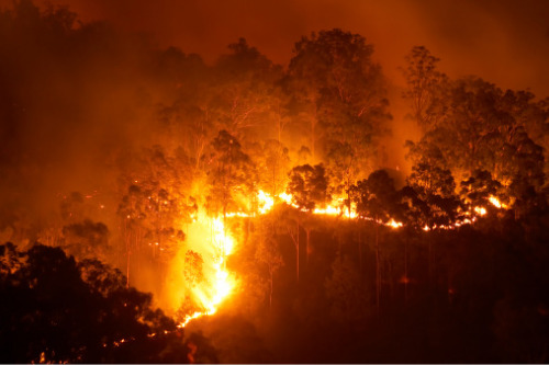
As some residents prepare to return home and some evacuation alerts are cancelled, officials are reporting no further growth at the White Rock Lake fire. The Aug. 30 ignitions in Irish Creek, and precipitation across the fire, has reduced risk of further spread on most of the fire perimeter. The planned ignition on the White Rock Lake wildfire was 975 hectares in size. The burn plan objectives were to mimic natural wildfire with up to 30 per cent tree mortality and understory woody debris consumption. The Irish Creek area has more than 40 years of debris buildup. Areas that had significant fuel build up, combined with steep slopes, burned with more intensity.
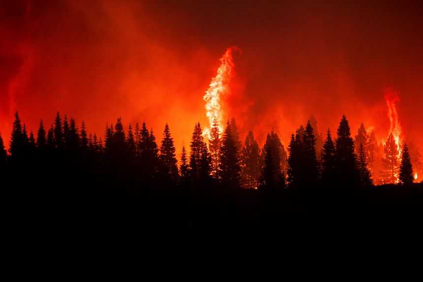
Read More

UPDATE: White Rock Lake fire ‘held’ after 52 days

Vernon Morning Star
September 2, 2021
Category: Forest Fires
Region: Canada, Canada West

The 83,342-hectare White Rock Lake wildfire is now classified as being held, according to the BC Wildfire Services. “Over the last 52 days, firefighters and support personnel from around the world have maintained response efforts on the White Rock Lake wildfire,” the provincial agency said Sept. 2. But “considerable work” remains before it’s completely suppressed. BC Wildfire Services will continue to work on fire suppression until there is no risk to public health and infrastructure. Already, alerts and orders have begun to be downgraded or cleared. And as disaster response moves into the recovery phase, local authorities have set up supports for evacuees returning home.

Read More

Wildfire near Penticton, B.C. balloons to 200 hectares, marches towards luxury development

By Shelby Thom
Global News
August 30, 2021
Category: Forest Fires
Region: Canada, Canada West

The Skaha Creek wildfire, burning southwest of Penticton, B.C., crested the ridge and crept down the mountainside on Sunday night, threatening a luxury hillside residential development. The wildfire, first discovered on Aug. 28, was described by locals as looking like a volcano had erupted as bright orange flames illuminated the night sky. …The blaze is now highly visible from the entire City of Penticton, Highway 97 and surrounding communities. It is 212 hectares in size and is believed to be human-caused. …The Skaha Creek wildfire is being managed as part of the Okanagan complex, lead by an incident management team. …The City of Penticton issued a statement on Sunday warning that firefighting response efforts may impact operations at the nearby Penticton airport. …A special air quality statement has been issued for the Okanagan Valley due to wildfire smoke.

Additional coverage by the Canadian Press in CBC News: Wildfire grows near Penticton as more military crews join firefighters

Read More

Fire will rain down today on massive White Rock Lake blaze

By Ron Seymour
The Kelowna Daily Courier
August 30, 2021
Category: Forest Fires
Region: Canada, Canada West

Gelled and ignited gasoline will be dumped from a helicopter today to spark a 3,000 ha. controlled blaze around the edge of the massive White Rock Lake fire. The operation is aimed at burning off trees and shrubs in hard-to-access terrain that would otherwise be consumed by the fire, which has destroyed 81,000 ha of forest between Vernon and Kamloops. Unless the controlled burns are undertaken, there’s a chance the fire could burn for months and even spark up again in the spring, particularly given the extremely dry conditions, the BC Wildfire Service says. “Planned ignitions are the safest way to remove fuel that can burn well into the fall and winter. In 2018, fires that occurred in severe drought areas burned underground over winter and started burning again in the spring,” the BCWS says. …No substantial growth in the size of the fire has been observed the last few days, the BCWS says. 

Read More

Out-of-control wildfire breaks out just 6 km southwest of Penticton

By Doyle Potenteau
Global News
August 28, 2021
Category: Forest Fires
Region: Canada, Canada West

The BC Wildfire Service is reporting a new fire in the South Okanagan.  The Skaha Creek wildfire is located approximately six kilometres southwest of Penticton and was estimated at 0.3 hectares in size as of 2:45 p.m.  As of Saturday night, the fire has expanded to 17 hectares.   The BC Wildfire Service says the fire is classified as out of control.  Originally, BC Wildfire said three personnel were en route to battle the blaze, along with one helicopter, multiple air tankers and air skimmers.  Two hours later, it said 23 ground personnel were on site, and that skimmers and air tankers were dropping retardant along its flanks.  “Currently, no structures are threatened,” said BC Wildfire, adding the fire is suspected to be human-caused.

Read More

Two Mile wildfire near Sicamous held thanks to firefighting crews’ ‘great work’: Fire chief

By Zachary Roman
Summerland Review
August 26, 2021
Category: Forest Fires
Region: Canada, Canada West

The Two Mile Road wildfire near the District of Sicamous is being held… [The] BC Wildfire Service (BCWS) announced the 2,455 hectare blaze was no longer expected to spread under current and forecasted conditions. Current resources assigned to the fire include 57 firefighters and five pieces of heavy equipment… It’s been more than a month since the wildfire ignited near Sicamous… Even though the fire is now being held, Sicamous fire chief Brett Ogino wants people to know work isn’t over for wildfire crews [who] will be mopping up hot spots on the fire for the foreseeable future, and residents of the district may continue to see smoke, especially from black areas of forest which have been burned through. The fire will not likely be officially out until the winter…

Read More

Restriction orders in place for Succour Lake and Flat Lake wildfire zones

BC Local News
August 25, 2021
Category: Forest Fires
Region: Canada, Canada West

The BC Wildfire Service has issued two area restriction orders for the Flat Lake and Succour Lake wildfires in an effort to keep both BC Wildfire crews and the general public safe. The orders, in effect until Sept. 30, apply to the northern area of the Flat Lake fire and in the vicinity of the Succour Lake wildfire… Exemptions will be made for the following reasons: carrying out an industrial activity, … completion of fire suppression, travelling to or from a … property not under an evacuation order, using a highway and engaging in range development… As of Aug. 25, seven of the nine wildfires burning in the South Cariboo are listed as under control, with Flat Lake and Succour Lake the only ones classified as out of control. The Flat Lake wildfire is estimated at 74,194 hectares while Succour Lake is 3,006 ha.

Read More

Wildfire near Mabel Lake now classified as being held, evacuation alert rescinded

By Darren Handschuh
Castanet.net
August 25, 2021
Category: Forest Fires
Region: Canada, Canada West

An evacuation alert has been rescinded for properties along a portion of Mabel Lake Forest Service Road (Lumby Mabel Lake Road)… The Bunting Road wildfire on the east side of Mabel Lake is now classified as held. That means it is no longer expected to grow beyond its current boundaries. Since July 7, the fire has burned 4,734 hectares. Heavy equipment is working in the north to establish an additional guard… Crews continue to work along Mabel Lake FSR. On the south flank, crews are using direct attack methods on the fire’s edge. Crews will also be actioning several deep burning hot spots on the southeast corner.

Read More

B.C. wildfire conditions trending in the right direction, official says

The Canadian Press in the CBC News
August 24, 2021
Category: Forest Fires
Region: Canada, Canada West

A manager for British Columbia’s wildfire service says conditions are trending in the right direction with the number of fires that threaten public safety and property dropping down to two dozen from 30 early this month. Todd Nessman says cooler temperatures have helped curtail significant fire growth in recent days and crews are making “some excellent progress” on some of the larger blazes. He says there are still areas that haven’t seen significant rain, including parts of the Cariboo and south Okanagan, and the fire service is keeping a close watch on the situation there. Nessman, who’s the manager of wildfire operations with the service, says crews are making “excellent progress” on the western flank of the 809-square-kilometre White Rock Lake fire that destroyed dozens of homes and chased thousands out of areas between Kamloops and Okanagan Lake in B.C.’s southern Interior.

Read More

No change in number of forest fires burning in northwestern Ontario over past few days

CBC News
September 6, 2021
Category: Forest Fires
Region: Canada, Canada East

The number of forest fires burning in northwestern Ontario has held steady over the last few days. Seventy-two fires were burning in the region as of Monday morning. The total number of active fires in the region has not changed since Friday, Aviation, Forest Fire and Emergency Services said. Of the 72 fires burning in the region as of Monday, 56 were being monitored, AFFES said. Six were not under control, 12 were under control, and two fires were being held with existing resources, and not expected to grow due to ongoing suppression efforts. The Sioux Lookout district had the most active fires out of all of northwestern Ontario’s fire districts with 31. There were 24 fires in the Red Lake district, seven in the Nipigon district, five in the Fort Frances district, four in the Dryden district, and one in the Kenora district.

Read More

Weekend rain helped Northwestern Ontario firefighters

Thunder Bay News Watch
August 30, 2021
Category: Forest Fires
Region: Canada, Canada East

DRYDEN, Ont. — Ontario’s Aviation, Forest Fire and Emergency Services Agency says significant rainfall has helped firefighters dealing with the 79 wildfires still burning in the Northwest Region. The fire hazard is now low throughout the region. AFFES said Sunday evening that only six fires are not under control, and 58 are being observed. Areas in the southern part of the region received the most rain, with some getting up to 50 millimetres. Fires in Quetico Provincial Park, where a ban on backcountry camping and canoeing remains in place, got 14 millimetres to add to the 5 to 15 millimetres they received Saturday. A Restricted Fire Zone remains in place in the Fort Frances district and southern portions of the Dryden and Kenora districts.

Read More

Rickford comments on forest fires, three new fires discovered over weekend

By Jay D Haughton
Kenora Online
August 30, 2021
Category: Forest Fires
Region: Canada, Canada East

Three new fires were discovered over the weekend from Friday, August 27, 2021, until Sunday, August 29, 2021, according to the daily updates from the Aviation, Forest Fire, and Emergency Services. The newly discovered fires were: Nipigon 81 is located near Peninsular Lake; Dryden 130 is located near Claw Lake; and Fort Frances 154 is located near Jackfish Lake. “There’s still too many of them out of control, but our firefighters, our front lines folks keep working on them, and our prospects keep improving on a daily basis, as I watch the numbers very closely,” said Greg Rickford Minister of Northern Development, Mines, Natural Resources, and Forestry. “We’re still not out of this, we anticipate a little bit more rain in the region for the next couple of days, I’m not a weatherman. Hopefully in the coming weeks we can see these fires down to a minimal size and number,” added Rickford

Read More

More progress made in fight against ‘stubborn’ northwestern Ontario forest fires

CBC News
August 29, 2021
Category: Forest Fires
Region: Canada, Canada East

ONTARIO — Rainfall over the weekend in northwestern Ontario has significantly helped fire suppression efforts, but officials warn that some larger fires are still expected to burn for weeks to come. “This wet weather and cooler temperatures and higher humidities, it really helped keep that fire behaviour down and reduce the potential for for new fires from lightning,” said Chris Marchand, fire information officer with Ontario’s aviation, forest fire and emergency services (AFFES). “So we still have a fair workload on our response system. Though, the sense of urgency today is obviously much less than it was a few weeks ago when we had a half a dozen communities evacuated,” he added, in an interview with CBC News Sunday.

Read More

Forest fires continue to burn in Northern Ontario

By Elain Della-Mattia
The Timmins Daily Press
August 25, 2021
Category: Forest Fires
Region: Canada, Canada East

Eleven active forest fires are currently burning in Northeastern Ontario, the Ministry of Natural Resources and Forest Fire Management reports. Two fires are considered not under control,including Hearst 4 and Wawa 15. Hearst 4 expands over 1,850 hectares and located north of Constance Lake. Wawa 15 is much smaller at 30.8 hectares. It is located southeast of Eager Lake. Of the other fires in the northeast region, three are under control, one is being held and five others are under observations. The fire hazard ranges mostly from moderate to high across the region, with the exception of the far north which is classified as low to moderate hazard. The Northeast region remains in much better shape than the northwestern portion of the province where 82 active fires have been reported. Of those, 10 are not under control, two are being held, 11 are under control and 59 others are being monitored.

Read More

US to bolster firefighter ranks as wildfires burn year-round

By Keith Riddler
The Associated Press in the Seattle Times
September 4, 2021
Category: Forest Fires
Region: United States

BOISE, Idaho — U.S. wildfire managers have started shifting from seasonal to full-time firefighting crews to deal with what has become a year-round wildfire season as climate change has made the American West warmer and drier. The crews also could remove brush and other hazardous fuels when not battling blazes.  The U.S. Bureau of Land Management said Thursday that it’s adding 76 firefighters and support personnel to its 3,400-person firefighting workforce.  Additionally, 428 firefighters will change from part-time seasonal work to either full-time seasonal or permanent work with health and retirement benefits. Ultimately, the agency wants about 80% of its firefighters on permanently. The rest would be seasonal, many of whom are college students who return to class in the fall.

Read More

California wildfires at risk of sparking as wind blows in

The Associated Press in the Washington Post
September 10, 2021
Category: Forest Fires
Region: United States, US West

SOUTH LAKE TAHOE, California — A weather system affecting northwest California was expected to bring dry lightning and blustery winds through early Friday, unleashing a risk of new wildfires as thousands of firefighters have been making headway against existing blazes. A warning for dangerous fire weather took effect in much of fire-scarred Northern California Thursday afternoon and was expected to last through at least 11 a.m. Friday. “The combination of isolated dry lightning and gusty winds with the dry fuels will bring the potential for critical fire weather conditions,” the National Weather Service said. …The California Department of Forestry and Fire Protection said Wednesday that firefighters were making significant progress against the flames in part because weather had improved. More than 14,600 firefighters were on the lines of 13 active, large wildfires in California on Thursday.

Read More

Northern California fires: Siskiyou County Sheriff orders evacuations north of Little Glass Mountain

By David Benda, Mike Chapman and Jessica Skropanic
Redding Record Searchlight
September 8, 2021
Category: Forest Fires
Region: United States, US West

Wildfires burning throughout Northern California prompted new evacuations on Wednesday, including in communities in Siskiyou, Shasta and Trinity counties. This year, California fires burned more than 2 million acres, destroying more than 3,000 thousand structures in their paths. Their swift speeds and dry conditions prompted closures of almost every national forest, state wilderness areas and parks throughout the state. Most of the fires are concentrated in the northern part of the state, according to the California Department of Forestry and Fire Protection.
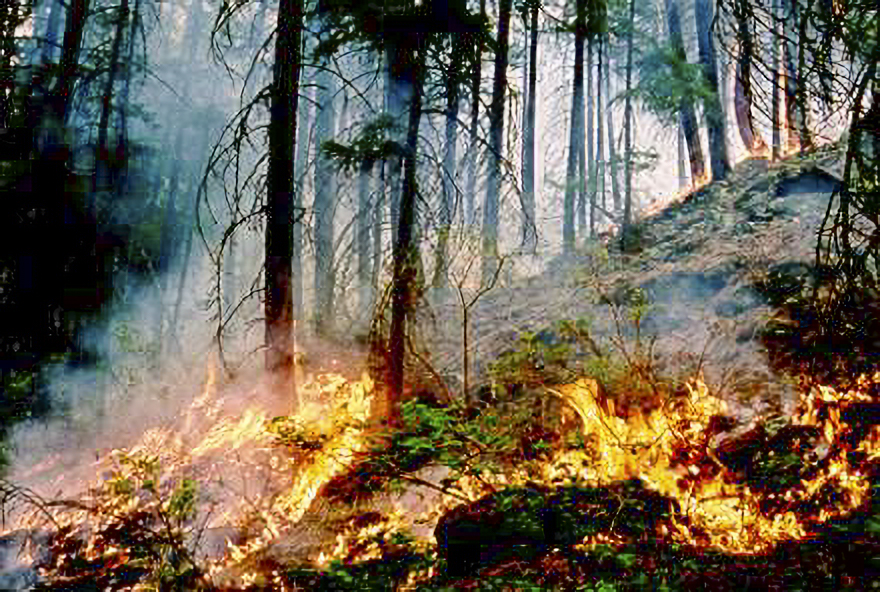
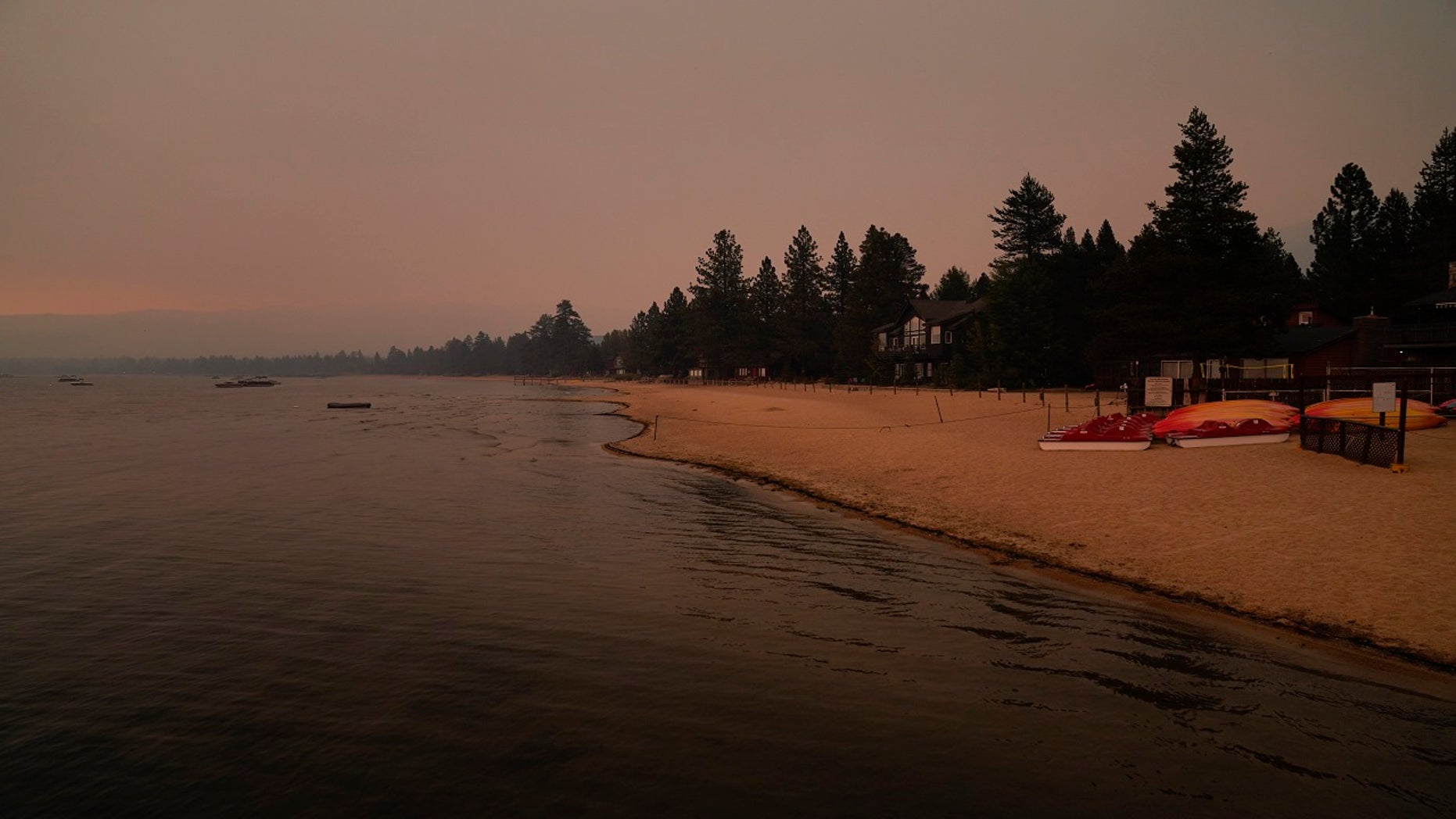
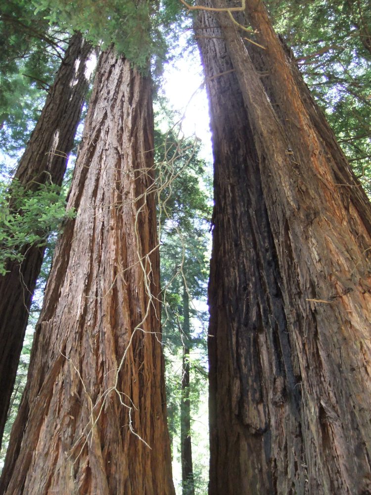
 That includes the three of the largest blazes in the state’s history:

  • The mammoth Dixie Fire, which at 922,507 acres is the second largest fire after last year’s August Complex.
  • The Caldor Fire, which threatened South Lake Tahoe last week, remains the 15th largest.
  • The Monument Fire burning in Trinity County is the 18th largest.

Read More

Cougar Peak fire in Lake County grows to 20,000 acres in two days, prompts evacuations

By Savannah Eadens
The Oregonian
September 9, 2021
Category: Forest Fires
Region: United States, US West

A new wildfire was burning and growing rapidly on the Fremont-Winema National Forest on Wednesday, about 15 miles northwest of Lakeview, a rural Oregon town and Lake County seat. The Cougar Peak fire was discovered about 1:45 p.m. Tuesday and had grown to approximately 20,000 acres by Wednesday night, according to the Lakeview Ranger District of the U.S. Forest Service. The cause is under investigation. Officials say that the current fire behavior and record low dry fuels are making the Cougar Peak fire extremely resistant to control tactics and processes. The blaze was growing rapidly enough that Gov. Kate Brown invoked the Emergency Conflagration Act, putting the State Fire Marshal in charge of battling the fire. The fire is growing in mixed conifer and brush and is threatening lands protected by the Oregon Department of Forestry.

Read More

Official: Wildfire near Lake Tahoe largely kept from towns

Associated Press in St. Louis Post-Dispatch
September 7, 2021
Category: Forest Fires
Region: United States, US West

SOUTH LAKE TAHOE, Calif. — The huge wildfire near the Lake Tahoe resort region was about half contained Tuesday, with the head of California’s firefighting agency saying crews largely have been able to keep flames away from populated areas. “We’ve been able to herd these fires around and outside of the main community corridors,” California Department of Forestry and Fire Protection Chief Thom Porter said. That includes the city of South Lake Tahoe and nearby Meyers that were threatened by the Caldor Fire as it churned east, and the communities of Pollock Pines and nearby Sly Park near where the fire ignited 3 1/2 weeks ago. …Nearly 1,000 structures have been destroyed in the fire near Lake Tahoe on the California-Nevada border, including 776 homes. Many were in the community of Grizzly Flats near where the fire started and was able to burn before officials could divert significant resources from other blazes scorching California.

Read More

Wildfire destroys historic Bull of the Woods fire lookout

By Jamie Hale
The Oregonian
September 7, 2021
Category: Forest Fires
Region: United States, US West

An old fire lookout tower that for 79 years stood atop a ridge overlooking the Mt. Hood National Forest is now gone.  On Sunday, the historic Bull of the Woods Lookout was consumed by the Bull Complex fire that has currently burned more than 17,000 acres in the Mt. Hood National Forest east of Salem, fire officials said.  Unlike some other fire lookouts in Oregon that operate as vacation rentals run by the U.S. Forest Service, the Bull of the Woods Lookout was long since shuttered, acting primarily as a landmark for hikers who made their way up Dickey Ridge for spectacular Cascade Mountain views.  From the lookout, hikers could see views of Mount Hood, Mount Jefferson and the Three Sisters. It was located within the Bull of the Woods Wilderness and could be accessed by a 3.2-mile hike from the Bull of the Woods Trailhead.

Read More

Dixie Fire burns more than 919K acres, 59% containment

KCRA Sacramento
September 7, 2021
Category: Forest Fires
Region: United States, US West

California’s second-largest wildfire in history has burned at least 919,300 acres, or 1,436 square miles, across Butte, Plumas, Lassen, Shasta and Tehama counties, and containment stands at 59%, Cal Fire said Tuesday evening.  Meanwhile, the lead agency managing the Dixie fire told KCRA 3 that a U.S. Forest Service firefighter assigned to the Dixie fire died from an illness. The firefighter, identified as Marcus Pacheco, was not actively fighting flames when he died. The death was first reported in Sunday’s fire update from Cal Fire.  Three other first responders have been injured in the blaze.  The blaze has charred an area nearly three times the size of Los Angeles and destroyed at least 1,282 structures, including 688 homes. It is the 14th-most destructive wildfire in state history, according to Cal Fire. …Roughly 5,958 structures remain threatened by the Dixie Fire, Cal Fire officials said. More than 4,600 personnel are helping battle the fire.

Read More

Firefighter assigned to the Dixie Fire dies as North State blazes top 1.4 million acres

By Mike Chapman, Damon Arthur & Michele Chandler
Redding Record Searchlight
September 5, 2021
Category: Forest Fires
Region: United States, US West

A firefighter working on the Dixie Fire has died, as the number of acres burned across the North State topped 1.4 million.  No deaths were reported specifically because of California’s current tide of wildfires. However, authorities said two people assigned to fire-related duties died from illness this week.  Marcus Pacheco, an assistant fire engine operator for Lassen National Forest with 30 years of experience, died on Thursday. He was assigned to the Dixie Fire burning north of the Caldor Fire, authorities said on Monday.  …The Dixie Fire has burned nearly 1,400 square miles in five counties and three national parks and forests, according to Cal Fire.  Meanwhile, containment inched higher on the ferocious Dixie Fire as U.S. Army soldiers arrived from Washington state to help firefighters battle the five-county blaze.

Read More

Lake Tahoe wildfire: Crews stall advance of Caldor blaze as evacuation orders are lifted

Associated Press in Fox News
September 6, 2021
Category: Forest Fires
Region: United States, US West

Tens of thousands of people who fled South Lake Tahoe in the teeth of a wildfire were returning home as crews finally managed to stall the advance of flames scant miles from the resort.  But authorities warned that residents of the scenic forest area on the California-Nevada state line weren’t out of the woods yet, with risks ranging from smoky, foul air to belligerent bears.   Evacuation orders for South Lake Tahoe and other lakeside areas were downgraded to warnings on Sunday afternoon and California Highway Patrol officers began removing roadblocks along State Highway 50 from Nevada to the city limits.   The threat from the Caldor Fire hasn’t entirely vanished but downgrading to a warning meant those who wish could return to their homes.

Read More

Official reports progress in defending Lake Tahoe from fire

By Sam Metz, Janie Har and John Antczak
St. Louis Post-Dispatch
September 1, 2021
Category: Forest Fires
Region: United States, US West

Favorable weather helped firefighters trying to save communities on the south end of Lake Tahoe from an approaching wildfire, but officials warned Wednesday that stiff winds and dry conditions mean that homes in the California-Nevada alpine region are still in danger… Jim Dudley, a meteorologist assigned to the fire, said …winds were expected to calm significantly over the next several days, but risks remain with extremely low humidity levels. The Caldor Fire remained roughly 3 miles (5 kilometers) south of the recently evacuated city of South Lake Tahoe, moving northeast toward the California-Nevada state line, said Henry Herrera, a battalion chief for … Cal Fire. Crews tried desperately to keep flames away from urban communities, where houses are close together and shopping centers, hotels and other structures would provide even more fuel…

Read More

Lake Tahoe wildfire seemed controllable, then it wasn’t

By Don Thompson
Associated Press in The Herald and News
September 1, 2021
Category: Forest Fires
Region: United States, US West

SACRAMENTO, Calif.  — Just last week, managers overseeing the fight against the massive wildfire scorching California’s Lake Tahoe region thought they could have it contained by the start of this week. Instead, the Caldor Fire crested the Sierra Nevada on Monday, forcing the unprecedented evacuation of South Lake Tahoe and tourists from the alpine lake straddling the California-Nevada state line. That drastic move might never have been needed if authorities could have thrown more firefighters at the blaze when it was small. That didn’t happen because the Dixie Fire was simultaneously raging across the mountain range 100 miles to the north, on the way to becoming the second-largest wildfire in California history. …By the time Caldor approached Lake Tahoe two weeks later, there were 4,000 fire personnel, dozens of water-dropping aircraft and hundreds of fire engines and bulldozers. But all that manpower and equipment were overmatched by tinder dry conditions…

Read More

Wildfire evacuees flood Lake Tahoe roads in rush to flee

By Sam Metz and Janie Har
Associated Press in Helena Independent Record
August 31, 2021
Category: Forest Fires
Region: United States, US West

SOUTH LAKE TAHOE, Calif. — A popular vacation haven normally filled with tens of thousands of summer tourists was clogged with fleeing vehicles Monday after the entire resort city of South Lake Tahoe was ordered to leave as a ferocious wildfire raced toward Lake Tahoe, a sparkling gem on the California-Nevada state line. Vehicles loaded with bikes and camping gear and hauling boats were in gridlock traffic in the city of 22,000, stalled in hazy, brown air that smelled like a campfire. Police and other emergency vehicles whizzed by. …By Monday night the fire had crossed state highways 50 and 89 and burned mountain cabins as it churned down slopes toward the Tahoe Basin. Flames came within just a few miles of South Lake Tahoe and residents of communities just over the state line in Douglas County, Nevada were warned to get ready to evacuate.

Read More

Middle Fork Complex wildfire evacuation notices canceled in Oakridge and Westfir

By Louis Krauss
The Register-Guard
August 31, 2021
Category: Forest Fires
Region: United States, US West

The Level 1 “Be Ready” evacuation notices for Oakridge and Westfir due to wildfire danger have been canceled by the Lane County Sheriff’s Office.  Both Oakridge and Westfir were under evacuation warnings due to the Middle Fork Complex fires and primarily the Kwis Fire, which has been burning several miles east of Oakridge along Salmon Creek Road.   The sheriff’s office said it was canceling the evacuation notices due to significant progress on the Middle Fork Complex fires by fire crews.   …The Middle Fork Complex began the week of July 26, when lightning started more than a dozen fires in the Willamette National Forest. Since then, the Kwis Fire had reached 90% containment as of Aug. 22, and crews have been shifting resources to the much larger Gales Fire to the north of Oakridge. On Tuesday morning, the entire complex had reached 20,094 acres and is 12% contained, according to a U.S. Forest Service update. 

Read More

Massive fire threatens Lake Tahoe, more ordered to flee

By Noah Berger
Associated Press in ABC News
August 30, 2021
Category: Forest Fires
Region: United States, US West

SOUTH LAKE TAHOE, Calif. — People were told to flee from a long section of the Lake Tahoe shoreline Monday as a huge forest fire threatened to push into the resort region straddling California and Nevada. The new orders for people to immediately evacuate included part of the tourist city of South Lake Tahoe and about 15 miles up the western shore of the lake. It comes a day after communities several miles south of the lake had abruptly been ordered evacuated as the Caldor Fire raged nearby. South Lake Tahoe’s main medical facility, Barton Memorial Hospital, proactively evacuated 36 patients needing skilled nursing and 16 in acute care beds Sunday… The rest of the hospital was evacuating following Monday’s expanded orders. The region is facing a warning from the National Weather Service about critical fire weather Monday through Tuesday across the northern Sierra Nevada and southern Cascade Range.

Read More

Middle Fork Complex: Weekend weather means ‘large potential for fire growth,’ closures to impact hunters

By egan Banta
The Register-Guard
August 28, 2021
Category: Forest Fires
Region: United States, US West

Low humidity and high temperatures will mean near-critical fire weather as crews continue battling the Middle Fork Complex.   And continued closures around the wildfire will mean hunters won’t have access to a large part of one hunting area as archery deer and elk season starts Saturday.  The Middle Fork Complex north of Oakridge has grown to 17,503 acres and remains at 10% containment.   Crews have transferred management of nine fires within the complex to the Willamette National Forest but are still fighting the Kwis Fire and Gales Fire.  Most of the focus is on the Gales Fire, which is nearly 16,000 acres and 2% contained.   Fire officials say weekend weather means there’s a “large potential for fire growth” on Sunday. 

Read More

Lake Tahoe threatened by massive fire, more ordered to flee

Associated Press in ABC News
August 30, 2021
Category: Forest Fires
Region: United States, US West

SOUTH LAKE TAHOE, Calif. — Fire officials ordered more evacuations around the Tahoe Basin as a two-week old blaze encroached on the threatened mountain towns surrounding glimmering Lake Tahoe. By nightfall, all residents on the California side of the Lake Tahoe Basin were warned to evacuate the region, after fire officials had stressed for days that protecting the area was their top firefighting priority. …Flames churned through mountains just a few miles southwest of the Tahoe Basin, where thick smoke sent tourists packing at a time when summer vacations would usually be in full swing ahead of the Labor Day weekend. “We’ve been seeing about a half-mile of movement on the fire’s perimeter each day for the last couple of weeks, and today, this has already moved at 2.5 miles on us, with no sign that it’s starting to slow down,” said Erich Schwab. 

Read More

Dixie Fire: New evacuation warnings in Lassen County

By Mike Chapman and Damon Arthur
The Redding Record Searchlight
August 29, 2021
Category: Forest Fires
Region: United States, US West

NORTHERN CALIFORNIA — The National Weather Service on Sunday issued a Red Flag Warning for northeast California, alerting officials and the public of expected strong winds, high temperatures and dry conditions that could worsen fire conditions. The warning said weather conditions posed a danger that could result in easier fire starts and the potential for rapid spread of new and existing fires. Wind gusts could reach 35 mph beginning about 11 a.m. Monday and last until late Tuesday night. Low relative humidity and high temperatures were also in the forecast, National Weather Service officials said. The Red Flag Alert was for eastern Shasta County and the Sierra Nevadas, according to the weather service. Even before the new fire danger arrived, the Dixie Fire had burned more than 6,400 acres.

Read More

California wildfire dangers may be spreading south

By Christopher Weber and John Antczak
Idaho Statesman
August 26, 2021
Category: Forest Fires
Region: US West

A wildfire that burned several homes near Los Angeles may signal that the region is facing the same dangers that have scorched Northern California this summer. The fire in San Bernardino County erupted Wednesday afternoon, quickly burned several hundred acres and damaged or destroyed at least a dozen homes and outbuildings in the foothills northeast of Los Angeles, fire officials said. Crews used shovels and bulldozers and mounted an air attack to keep the South Fire from the tiny communities of Lytle Creek and Scotland. About 600 homes and other buildings were threatened by the blaze along with power transmission lines and 1,000 residents were under evacuation orders… In addition to dangerously dry conditions, the region faces firefighting staffing that is increasingly stretched thin

Read More

Minnesota wildfire doubles in size, creates its own weather

By Dennis Romero
NBC News
August 24, 2021
Category: Forest Fires
Region: United States, US West

A wildfire in northeastern Minnesota more than doubled in size Tuesday, growing to more than 19,000 acres, after it produced pyrocumulous clouds that generated lightning and even raindrops, fire officials said. The Greenwood Fire’s growth, most of which happened Monday afternoon, prompted firefighters to leave McDougal Lake, about 80 miles northeast of Duluth, officials said. Authorities fear that structures might have been destroyed or damaged. “We had crews embedded, and as this fire took off, it was quite an effort to communicate with forces on the ground so they could get out,” said federal fire incident spokesman Clark McCreedy. …So far, firefighters have scored no containment, and areas including McDougal Lake, Sand Lake and the Highway 2 corridor have been under mandatory evacuation orders. The federal Boundary Waters Canoe Area Wilderness was closed Saturday “due to active and increasing fire activity, extreme drought, limited resources,” the National Forest Service said.

Read More

Crews struggle to stop fire bearing down on Lake Tahoe

The Associated Press in the Longview Daily News
August 25, 2021
Category: Forest Fires
Region: United States, US West

A California fire that gutted hundreds of homes advanced toward Lake Tahoe on Wednesday as thousands of firefighters tried to box in the flames and tourists who hoped to boat or swim found themselves looking at thick yellow haze instead of alpine scenery. The Caldor Fire was less than 20 miles (32 kilometers) east of the lake that straddles the California-Nevada state line. The fire was eating its way through rugged timberlands and was “knocking on the door” of the Lake Tahoe basin, California’s state fire chief Thom Porter warned this week… Although there were no evacuations ordered for Lake Tahoe, it was impossible to ignore a blanket of haze so thick and vast that it closed schools for a second day in Reno, Nevada, which is about 60 miles (100 kilometers) from the fire.

Read More

Wildfire in southern Spain spreads, forcing 800 people from their homes

By Laura J. Varo
El País
September 9, 2021
Category: Forest Fires
Region: International

Nearly 800 people had been evacuated from their homes by Thursday in Spain’s southern Málaga province due to a wildfire affecting the municipalities of Estepona, Benahavís, Jubrique and Genalguacil, said Andalusian emergency services. The fire broke out in the mountains of Sierra Bermeja, within the municipal limits of Jubrique. Preventive evacuations took place in Estepona’s Forest Hill and Las Abejeras residential areas in the early hours of Thursday, and by the afternoon the flames had reached Benahavís, where a residential development called Montemayor was also evacuated. The uneven terrain and changing winds hampered the firefighting effort in an area that is also home to a forest of Spanish fir (pinsapo), a natural space that is considered of particular environmental value in southern Spain along with the nearby Sierra de las Nieves.

Read More