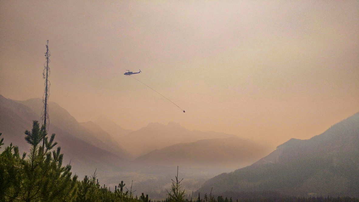
 BC Wildfire Service air tankers have crossed the border to help combat the Wannacut fire in Washington. In a social media post, BCWS said it was aware of the wildfire approximately 18 kilometres south of Osoyoos, on the south side of the US-Canada border. “At this time, we are supporting with air tanker resources and are in communication with our partners in the U.S.,” BCWS said. BCWS told Castanet one birddog and two air tankers have been deployed to combat the blaze. Winds appear to be pushing smoke from the wildfire north and BCWS said it will be highly visible to communities in the south Okanagan. The Town of Osoyoos and the Regional District of Okanagan-Similkameen Emergency Operations Centre said it is aware of the wildfire and no action is required at this time.
 BC Wildfire Service are handling a new wildfire discovered on Saturday afternoon west of Princeton. Fire Information Officer Shae Stearns said they have one initial attack crew and a response officer on site, along with one helicopter assisting with water tanking. The fire is near Arrastra Creek and behind Black Mine Road. The fire is estimated at just over one hectare in size and is classified at out of control. The fire is believed to be human-caused, but further details on how the fire started are not known. …As of Friday, May 16, category 3 open fires were ordered prohibited across the Kamloops Fire Centre.
 Flags have been lowered to half-mast at the Manitoba Legislative Building to honour two people who died after being trapped by an out-of-control wildfire in the rural municipality of Lac du Bonnet. Premier Wab Kinew, who offered condolences to the family, friends and community members of the victims, called the move “a small gesture towards the sympathies that we feel and how this latest turn in this year’s wildfire situation hits on a different emotional level.” “The news of this loss of life changes what was an emergency into a tragedy,” he said at a Thursday morning news conference. …Kinew urged people heading into the May long weekend — traditionally the unofficial start to summer and camping season — to listen to evacuation orders and stay out of areas where emergency crews are working. As of Thursday, there are 21 fires burning in the province, with a total of 80 recorded so far this season…
 A major wildfire burning in central Canada has killed two people and forced 1,000 more to evacuate their homes, kicking off a fire season authorities warn could prove devastating. Canadian federal police confirmed on Wednesday that two people died in the small community of Lac du Bonnet, in the central province of Manitoba, which is experiencing unusually hot, dry and windy conditions. Manitoba’s premier, Wab Kinew, said he was “deeply saddened to learn of the tragic loss of two Manitobans due to the wildfires”. “My heart goes out to their loved ones,” he added in a post on Twitter/X. In 2023, during Canada’s worst wildfire season, there were no recorded civilian deaths. Chris Hastie of the Royal Canadian mounted police told reporters that authorities “were aware that these individuals had been trapped in the fire”.
 Dozens of firefighters from British Columbia arrived in Manitoba over the weekend to help local first responders battle an out-of-control wildfire in northern Manitoba. Manitoba Premier Wab Kinew said Friday he put out a call to the Canadian Interagency Forest Fire Centre (CIFFC) for help from other jurisdictions to fight the flames. British Columbia responded, sending 42 firefighters. “I’m just happy to say that B.C. has answered the call. We’re there for other provinces. I know they’ll be there for us,” Kinew said at a news conference Friday. According to Manitoba’s fire map, a 20,000-hectare fire west of The Pas was still burning out of control as of Monday morning. It broke out over a week ago, engulfing 100 hectares, with heavy winds and little moisture causing it to more than quadruple in size in 24 hours.


 MOUNTAIN VIEW COUNTY, Alberta – Provincial officials elevated the wildfire danger rating to extreme across the Rocky Mountain House Forest Area Saturday after five new wildfires ignited in the area in recent days. Parts of Mountain View County are included in the forest area, namely west of Sundre and Bergen, covering Coal Camp and Bearberry west of Range Road 60 from Township Road 312 to the north boundary of the county. “The wildfire danger is now extreme in the Rocky Mountain House Forest Area,” the province said in its May 3 update for the forest protection area. “Dead and dry vegetation continues to be a major concern, as it is highly flammable and provides an easily available fuel source for wildfires.” …On Thursday, two wildfires were discovered in the Rocky Mountain House Forest Area while three more were discovered on Friday.
 Firefighters from Fort St. John and the B.C. Wildfire Service were battling a blaze that prompted evacuations late Thursday, the city said. The fire is in the Fish Creek Community Forest on the northern outskirts of the city. …The wildfire service website indicates the out-of-control blaze was discovered Thursday and spanned an estimated 0.56 square kilometres — about four times the size of Granville Island in Vancouver — as of 7:32 p.m. The suspected cause of the fire is human activity. The fire is one of nearly two dozen active across BC on Thursday, as the provincial government warned that a combination of warm, dry conditions and strong winds would raise the fire risk in southern parts of B.C. It’s one of two blazes classified as burning out of control, the other being a 1.85-square-kilometre blaze that began as two separate fires about 30 kilometres southwest of Dawson Creek, which is south of Fort St. John.
 Thunder Bay – The Northwest Fire Region continues to face escalating wildfire activity, with 12 active fires currently being managed across the region. According to Aviation, Forest Fire and Emergency Services, 4 of the fires are not under control, 3 are being held, and 5 are under control. As of Tuesday evening, five new wildland fires were confirmed: THUNDER BAY 13: Located at the south end of Dog Lake in Silver Falls Provincial Park, this 0.1-hectare fire is not under control. NIPIGON 3: Located 2 km west of Longlac, along the north end of Long Lake, this 0.1-hectare fire remains uncontrolled. RED LAKE 9: Found on the east side of Pikangikum First Nation beside Pikangikum Lake, this 0.1-hectare fire is now out. …The wildland fire hazard is high to extreme across most of the Northwest Region, driven by persistent dry conditions and strong winds.
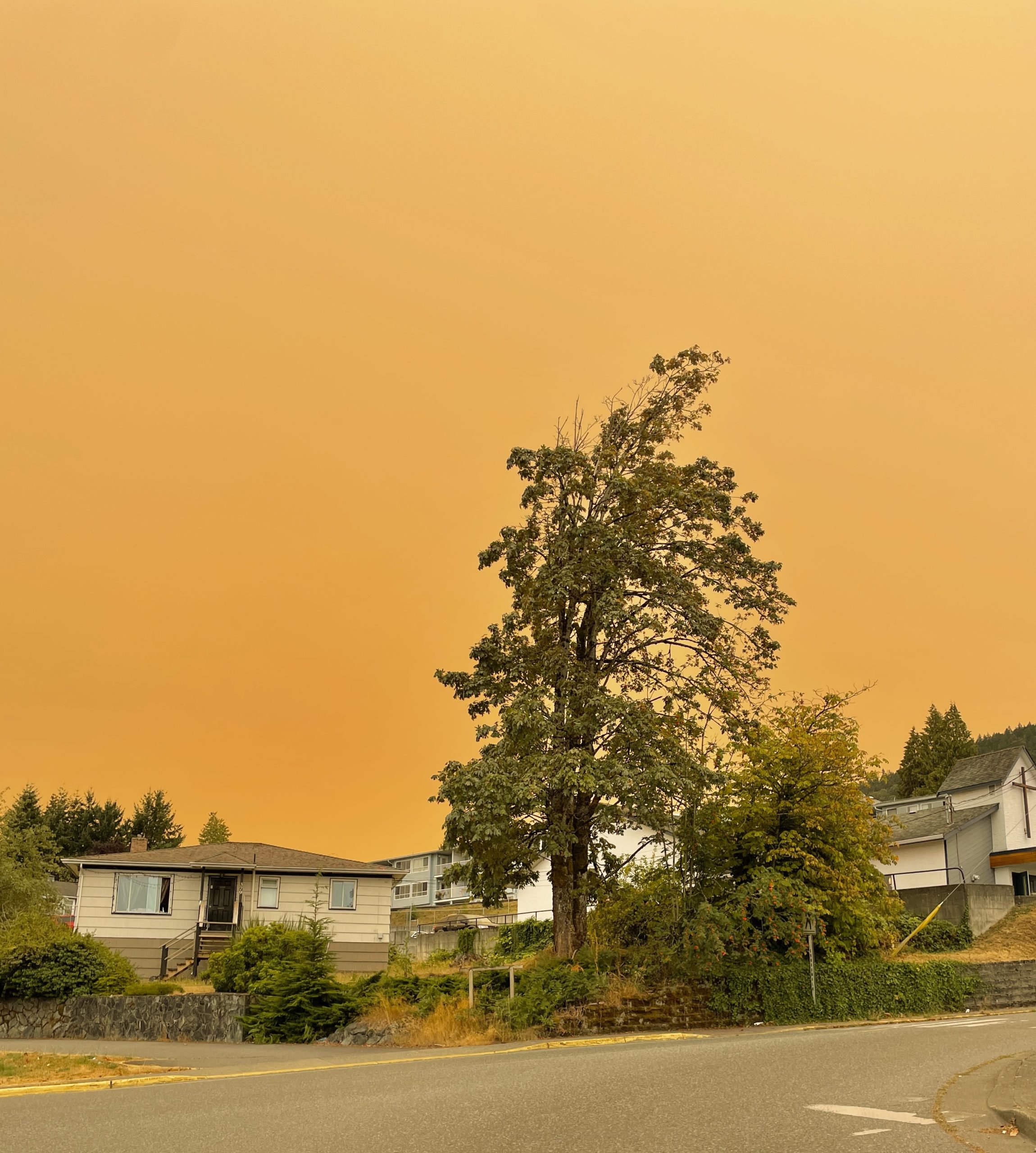 A drop in temperatures and some precipitation has reduced the fire hazard in the region, prompting an evacuation alert in the Northwest to be lifted. On Sunday, the Ministry of Natural Resources and Forestry (MNRF) lifted an evacuation alert issued last week for the Fort Frances District. The alert was implemented due to a 3,500-hectare fire burning south of Atikokan. There has been no growth observed in that fire for several days and precipitation and cooler weather has reduced fire behaviour. An evacuation order remains in effect for an area northwest of Kenora near the Ontario and Manitoba border due to the wildfire designated Kenora 20. It is a 400-square-kilometre fire burning south of Wabaseemoong First Nation that is not considered under control. The community of Wabaseemoong First Nation was evacuated late last week and structural protection efforts remain ongoing.
 Favourable winds and provincial firefighting efforts have led to the cancellation of a stage one evacuation for Wabaseemoong Independent Nations as a large forest fire burns nearby. The fire, known as Kenora 14, was discovered on Thursday 12 kilometres from Wabaseemoong. It has since grown to more than 1,000 hectares in size, and is not under control. “We had another update meeting (Sunday) morning, and it looked promising that we won’t have to do any evacuation,” said Waylon Scott, chief of Wabaseemoong. “We were at the midst of doing a stage one evacuation, which is basically the vulnerable population.” Scott said the evacuation has now been put on hold. Chris Marchand, fire information officer with Ontario’s Aviation, Forest Fire and Emergency Services (AFFES), said southerly winds have kept the fire from advancing any closer to Wabaseemoong, and helped keep smoke out of the community.
 KENORA — The largest wildfire of the season in Northwestern Ontario has consumed 1,300 hectares of forest, but Ministry of Natural Resources crews have been aided by more favourable weather conditions. Heading into the weekend, there were concerns about the fire’s proximity to Wabaseemoong Independent Nations, as it was only 12 kilometres to the south and the fire was exhibiting some extreme behaviour. However, there was minimal growth on the fire’s perimeter on Saturday, and the wind changed direction, blowing from the south to direct fire activity and smoke away from the community. The MNR expects southerly winds will persist for a few days.
 ATIKOKAN — A forest fire forced the closure of a section of Highway 11 in Northwestern Ontario. Ontario 511 reported the closure of both lanes of the highway at 5:27 pm EDT Monday. The road was blocked between Highway 623 at Sapawe and Highway 633 near Kawene. According to witnesses at the scene, Ministry of Natural Resources waterbombers were working steadily on the fire. The MNR estimated the fire had burned 180 hectares by 8:30 pm, and listed the outbreak as “not under control.”
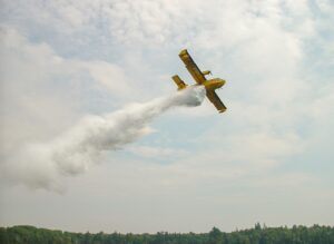 Quebec’s forest fire prevention agency says it is sending reinforcements to Ontario and Saskatchewan to help teams fight several forest and brush fires. Two CL-415 firefighting aircraft and their crews will head to Dryden, Ont., while two other of the same aircraft will head to Meadow Lake, Sask. Quebec’s forest fire prevention agency, known as SOPFEU, says the teams departed Sunday from Quebec City. The agency says the current situation in Quebec allows for resources to head to other provinces. In Ontario, there were six active fires burning across the province shortly before noon Sunday, including one in Haliburton, located about 170 km north of Oshawa, according to the Ministry of Natural Resources’ interactive map. The Saskatchewan Ministry of Public Safety map showed there were 18 active wildfires burning Sunday, for a total of 142 fires since the season began on April 1. There were 19 active fires burning in Saskatchewan on Saturday.
 In Ocean County, the Jones Road Wildfire continues burning into its sixth day. Roads are now back open including Wells Mills Road. The command post sits at Wells Mills County Park. As of Sunday, over 15,000 acres have burned, and it is now 65% contained. Four structures were threatened as of Sunday. Evacuations have been 100% lifted for residents previously evacuated in Lacey and Ocean townships. Crews Sunday were working on hotspots and patrolling the fire perimeter.
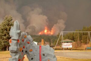 A New Jersey teenager is being charged with arson following a
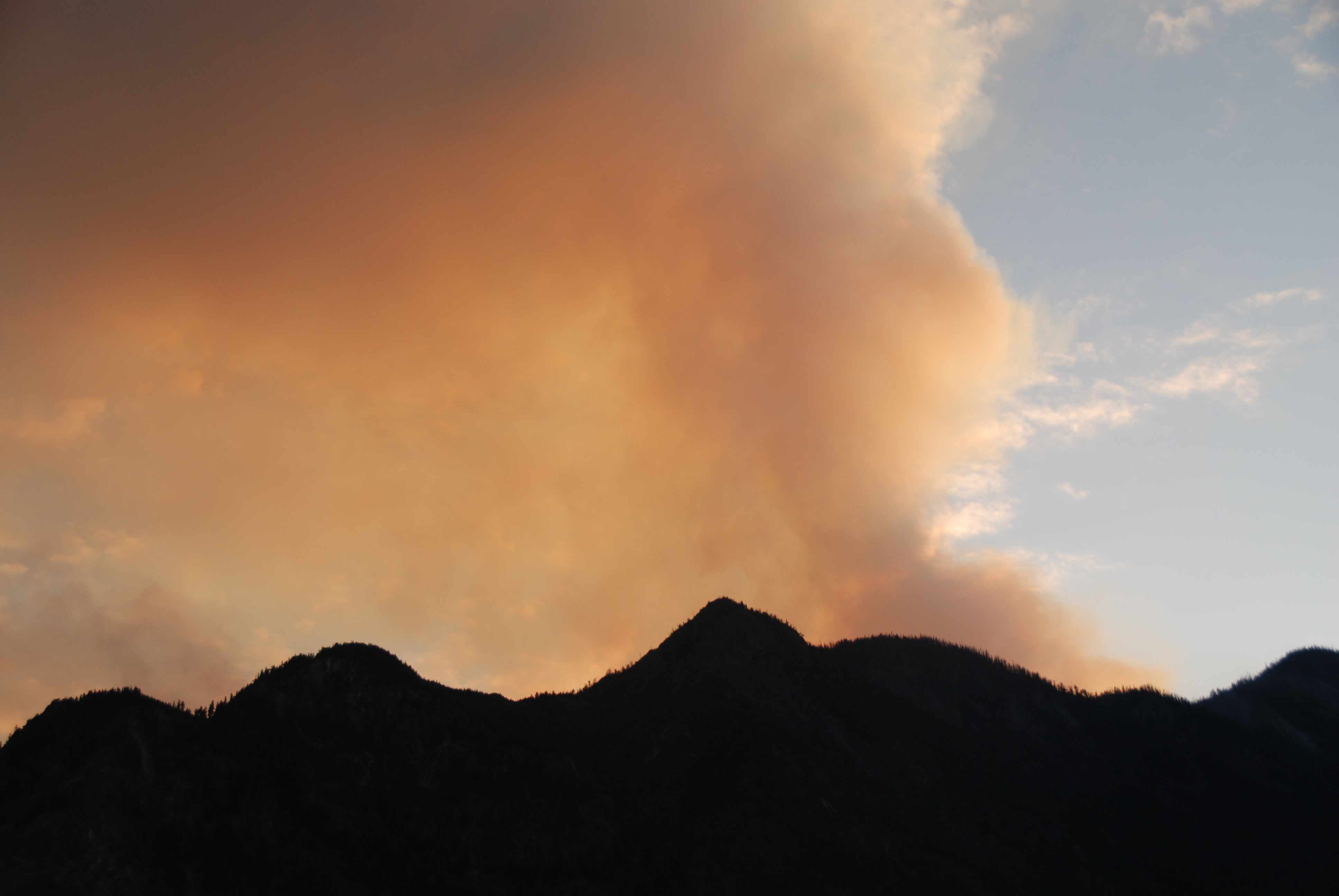 Severe wildfires raging in a Siberian region of Russia have engulfed more than 600,000 hectares of forest, local authorities have warned. In the Eastern Siberian territory of Zabaykalsky Krai, a federal-level state of emergencies has been in place since late April, Russian state news agency TASS reported. Despite huge efforts to tackle wildfire outbreaks in the region, which borders Mongolia, 49 forest fires continue to burn, with a total area exceeding 629,000 hectares, the Russian Ministry of Emergency Situations said Wednesday. Since the beginning of this year, more than 1.4 million hectares of land have been affected by wildfires, according to figures from Russia’s Federal Agency for Forestry published on Tuesday, about three times the total area affected by fires in the United States and Canada so far this year combined.
 Israel asked Greece, Bulgaria, Cyprus, Italy and Croatia to help extinguish major wildfires that broke out Wednesday morning in several locations near Jerusalem and along Highway 1 leading to the city as communities along the road were instructed to evacuate. At least one man suspected of involvement in igniting the fires was arrested, according to Israeli broadcaster Kan, which reported that the suspect is now detained at the Oz police station in east Jerusalem. Israel police did not confirm or give any details on what started the fires. …Foreign Minister Gideon Saar asked his counterparts in the four countries to send firefighting airplanes and helicopters to Israel, including supertankers. Ynet reported that Greece and Italy are sending supertankers and that the Palestinian Authority offered to send firefighters, though Israel has not yet responded to the offer. International aid is expected to arrive Thursday morning.
 The scale of forest damage caused by recent wildfires in North Gyeongsang is nearly double the amount initially estimated by the Korea Forest Service, according to multiple local governments and authorities on Thursday. A joint investigation conducted by government agencies, including the Korea Forest Service, found that the wildfires that swept across five cities and counties in North Gyeongsang burned close to 90,000 hectares (222,395 acres) of forest. This is a significant increase from the 45,157 hectares that the Korea Forest Service previously announced as the affected area after fire suppression efforts concluded. The actual damage is twice the originally reported figure and nearly four times greater than the forest damage caused by the East Coast wildfires in 2000, which had been considered the worst in the country’s history until the recent disaster.