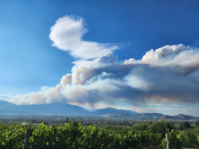
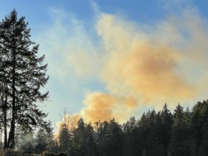
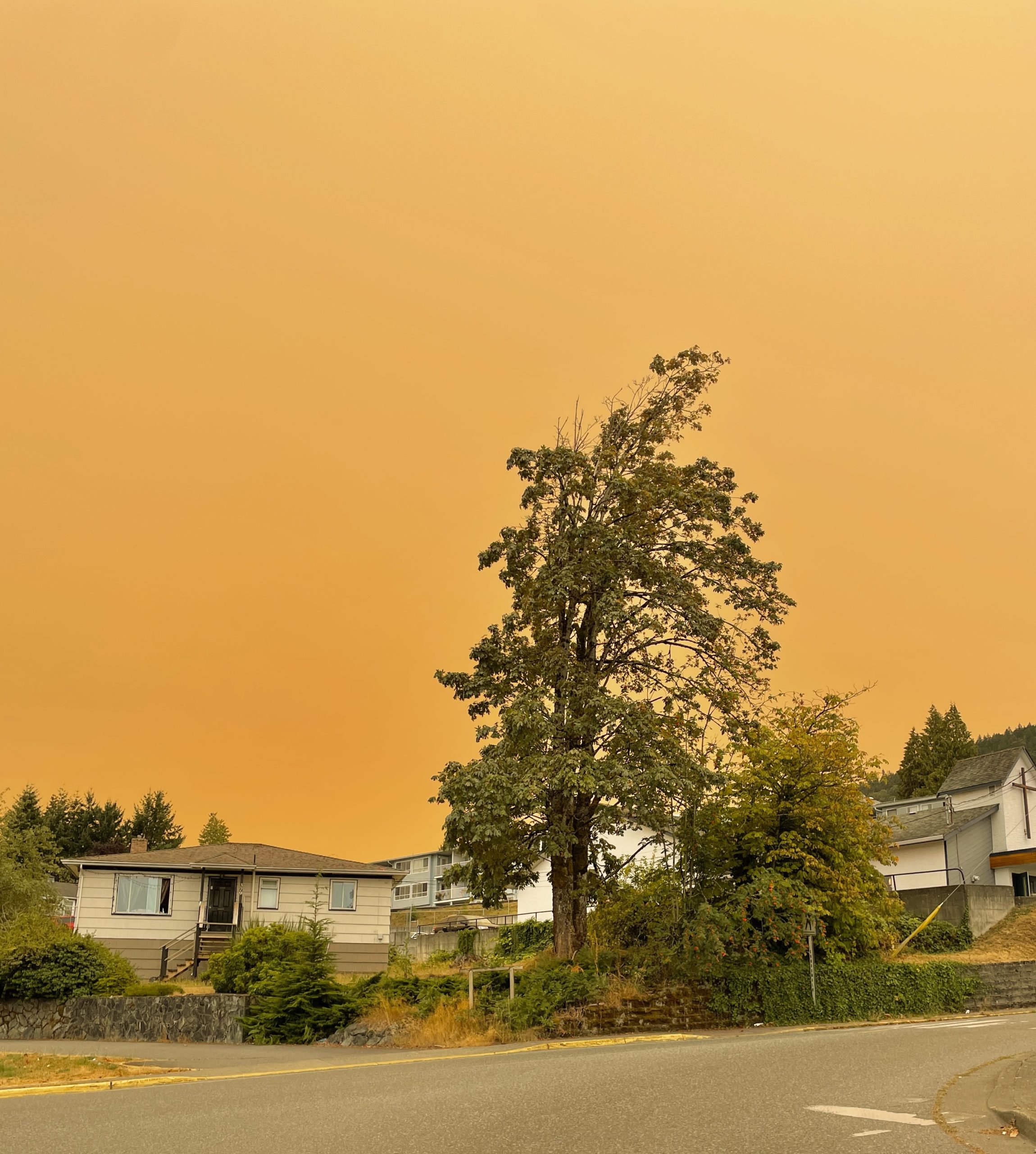
 “Wildfires are happening more frequently. They’re getting bigger. They’re emitting more smoke,” Paige Fischer, a professor of environmental sustainability at the University of Michigan says. “The climate models are projecting that we’re going to have more frequent, more severe wildfires.” As of Thursday, the Canadian Interagency Forest Fire Center said 201 fires are burning right now in British Columbia, Alberta, Saskatchewan, Manitoba and Ontario … residents of the U.S. Midwest — especially in Minnesota, Wisconsin and Michigan — are being forced to contend with the thick smoke. …the U.S. Environmental Protection Agency’s AirNow page is showing air quality moderate to unhealthy throughout a large swath of the U.S., with the worst conditions in Wisconsin, Illinois, Michigan and Indiana. …Lori Daniels, a forest ecologist and professor at the University of British Columbia (UBC) who specializes in wildfire science, agrees. “Smoke knows no political boundaries — and neither does fire,” she says.
Related coverage in Euro News by Rosie Frost: Smoke from Canada’s wildfires reaches Europe amid extreme start to the 2025 fire season
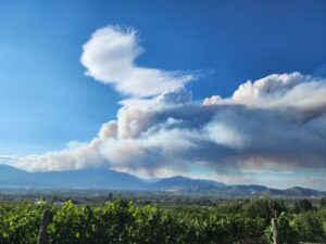
 Canada’s wildfires have forced evacuations of more than 26,000 people and continue to spread with heavy smoke choking millions of Canadians and Americans and reaching as far away as Europe. Hazardous air quality alerts were issued for parts of Canada and the neighbouring United States. A water tanker air base was consumed by flames in Saskatchewan province, oil production has been disrupted in Alberta, and more communities are threatened each day. “We have some challenging days ahead of us,” said Saskatchewan Premier Scott Moe, adding that the number of evacuees could rise quickly. …Heavy smoke has engulfed part of the continent, forcing residents of four Canadian provinces and the US states of Michigan, Minnesota, Nebraska and Wisconsin to limit outdoor activities. …Elsewhere, extensive forest fires have been raging in Russia’s Far Eastern Federal District since early April, generating carbon emissions of around 35 million tons, Copernicus reported.
 WASHINGTON D.C. — The U.S. Department of Agriculture (USDA) Forest Service has sent resources to Canada as wildfires spread across multiple parts of the country. On May 29, the Canadian Interagency Forest Fire Center raised its wildfire preparedness level as Saskatchewan, Manitoba, Ontario, and Alberta, Canada, have seen very high wildfire activity. “We are here to help our neighbors during their time of need, and our Forest Service Wildland Firefighters are the best in the business,” said Brooke L. Rollins, the U.S. Secretary of Agriculture.
 High winds fanned a wildfire threatening Squamish as some residents remained on evacuation alert and under a heavy blanket of smoke. On Wednesday evening, the B.C. Wildfire Service had mapped the Dryden Creek fire at about 54 hectares, or about a half-square kilometre, up from five hectares two days ago. The District of Squamish said daytime winds have contributed to the fire’s size, pushing it further north away from properties. “Existing containment lines on the southern flank are not currently threatened,” said the district in an update Wednesday evening. Aaron Foote, chief of Squamish Fire Rescue, said the fire is within 40 metres of some homes as debris from burning trees falls near properties, but added that the properties were not at risk. He said debris has been rolling down steep hillsides as local firefighters battle the blaze that’s looming over the community, next to the Sea to Sky Highway.

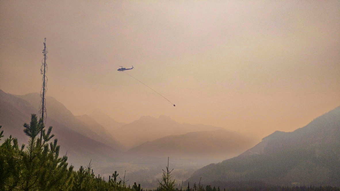
 In response to the Dryden Creek fire, as this wildfire is called, Squamish Fire Rescue said in a post late Monday night that the District’s emergency response team is working out of the Emergency Operations Centre, located at Fire Hall 1 in Valleycliffe. The out of control fire is located above the eastern end of Depot Road, in the north end of Squamish. It said the BC Wildfire Service has “actively and aggressively” attacked the wildfire thus far by air and with ground crews and would continue to late into the night, and will begin again early this morning. Aerial attack will also resume early Tuesday morning, the post said. Late last night the District of Squamish issued evacuation alerts to those living in properties at the east end of Depot Road, east of Highway 99 including the campground Mountain Fun Basecamp and at the end of Tantalus Road.
 Smoke from wildfires in northern Alberta and northeastern B.C. reached Calgary this weekend, resulting in poor air quality in the city through the weekend and into Monday morning. Fire bans remain in effect for a large part of Alberta, including in all of Rocky View County, as six of the province’s forest areas are considered to be at extreme wildfire risk. An evacuation order for parts of the County of Grande Prairie was expanded again late Saturday after the Kiskatinaw River wildfire in B.C. crossed into Alberta Friday afternoon. …As of Monday night, there were 60 fires burning in the province, with 23 of them classified as out of control. More than 615,000 hectares have burned in Alberta so far in 2025. Fire personnel and aircraft from British Columbia, Yukon, Quebec, Nova Scotia, New Brunswick, Washington State, Oregon and Idaho have arrived in Alberta to assist with battling out-of-control blazes.
 BC Wildfire Service crews are responding to an out-of-control, 10-hectare blaze south of Sproat Lake on Vancouver Island and say it’s expected to spread. Gordon Robinson, Coastal Fire Centre information officer, tells CHEK News 18 firefighters, three helicopters and a response officer are on scene in the Beverly Main area, west of Port Alberni. The fire currently measures 10 hectares, reads information online. The blaze was discovered on Sunday – and as of around 2 p.m., it’s listed as “out-of-control,” meaning it’s “anticipated to spread beyond the current perimeter or control line. Robinson says the fire is believed to be human-caused because there hasn’t been any lightning in the area. Crews are trying to determine the cause, the BC Wildfire website says, adding that such investigations “often take time and can be very complex.”


 Wildfires in Saskatchewan are expected to continue to grow aggressively during the next few days, fuelled by high temperatures, winds and dry conditions. And there’s no sign of relief in sight, according to the Saskatchewan Public Safety Agency. “This will drastically impact our ability to contain some of these fires and will actually cause some of these fires to grow in size over the next period of time,” Steve Roberts, SPSA vice-president of operations, said Sunday. As of Sunday afternoon, 15 fires were burning in the province, down from 17 because two fires have merged and some small fires have been contained, the SPSA said. Roberts said 20 communities are under an evacuation order as of Sunday. The latest evacuation orders have been in Sturgeon Landing and Timber Bay. Thousands of people have already been displaced from their homes in communities including Hall Lake, Pelican Narrows, Creighton, Denare Beach and Weyakwin.
 It’s not yet summer, but out-of-control wildfires are raging across Western Canada, fuelled by drought, warmer temperatures and lack of rainfall. Residents in northeastern BC, near Kelly Lake, have fled their homes, as Manitoba and Saskatchewan declared provincial emergencies this week. As of Friday, wildfires in Manitoba had displaced more than 17,000 people. Thousands more have been given evacuation orders because of wildfires in Saskatchewan and Alberta, including 1,300 residents of Swan Hills, a community northwest of Edmonton. …“We did see similar early-season activity like this in the far northeast in 2023 and in 2024 in BC,” said Budd. “That’s really the result of prolonged drought in the region that goes back as early as 2022.” …Manitoba is also facing a dire situation. The Flin Flon fire, located on the Manitoba-Saskatchewan border near Creighton, started at a landfill before crossing over the Manitoba border. It has grown to more than 200 square kilometres.
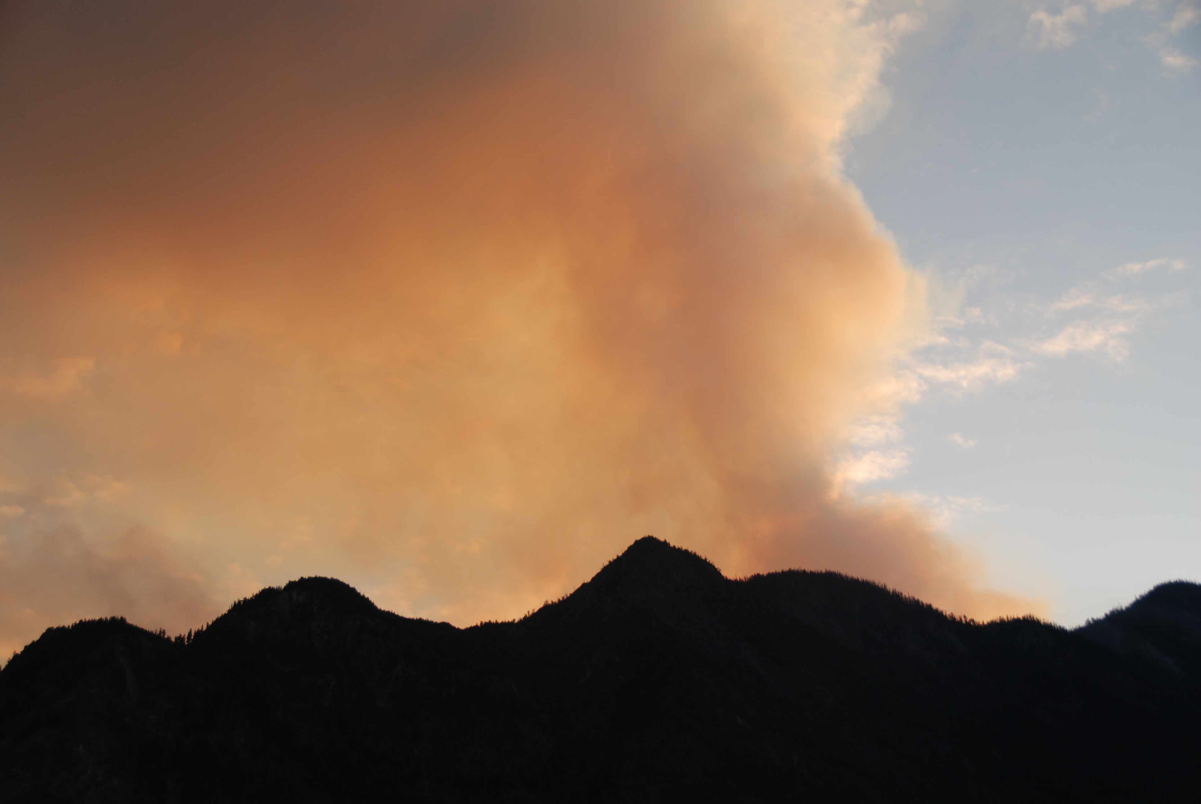 Fire crews in northern Manitoba have so far been able to contain an encroaching wildfire that forced thousands from their homes, while more residents in Saskatchewan have been told to leave due to a fast-moving blaze. The Saskatchewan government issued an evacuation alert Sunday morning for the dozens of residents that live in the hamlet of Timber Bay. Residents were told to leave the community on their own and head south to a hotel in Regina, about 484 kilometres away, to receive further support. …Approximately 80 people from Timber Bay are the latest to be forced from their homes. In Manitoba, some 17,000 Manitobans have had to leave their homes due to fires. Officials in Flin Flon, Man., where a nearby out-of-control wildfire crews have been trying to keep a nearby blaze at bay, said the fire burning near the mining city has been contained to outside its perimeter highway…
 FLIN FLON, Manitoba – Cooler temperatures and a chance of rain this week is expected in a northwestern Manitoba city that’s had to evacuate thousands of people due to wildfire. Environment Canada says temperatures in the mid teens to mid 20s are forecasted this week, with a good chance of rain coming Saturday in Flin Flon. Fire crews have been trying to keep a blaze near Flin Flon at bay, and have said the fire has been contained to outside its perimeter highway. Crews say there have been no structures lost due to the wildfire. More than 17,000 people have been displaced by wildfires in Manitoba, including 5,000 from Flin Flon. Thousands have been affected by wildfires across the Prairie provinces, with Saskatchewan issuing an evacuation alert Sunday morning for dozens of residents in the small northern community of Timber Bay, located about 260 kilometres northeast of Saskatoon. [END]
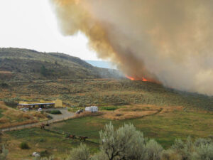 Saskatchewan is battling the worst wildfire it’s seen in decades — including the 300,000-hectare Shoe Fire in northern Saskatchewan — and experts say it’s largely caused by climate change. “This is classic climate change,” said Colin Laroque, head of soil science and professor at the University of Saskatchewan. Laroque said climatology is studied using 30-year timeframes of weather patterns, which “weren’t that different” until recently. …”These are things that we traditionally saw more in June, July and later summer, when everything dried out and then the fires took off,” Laroque said. Saskatchewan is making its way out of a relatively dry period. Few places had snow for long periods of time over winter. In the past, “snowpacks” would take time to fully melt and trickle into the ground as it warmed up. This would recharge the moisture of the soil.


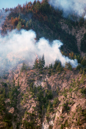
 BC Wildfire Service are handling a new wildfire discovered on Saturday afternoon west of Princeton. Fire Information Officer Shae Stearns said they have one initial attack crew and a response officer on site, along with one helicopter assisting with water tanking. The fire is near Arrastra Creek and behind Black Mine Road. The fire is estimated at just over one hectare in size and is classified at out of control. The fire is believed to be human-caused, but further details on how the fire started are not known. …As of Friday, May 16, category 3 open fires were ordered prohibited across the Kamloops Fire Centre.
 Flags have been lowered to half-mast at the Manitoba Legislative Building to honour two people who died after being trapped by an out-of-control wildfire in the rural municipality of Lac du Bonnet. Premier Wab Kinew, who offered condolences to the family, friends and community members of the victims, called the move “a small gesture towards the sympathies that we feel and how this latest turn in this year’s wildfire situation hits on a different emotional level.” “The news of this loss of life changes what was an emergency into a tragedy,” he said at a Thursday morning news conference. …Kinew urged people heading into the May long weekend — traditionally the unofficial start to summer and camping season — to listen to evacuation orders and stay out of areas where emergency crews are working. As of Thursday, there are 21 fires burning in the province, with a total of 80 recorded so far this season…


 MOUNTAIN VIEW COUNTY, Alberta – Provincial officials elevated the wildfire danger rating to extreme across the Rocky Mountain House Forest Area Saturday after five new wildfires ignited in the area in recent days. Parts of Mountain View County are included in the forest area, namely west of Sundre and Bergen, covering Coal Camp and Bearberry west of Range Road 60 from Township Road 312 to the north boundary of the county. “The wildfire danger is now extreme in the Rocky Mountain House Forest Area,” the province said in its May 3 update for the forest protection area. “Dead and dry vegetation continues to be a major concern, as it is highly flammable and provides an easily available fuel source for wildfires.” …On Thursday, two wildfires were discovered in the Rocky Mountain House Forest Area while three more were discovered on Friday.
 Firefighters from Fort St. John and the B.C. Wildfire Service were battling a blaze that prompted evacuations late Thursday, the city said. The fire is in the Fish Creek Community Forest on the northern outskirts of the city. …The wildfire service website indicates the out-of-control blaze was discovered Thursday and spanned an estimated 0.56 square kilometres — about four times the size of Granville Island in Vancouver — as of 7:32 p.m. The suspected cause of the fire is human activity. The fire is one of nearly two dozen active across BC on Thursday, as the provincial government warned that a combination of warm, dry conditions and strong winds would raise the fire risk in southern parts of B.C. It’s one of two blazes classified as burning out of control, the other being a 1.85-square-kilometre blaze that began as two separate fires about 30 kilometres southwest of Dawson Creek, which is south of Fort St. John.
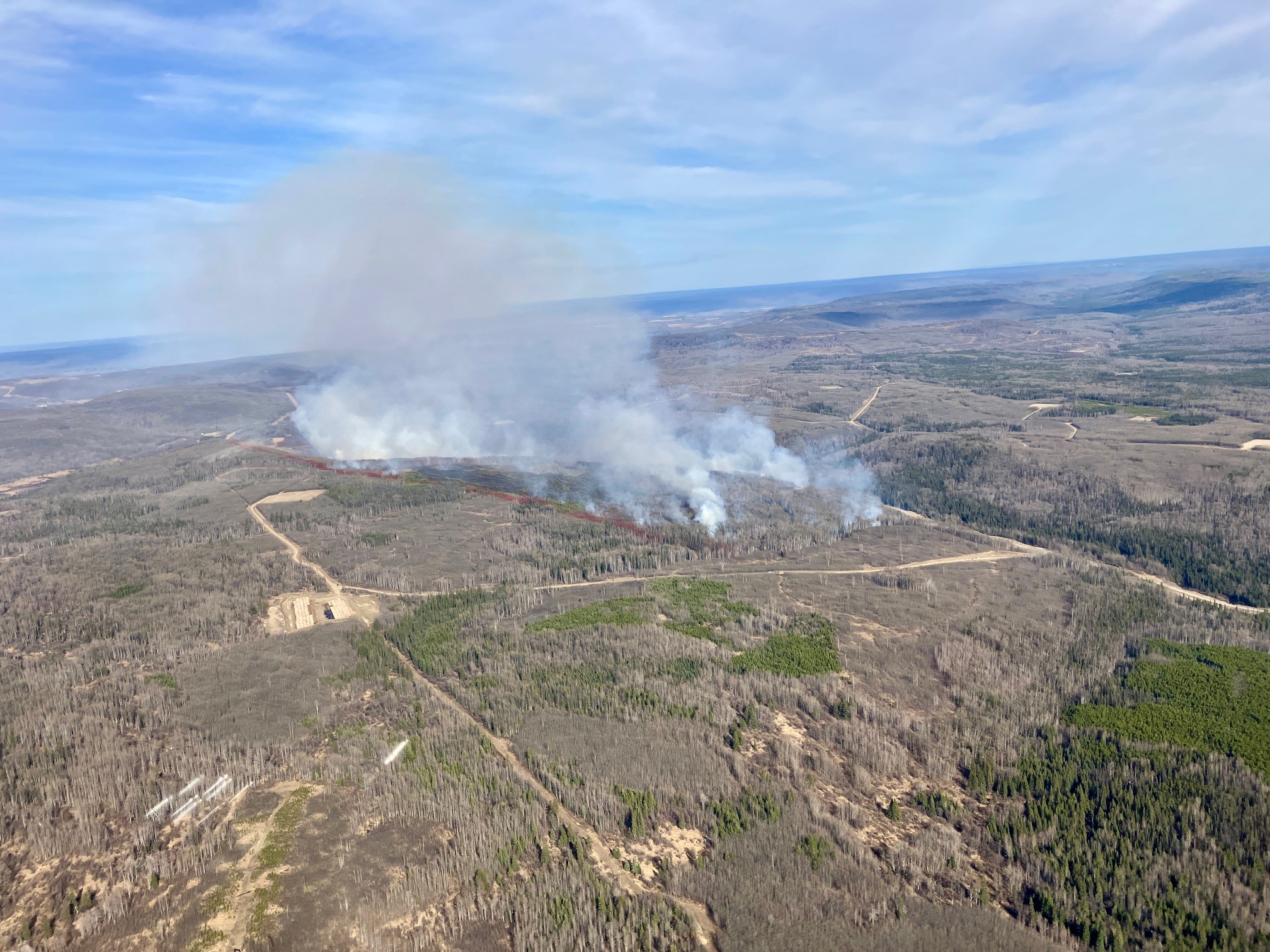

 The forest fire west of Wabaseemoong is no longer the largest in Northwestern Ontario now that a blaze farther north has grown to more than 65,000 hectares. The Red Lake 12 fire that caused the evacuation of Deer Lake First Nation last week was blanketing 65,186 hectares as of Wednesday afternoon, according to the Ministry of Natural Resources. That’s more than 3.5 times the size estimated on Monday. Smoke from fires to the west hurt the ministry’s ability “to monitor the growth of Red Lake 12 consistently throughout the operational window,” MNR fire information officer Allison Lake told Newswatch in an email. “After several days of reduced visibility, conditions improved, allowing for high-level infrared scanning of wildland fire Red Lake 12. “As a result of the scanning, the fire has now been remapped at 65,186 hectares, which accounts for growth that has occurred over the past few days.”
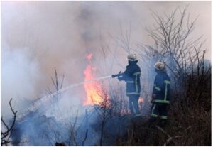 Ontario’s Ministry of Natural Resources (MNR) continues to monitor wildfires across the province, with varying conditions in the northeast and northwest regions. While some fires have been brought under control, others remain active, prompting ongoing suppression efforts and precautionary measures. The northeast region reports two active wildfires, with one recently contained. Sudbury 13, a 0.5-hectare fire near Wikwemikong that was identified on Saturday, was declared out Sunday morning. Cochrane 2, an 8-hectare fire northwest of Attawapiskat, is now under control. Cochrane 3, burning 48 kilometres west of Attawapiskat, remains not under control at 150 hectares. Though the MNR confirms no immediate threats to communities or infrastructure at this time. The northwest region remains a focal point, with 15 active fires and persistent high-risk conditions.
 The wildfire season in Nova Scotia has been off to a “slow” start, according to the manager of forest protection with the province’s natural resources department. Scott Tingely told CBC News that so far, the number of fires and the amount of hectares burned are both below average at this point. “We had a pretty cool, wet spring so far, so that has certainly helped kind of mitigate the conditions and the risk,” Tingley said. As of Thursday, 39 fires have burned about 35 hectares across the province so far. …The wildfire situation in Nova Scotia has changed rapidly over the last week, according to data from Natural Resources Canada. On Tuesday, the department listed the fire danger across most of the province as low. And as of Thursday, that classification was raised to high for the bulk of the mainland and Cape Breton.

 A drop in temperatures and some precipitation has reduced the fire hazard in the region, prompting an evacuation alert in the Northwest to be lifted. On Sunday, the Ministry of Natural Resources and Forestry (MNRF) lifted an evacuation alert issued last week for the Fort Frances District. The alert was implemented due to a 3,500-hectare fire burning south of Atikokan. There has been no growth observed in that fire for several days and precipitation and cooler weather has reduced fire behaviour. An evacuation order remains in effect for an area northwest of Kenora near the Ontario and Manitoba border due to the wildfire designated Kenora 20. It is a 400-square-kilometre fire burning south of Wabaseemoong First Nation that is not considered under control. The community of Wabaseemoong First Nation was evacuated late last week and structural protection efforts remain ongoing.
 Favourable winds and provincial firefighting efforts have led to the cancellation of a stage one evacuation for Wabaseemoong Independent Nations as a large forest fire burns nearby. The fire, known as Kenora 14, was discovered on Thursday 12 kilometres from Wabaseemoong. It has since grown to more than 1,000 hectares in size, and is not under control. “We had another update meeting (Sunday) morning, and it looked promising that we won’t have to do any evacuation,” said Waylon Scott, chief of Wabaseemoong. “We were at the midst of doing a stage one evacuation, which is basically the vulnerable population.” Scott said the evacuation has now been put on hold. Chris Marchand, fire information officer with Ontario’s Aviation, Forest Fire and Emergency Services (AFFES), said southerly winds have kept the fire from advancing any closer to Wabaseemoong, and helped keep smoke out of the community.
 KENORA — The largest wildfire of the season in Northwestern Ontario has consumed 1,300 hectares of forest, but Ministry of Natural Resources crews have been aided by more favourable weather conditions. Heading into the weekend, there were concerns about the fire’s proximity to Wabaseemoong Independent Nations, as it was only 12 kilometres to the south and the fire was exhibiting some extreme behaviour. However, there was minimal growth on the fire’s perimeter on Saturday, and the wind changed direction, blowing from the south to direct fire activity and smoke away from the community. The MNR expects southerly winds will persist for a few days.
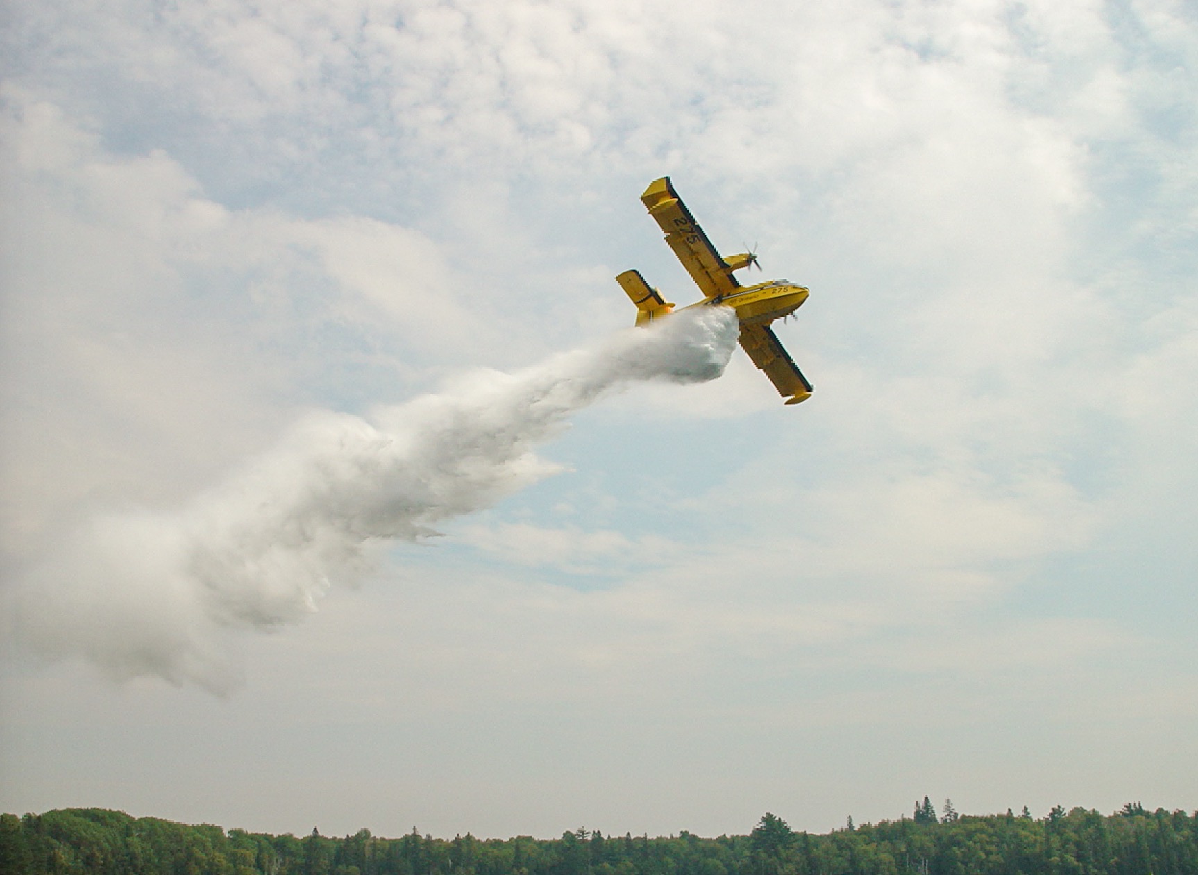 ATIKOKAN — A forest fire forced the closure of a section of Highway 11 in Northwestern Ontario. Ontario 511 reported the closure of both lanes of the highway at 5:27 pm EDT Monday. The road was blocked between Highway 623 at Sapawe and Highway 633 near Kawene. According to witnesses at the scene, Ministry of Natural Resources waterbombers were working steadily on the fire. The MNR estimated the fire had burned 180 hectares by 8:30 pm, and listed the outbreak as “not under control.”
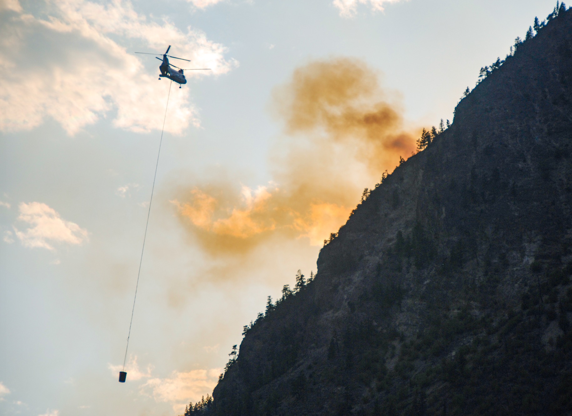
 Quebec’s forest fire prevention agency says it is sending reinforcements to Ontario and Saskatchewan to help teams fight several forest and brush fires. Two CL-415 firefighting aircraft and their crews will head to Dryden, Ont., while two other of the same aircraft will head to Meadow Lake, Sask. Quebec’s forest fire prevention agency, known as SOPFEU, says the teams departed Sunday from Quebec City. The agency says the current situation in Quebec allows for resources to head to other provinces. In Ontario, there were six active fires burning across the province shortly before noon Sunday, including one in Haliburton, located about 170 km north of Oshawa, according to the Ministry of Natural Resources’ interactive map. The Saskatchewan Ministry of Public Safety map showed there were 18 active wildfires burning Sunday, for a total of 142 fires since the season began on April 1. There were 19 active fires burning in Saskatchewan on Saturday.
 KITTITAS COUNTY, Wash. — The US Forest Service has taken command of the 60-acre Red Bridge Fire burning about 7 miles east of Cle Elum. Level 3 evacuations were issued for those nearby. A Level 3 evacuation means residents should “go now” or leave immediately. A Level 2 evacuation means there is significant danger in the area; be ready to go or voluntarily evacuate. Level 1 means there is danger in the area. Residents should plan escape routes, but evacuations are voluntary, according to the Washington Smoke Blog. The Red Bridge Fire started on June 9, 2025, at approximately 3:57 p.m. As of 8 p.m., the fire is estimated at 60 acres and growing, according to the Washington State Department of Natural Resources (DNR).
 In Ocean County, the Jones Road Wildfire continues burning into its sixth day. Roads are now back open including Wells Mills Road. The command post sits at Wells Mills County Park. As of Sunday, over 15,000 acres have burned, and it is now 65% contained. Four structures were threatened as of Sunday. Evacuations have been 100% lifted for residents previously evacuated in Lacey and Ocean townships. Crews Sunday were working on hotspots and patrolling the fire perimeter.
 A New Jersey teenager is being charged with arson following a
 Israel asked Greece, Bulgaria, Cyprus, Italy and Croatia to help extinguish major wildfires that broke out Wednesday morning in several locations near Jerusalem and along Highway 1 leading to the city as communities along the road were instructed to evacuate. At least one man suspected of involvement in igniting the fires was arrested, according to Israeli broadcaster Kan, which reported that the suspect is now detained at the Oz police station in east Jerusalem. Israel police did not confirm or give any details on what started the fires. …Foreign Minister Gideon Saar asked his counterparts in the four countries to send firefighting airplanes and helicopters to Israel, including supertankers. Ynet reported that Greece and Italy are sending supertankers and that the Palestinian Authority offered to send firefighters, though Israel has not yet responded to the offer. International aid is expected to arrive Thursday morning.
 The scale of forest damage caused by recent wildfires in North Gyeongsang is nearly double the amount initially estimated by the Korea Forest Service, according to multiple local governments and authorities on Thursday. A joint investigation conducted by government agencies, including the Korea Forest Service, found that the wildfires that swept across five cities and counties in North Gyeongsang burned close to 90,000 hectares (222,395 acres) of forest. This is a significant increase from the 45,157 hectares that the Korea Forest Service previously announced as the affected area after fire suppression efforts concluded. The actual damage is twice the originally reported figure and nearly four times greater than the forest damage caused by the East Coast wildfires in 2000, which had been considered the worst in the country’s history until the recent disaster.