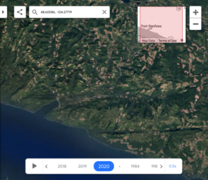
 Thanks to Google Earth Engine, people are able to see the effects of humans on our ecosystems happen in a flash. On Vancouver Island specifically, it’s easy to see the deforestation of Fairy Creek near Port Renfrew as well as several other locations. The provincial government recently made an announcement on efforts in protecting some of Vancouver Island’s last precious old-growth groves and pristine ecosystems. …This innovative tool also sheds light on urban sprawl in metro areas such as Greater Victoria, specifically, the Westshore. In 1984, when the timelapse began, the population of Greater Victoria was around 242,000. Now the population has grown to nearly 398,000. Greater Victoria is limited in where it can sprawl to, but Langford and the entirety of the Westshore have boomed and sprawled considerably over the past 39 years.